
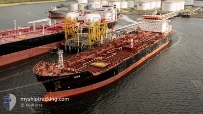
NINA
Oil/Chemical Tanker
Aktuelle Reise
BOURGAS,BULGARIA
| Bisherige Reisezeit | 2 Tage |
|---|---|
| Verbleibende Reisezeit | --- |
| Zurückgelegte Distanz | 132.66 nm |
| Verbleibende Distanz | --- |
| Durchschnittliche Geschwindigkeit | 10 Knoten |
| Maximale Geschwindigkeit | 11.5 Knoten |
| Durchschnittliche Windgeschwindigkeit | 8 Knoten |
| Maximale Windgeschwindigkeit | 12 Knoten |
| Minimale Temperatur | 13.3°C / 55.94°F |
| Maximale Temperatur | 16.4°C / 61.52°F |
| Tiefgang | 9.1 m |
| Position erhalten | 12 d alt |
Aktuelle Position
| Länge | --- |
|---|---|
| Breite | --- |
| Zustand | Under way using engine |
| Geschwindigkeit | 10.6 Knoten |
| Kurs | 331.1° |
| Gebiet | Black Sea |
| Station | T-AIS |
| Position erhalten | 12 d alt |
Schiffsdetails
Information
Die NINA befindet sich derzeit in Black Sea mit den Koordinaten 41.41773° / 29.17106°, Diese Position wurde am 2024-10-19 18:29 von unserer Schiffsverfolgungs-App über AIS erfasst. Das Schiff fährt momentan mit einer Geschwindigkeit von 10.6 Knoten
Das Schiff NINA (IMO: 9451733, MMSI: 247239700) ist Oil/Chemical Tanker das wurde im Jahr 2010 ( 14 Jahre alt ) gebaut. und fährt unter der Flagge von [IT] Italy.
Auf dieser Seite erhalten Sie Informationen zur aktuellen Position des Schiffes, zu den letzten bekannten Hafenanläufen und zu den aktuellen Reiseinformationen. Sollte das Schiff nicht durch AIS abgedeckt sein, wird die zuletzt erfasste Position angezeigt.
Die NINA wird durch unsere AIS-Empfänger ermittelt. Wir übernehmen keine Gewähr für die Richtigkeit der Daten. Die letzte Position wurde von unseren AIS-Empfängern aufgezeichnet, während das Schiff in Reichweite war.
Der aktuelle Entwurf von NINA, wie von AIS gemeldet, betragt 9.1 meter
Wetter
| Temperatur | 15.4°C / 59.72°F |
|---|---|
| Windgeschwindigkeit | 5 Knoten |
| Windrichtung | 222° SW |
| Luftdruck | 1024 hPa |
| Luftfeuchtigkeit | 66.9 % |
| Wolken | 100 % |
Featured Company
Letzte Hafenanläufe
| Hafen | Ankunft | Abfahrt | Time In Port |
|---|---|---|---|
| 2024-10-28 11:51 | 2024-10-29 18:32 | 1 d | |
| 2024-10-13 17:54 | 2024-10-15 20:30 | 2 d | |
| 2024-10-07 16:23 | 2024-10-09 14:22 | 1 d | |
| 2024-09-30 17:41 | 2024-10-03 01:43 | 2 d | |
| 2024-09-24 15:23 | 2024-09-25 02:07 | 10 h | |
| 2024-09-23 03:33 | 2024-09-24 14:59 | 1 d | |
| 2024-09-11 22:26 | 2024-09-13 01:35 | 1 d | |
| 2024-09-02 14:14 | 2024-09-04 10:18 | 1 d | |
| 2024-08-27 16:45 | 2024-08-29 19:42 | 2 d | |
| 2024-08-22 06:25 | 2024-08-23 22:08 | 1 d |
Meistbesuchte Häfen (Letztes Jahr)
| Hafen | Ankünfte | |
|---|---|---|
| 5 | ||
| 4 | ||
| 4 | ||
| 4 | ||
| 3 | ||
| 3 |
Letzte Reisen
| Herkunft | Abfahrt | Ziel | Ankunft | Distanz | |
|---|---|---|---|---|---|
| 2024-10-15 22:30 | 2024-10-28 13:51 | 980.33 nm | |||
| 2024-10-09 16:22 | 2024-10-13 19:54 | 1275.45 nm | |||
| 2024-10-03 03:43 | 2024-10-07 18:23 | 1256.12 nm | |||
| 2024-09-25 03:07 | 2024-09-30 19:41 | 1600.97 nm | |||
| 2024-09-24 15:59 | 2024-09-24 16:23 | 1.44 nm | |||
| 2024-09-13 03:35 | 2024-09-23 04:33 | 2265.46 nm | |||
| 2024-09-04 12:18 | 2024-09-12 00:26 | 1883.91 nm | |||
| 2024-08-29 21:42 | 2024-09-02 16:14 | 1061.23 nm | |||
| 2024-08-24 00:08 | 2024-08-27 18:45 | 889.44 nm | |||
| 2024-08-08 00:56 | 2024-08-22 08:25 | 2961.38 nm |
Events
| Zeit | Ereignis | Details | Position / Ziel | Information |
|---|---|---|---|---|
| 2024-10-30 07:44 | STOP Bewegung | 6.55 nm, North East of CONSTANTA |
44.17099 / 28.80754
BOURGAS,BULGARIA
|
Geschwindigkeit: 0.3 kn Kurs: 53° |
| 2024-10-29 18:32 | ABFAHRTSHAFEN |
|
42.47118 / 27.53587
BOURGAS,BULGARIA
|
Geschwindigkeit: 8 kn Kurs: 27° |
| 2024-10-29 18:24 | START Bewegung |
42.45621 / 27.52903
[BG] BURGAS
|
Geschwindigkeit: 5.9 kn Kurs: 358° |
|
| 2024-10-28 12:32 | STOP Bewegung |
42.45120 / 27.53626
[BG] BURGAS
|
Geschwindigkeit: Kurs: 140° |
|
| 2024-10-28 11:51 | ZIELHAFEN |
|
42.45324 / 27.53204
[BG] BURGAS
|
Geschwindigkeit: 1.6 kn Kurs: 220° |
| 2024-10-28 11:00 | START Bewegung | 3.18 nm, North East of BURGAS |
42.48704 / 27.55370
BOURGAS,BULGARIA
|
Geschwindigkeit: 3.6 kn Kurs: 216° |