
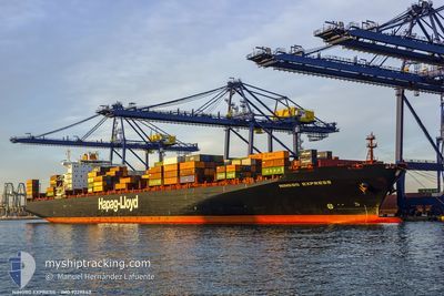
NINGBO EXPRESS
Container Ship
Current Trip
| Time Travelled | 20 days |
|---|---|
| Remaining Time | --- |
| Distance Travelled | 8230.94 nm |
| Remaining Distance | --- |
| AVG Speed | 16.8 Knots |
| MAX Speed | 19.2 Knots |
| AVG Wind | 12 knots |
| MAX Wind | 37 knots |
| MIN Temp | 15.7°C / 60.26°F |
| MAX Temp | 28.5°C / 83.3°F |
| Draught | 14.5 m |
| Position Received | 4 d ago |
Current Position
| Longitude | 31.98104° |
|---|---|
| Latitude | -29.66465° |
| Status | Under way using engine |
| Speed | 15.3 Knots |
| Course | 31.8° |
| Area | Indian Ocean |
| Station | T-AIS |
| Position Received | 4 d ago |
Info
Information
The current position of NINGBO EXPRESS is in Indian Ocean with coordinates -29.66465° / 31.98104° as reported on 2024-06-01 03:33 by AIS to our vessel tracker app. The vessel's current speed is 15.3 Knots and is heading at the port of JEBEL ALI. The estimated time of arrival as calculated by vessel tracking app is 2024-06-12 02:00 LT
The vessel NINGBO EXPRESS (IMO: 9229843, MMSI: 636093154) is a Container Ship that was built in 2002 ( 22 years old ). It's sailing under the flag of [LR] Liberia.
In this page you can find informations about the vessels current position, last detected port calls, and current voyage information. If the vessels is not in coverage by AIS you will find the latest position.
The current position of NINGBO EXPRESS is detected by our AIS receivers and we are not responsible for the reliability of the data. The last position was recorded while the vessel was in Coverage by the Ais receivers of our vessel tracking app.
The current draught of NINGBO EXPRESS as reported by AIS is 14.5 meters
Weather
| Temperature | 26.4°C / 79.52°F |
|---|---|
| Wind Speed | 21 knots |
| Direction | 152° SSE |
| Pressure | 1013.8 hPa |
| Humidity | 84 % |
| Cloud Coverage | 5 % |
Featured Company
Last Port Calls
| Port | Arrival | Departure | Time In Port |
|---|---|---|---|
| 2024-05-15 07:35 | 2024-05-16 05:15 | 21 h | |
| 2024-05-12 14:49 | 2024-05-13 20:44 | 1 d | |
| 2024-05-08 22:44 | 2024-05-10 15:07 | 1 d | |
| 2024-05-05 03:13 | 2024-05-07 01:29 | 1 d | |
| 2024-04-26 05:33 | 2024-04-27 17:05 | 1 d | |
| 2024-04-21 10:00 | 2024-04-22 11:04 | 1 d |
Most Visited Ports (Last year)
| Port | Arrivals | |
|---|---|---|
| 8 | ||
| 7 | ||
| 6 | ||
| 6 | ||
| 6 | ||
| 5 |
Last Trips
| Origin | Departure | Destination | Arrival | Distance | |
|---|---|---|---|---|---|
| 2024-05-13 22:44 | 2024-05-15 09:35 | 221.45 nm | |||
| 2024-05-10 17:07 | 2024-05-12 16:49 | 371.83 nm | |||
| 2024-05-07 03:29 | 2024-05-09 00:44 | 312.94 nm | |||
| 2024-04-27 20:05 | 2024-05-05 05:13 | 1358.77 nm | |||
| 2024-04-22 13:04 | 2024-04-26 08:33 | 1309.29 nm | |||
| 2024-03-27 17:45 | 2024-04-21 12:00 | 10378.72 nm |
Events
| Time | Event | Details | Position / Dest | Info |
|---|---|---|---|---|
| 2024-06-01 03:40 | Status Changed | Default Under way using engine |
-29.63985 / 31.99983
AEJEA
|
Speed: 15.3 kn Course: 31.8° |
| 2024-06-01 03:33 | OUT of Coverage |
-29.66465 / 31.98104
Indian Ocean
AEJEA
|
Speed: 15.3 kn Course: 31.8° |
|
| 2024-06-01 03:04 | Status Changed | Under way using engine Default |
-29.76742 / 31.90459
AEJEA
|
Speed: 15.3 kn Course: 29° |
| 2024-06-01 03:01 | Status Changed | Default Under way using engine |
-29.77930 / 31.89583
AEJEA
|
Speed: 15.4 kn Course: 39.9° |
| 2024-06-01 02:53 | Status Changed | Under way using engine Default |
-29.80516 / 31.87578
AEJEA
|
Speed: 15.1 kn Course: 38° |
| 2024-06-01 02:49 | Status Changed | Default Under way using engine |
-29.82205 / 31.86283
AEJEA
|
Speed: 14.7 kn Course: 36.2° |
| 2024-05-31 23:34 | ETA Changed | 2024/06/12 02:00 2024/06/10 19:00 |
-30.38211 / 31.25475
AEJEA
|
Speed: 14.2 kn Course: 41.7° |
| 2024-05-31 22:52 | Change Sea Area | South African part of the Indian Ocean South African part of the South Atlantic Ocean |
-30.52020 / 31.15008
Indian Ocean
AEJEA
|
Speed: 14.1 kn Course: 29.1° |
| 2024-05-31 22:52 | IN Coverage |
-30.52020 / 31.15008
Indian Ocean
AEJEA
|
Speed: 14.1 kn Course: 29.1° |
|
| 2024-05-31 22:51 | Status Changed | Under way using engine Default |
-30.52536 / 31.14662
AEJEA
|
Speed: 14.5 kn Course: 27° |