
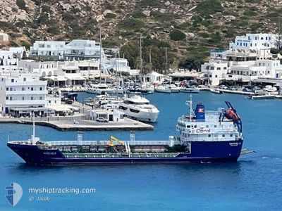
NIREAS K
Tanker
Current Trip
| Time Travelled | 23 h, 56 mins |
|---|---|
| Remaining Time | --- |
| Distance Travelled | 69.18 nm |
| Remaining Distance | --- |
| AVG Speed | 8.5 Knots |
| MAX Speed | 9.1 Knots |
| AVG Wind | 6.3 knots |
| MAX Wind | 11.9 knots |
| MIN Temp | 21.8°C / 71.24°F |
| MAX Temp | 30.1°C / 86.18°F |
| Draught | 5 m |
| Position Received | 15 h, 48 m ago |
Current Position
| Longitude | 25.39759° |
|---|---|
| Latitude | 39.68891° |
| Status | Under way using engine |
| Speed | 9.1 Knots |
| Course | 288.4° |
| Area | Aegean Sea |
| Station | T-AIS |
| Position Received | 15 h, 48 m ago |
Info
Information
The current position of NIREAS K is in Aegean Sea with coordinates 39.68891° / 25.39759° as reported on 2024-06-06 12:19 by AIS to our vessel tracker app. The vessel's current speed is 9.1 Knots
The vessel NIREAS K (IMO: 9505144, MMSI: 240183900) is a Tanker It's sailing under the flag of [GR] Greece.
In this page you can find informations about the vessels current position, last detected port calls, and current voyage information. If the vessels is not in coverage by AIS you will find the latest position.
The current position of NIREAS K is detected by our AIS receivers and we are not responsible for the reliability of the data. The last position was recorded while the vessel was in Coverage by the Ais receivers of our vessel tracking app.
The current draught of NIREAS K as reported by AIS is 5 meters
Weather
| Temperature | 23.8°C / 74.84°F |
|---|---|
| Wind Speed | 8 knots |
| Direction | 8° N |
| Pressure | 1013.8 hPa |
| Humidity | 71.6 % |
| Cloud Coverage | 10 % |
Featured Company
Last Port Calls
| Port | Arrival | Departure | Time In Port |
|---|---|---|---|
| 2024-06-03 23:23 | 2024-06-06 04:11 | 2 d | |
| 2024-06-03 04:29 | 2024-06-03 15:13 | 10 h | |
| 2024-06-02 13:33 | 2024-06-02 21:09 | 7 h | |
| 2024-06-01 17:35 | 2024-06-02 04:15 | 10 h | |
| 2024-05-31 05:19 | 2024-05-31 12:36 | 7 h | |
| 2024-05-29 14:49 | 2024-05-30 18:39 | 1 d | |
| 2024-05-28 14:44 | 2024-05-29 14:40 | 23 h | |
| 2024-05-25 18:16 | 2024-05-28 03:50 | 2 d | |
| 2024-05-25 08:06 | 2024-05-25 12:38 | 4 h | |
| 2024-05-24 11:55 | 2024-05-24 15:17 | 3 h |
Last Trips
| Origin | Departure | Destination | Arrival | Distance | |
|---|---|---|---|---|---|
| 2024-06-03 18:13 | 2024-06-04 02:23 | 70.54 nm | |||
| 2024-06-03 00:09 | 2024-06-03 07:29 | 61.04 nm | |||
| 2024-06-02 07:15 | 2024-06-02 16:33 | 62.63 nm | |||
| 2024-05-31 15:36 | 2024-06-01 20:35 | 52.16 nm | |||
| 2024-05-30 21:39 | 2024-05-31 08:19 | 87.07 nm | |||
| 2024-05-29 17:40 | 2024-05-29 17:49 | 0.75 nm | |||
| 2024-05-28 06:50 | 2024-05-28 17:44 | 95.62 nm | |||
| 2024-05-25 15:38 | 2024-05-25 21:16 | 51.31 nm | |||
| 2024-05-24 18:17 | 2024-05-25 11:06 | 110.51 nm | |||
| 2024-05-24 05:46 | 2024-05-24 14:55 | 76.06 nm |
Events
| Time | Event | Details | Position / Dest | Info |
|---|---|---|---|---|
| 2024-06-06 12:19 | OUT of Coverage |
39.68891 / 25.39759
Aegean Sea
MIRINA
|
Speed: 9.1 kn Course: 288.4° |
|
| 2024-06-06 11:27 | Status Changed | Under way using engine Default |
39.63337 / 25.54634
MIRINA
|
Speed: 9.1 kn Course: 297° |
| 2024-06-06 11:19 | Status Changed | Default Under way using engine |
39.62395 / 25.56969
MIRINA
|
Speed: 9 kn Course: 297.4° |
| 2024-06-06 09:17 | Change Sea Area | Greek part of the Aegean Sea Turkish part of the Aegean Sea |
39.49365 / 25.92203
Aegean Sea
MIRINA
|
Speed: 8.4 kn Course: 295° |
| 2024-06-06 07:32 | Change Sea Area | Turkish part of the Aegean Sea Greek part of the Aegean Sea |
39.41365 / 26.22104
Aegean Sea
MIRINA
|
Speed: 8.4 kn Course: 284.8° |
| 2024-06-06 06:21 | IN Coverage |
39.36604 / 26.41965
Aegean Sea
MIRINA
|
Speed: 8.7 kn Course: 318.7° |
|
| 2024-06-06 05:16 | OUT of Coverage |
39.23352 / 26.52514
Aegean Sea
MIRINA
|
Speed: 8.7 kn Course: 336.3° |
|
| 2024-06-06 04:44 | Destination Changed | MIRINA MYTILINI |
39.16460 / 26.56216
MIRINA
|
Speed: 8.4 kn Course: 0.5° |
| 2024-06-06 04:44 | ETA Changed | 2024/06/06 17:30 2024/06/04 01:30 |
39.16460 / 26.56216
MIRINA
|
Speed: 8.4 kn Course: 0.5° |
| 2024-06-06 04:17 | IN Coverage |
39.10852 / 26.57517
Aegean Sea
|
Speed: 8.5 kn Course: 17.4° |