
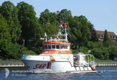
NIS RANDERS
Search and Rescue vessel
Current Position
| Longitude | 13.03239° |
|---|---|
| Latitude | 54.43449° |
| Status | Moored |
| Speed | |
| Course | 297° |
| Area | Baltic Sea |
| Station | T-AIS |
| Position Received | 5 m ago |
Info
Information
The current position of NIS RANDERS is in Baltic Sea with coordinates 54.43449° / 13.03239° as reported on 2024-06-27 03:00 by AIS to our vessel tracker app. The vessel's current speed is 0 Knots and is currently inside the port of BARHOFT.
The vessel NIS RANDERS (MMSI: 211460410) is a Search and Rescue vessel It's sailing under the flag of [DE] Germany.
In this page you can find informations about the vessels current position, last detected port calls, and current voyage information. If the vessels is not in coverage by AIS you will find the latest position.
The current position of NIS RANDERS is detected by our AIS receivers and we are not responsible for the reliability of the data. The last position was recorded while the vessel was in Coverage by the Ais receivers of our vessel tracking app.
The current draught of NIS RANDERS as reported by AIS is 1.8 meters
Weather
| Temperature | 18.1°C / 64.58°F |
|---|---|
| Wind Speed | 5 knots |
| Direction | 118° ESE |
| Pressure | 1010.6 hPa |
| Humidity | 87.8 % |
| Cloud Coverage | 39 % |
Featured Company
Last Port Calls
| Port | Arrival | Departure | Time In Port |
|---|---|---|---|
| 2024-06-26 15:06 | |||
| 2024-06-25 18:39 | 2024-06-26 05:32 | 10 h | |
| 2024-06-24 19:19 | 2024-06-25 18:07 | 22 h | |
| 2024-06-23 15:07 | |||
| 2024-06-21 08:45 | 2024-06-23 07:03 | 1 d | |
| 2024-06-15 17:35 | 2024-06-21 06:47 | 5 d | |
| 2024-06-14 15:45 | 2024-06-15 07:29 | 15 h | |
| 2024-06-13 17:15 | 2024-06-14 13:04 | 19 h | |
| 2024-06-13 07:11 | |||
| 2024-06-01 13:26 | 2024-06-05 08:25 | 3 d |
Most Visited Ports (Last year)
| Port | Arrivals | |
|---|---|---|
| 46 | ||
| 8 | ||
| 6 | ||
| 5 | ||
| 4 | ||
| 4 |
Last Trips
| Origin | Departure | Destination | Arrival | Distance | |
|---|---|---|---|---|---|
| 2024-06-26 07:32 | 2024-06-26 17:06 | 1.73 nm | |||
| 2024-06-25 20:07 | 2024-06-25 20:39 | 4.47 nm | |||
| 2024-06-23 09:03 | 2024-06-24 21:19 | 92.24 nm | |||
| 2024-06-23 09:03 | 2024-06-23 17:07 | 66.29 nm | |||
| 2024-06-21 08:47 | 2024-06-21 10:45 | 19.93 nm | |||
| 2024-06-15 09:29 | 2024-06-15 19:35 | 89.04 nm | |||
| 2024-06-14 15:04 | 2024-06-14 17:45 | 22.98 nm | |||
| 2024-06-13 09:11 | 2024-06-13 19:15 | 43.88 nm | |||
| 2024-06-01 08:46 | 2024-06-01 15:26 | 112.98 nm | |||
| 2024-05-31 08:44 | 2024-05-31 18:39 | 69.97 nm |
Events
| Time | Event | Details | Position / Dest | Info |
|---|---|---|---|---|
| 2024-06-26 15:06 | IN Coverage |
54.43449 / 13.03243
Baltic Sea
[DE] BARHOFT
|
Speed: Course: 303.2° |
|
| 2024-06-26 15:06 | PORT ARRIVAL |
|
54.43449 / 13.03243
[DE] BARHOFT
|
Speed: Course: 229° |
| 2024-06-26 08:13 | OUT of Coverage |
54.44543 / 13.04985
Baltic Sea
|
Speed: Course: 274.3° |
|
| 2024-06-26 05:43 | STOP Moving | 0.93 nm, North East of BARHOFT |
54.44542 / 13.04984
BARHOEFT
|
Speed: 0.1 kn Course: 229° |
| 2024-06-26 05:32 | START Moving | 0.14 nm, North East of BARHOFT |
54.43555 / 13.03506
BARHOEFT
|
Speed: 6.3 kn Course: 48.1° |
| 2024-06-26 05:32 | PORT DEPARTURE |
|
54.43537 / 13.03473
BARHOEFT
|
Speed: 6.2 kn Course: 48° |
| 2024-06-25 18:43 | Status Changed | Moored Under way using engine |
54.43448 / 13.03241
[DE] BARHOFT
|
Speed: Course: 297° |
| 2024-06-25 18:40 | STOP Moving |
54.43447 / 13.03245
[DE] BARHOFT
|
Speed: 0.2 kn Course: 297° |
|
| 2024-06-25 18:39 | PORT ARRIVAL |
|
54.43441 / 13.03256
[DE] BARHOFT
|
Speed: 2.3 kn Course: 237° |
| 2024-06-25 18:17 | Status Changed | Under way using engine Moored |
54.44987 / 13.06776
BARHOEFT
|
Speed: 11.1 kn Course: 9.8° |