
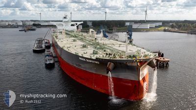
NISSOS DESPOTIKO
Tanker
Current Trip
| Time Travelled | 11 days |
|---|---|
| Remaining Time | --- |
| Distance Travelled | 965.46 nm |
| Remaining Distance | --- |
| AVG Speed | 9.8 Knots |
| MAX Speed | 15.4 Knots |
| AVG Wind | 9.4 knots |
| MAX Wind | 21.3 knots |
| MIN Temp | 14.2°C / 57.56°F |
| MAX Temp | 28°C / 82.4°F |
| Draught | 11 m |
| Position Received | 10 d ago |
Current Position
| Longitude | 127.87929° |
|---|---|
| Latitude | 34.11542° |
| Status | Under way using engine |
| Speed | 13 Knots |
| Course | 23.7° |
| Area | Japan Sea |
| Station | T-AIS |
| Position Received | 10 d ago |
Info
Information
The current position of NISSOS DESPOTIKO is in Japan Sea with coordinates 34.11542° / 127.87929° as reported on 2024-05-18 22:16 by AIS to our vessel tracker app. The vessel's current speed is 13 Knots and is heading at the port of YEOSU. The estimated time of arrival as calculated by vessel tracking app is 2024-05-18 23:00 LT
The vessel NISSOS DESPOTIKO (IMO: 9845697, MMSI: 538008312) is a Tanker It's sailing under the flag of [MH] Marshall Is.
In this page you can find informations about the vessels current position, last detected port calls, and current voyage information. If the vessels is not in coverage by AIS you will find the latest position.
The current position of NISSOS DESPOTIKO is detected by our AIS receivers and we are not responsible for the reliability of the data. The last position was recorded while the vessel was in Coverage by the Ais receivers of our vessel tracking app.
The current draught of NISSOS DESPOTIKO as reported by AIS is 11 meters
Weather
| Temperature | 19.8°C / 67.64°F |
|---|---|
| Wind Speed | 10 knots |
| Direction | 98° E |
| Pressure | 1012.9 hPa |
| Humidity | 68.6 % |
| Cloud Coverage | 100 % |
Featured Company
Events
| Time | Event | Details | Position / Dest | Info |
|---|---|---|---|---|
| 2024-05-24 08:36 | STOP Moving | 14.38 nm, East of TAICANG |
31.58766 / 121.46193
KRYOS
|
Speed: 0.3 kn Course: 288° |
| 2024-05-23 22:17 | START Moving | 20.25 nm, North East of SHENGSI |
31.00612 / 122.66537
KRYOS
|
Speed: 4.5 kn Course: 275° |
| 2024-05-23 15:10 | STOP Moving | 20.45 nm, North East of SHENGSI |
31.00833 / 122.66833
KRYOS
|
Speed: Course: -1° |
| 2024-05-23 00:52 | START Moving |
31.61213 / 124.87468
KRYOS
|
Speed: 10.4 kn Course: 329° |
|
| 2024-05-22 14:19 | STOP Moving |
31.71500 / 125.10667
KRYOS
|
Speed: Course: -1° |
|
| 2024-05-20 13:07 | STOP Moving |
32.32500 / 125.83833
KRYOS
|
Speed: Course: -1° |
|
| 2024-05-19 12:05 | START Moving | 16.72 nm, East of YEOSU |
34.63278 / 127.97888
KRYOS
|
Speed: 3.5 kn Course: 255° |
| 2024-05-19 04:29 | STOP Moving | 16.67 nm, South of SINSUAN-GIL |
34.63434 / 127.98244
KRYOS
|
Speed: 0.3 kn Course: 263° |
| 2024-05-19 02:56 | START Moving | 21.39 nm, South of SINSUAN-GIL |
34.54695 / 128.03377
KRYOS
|
Speed: 3.2 kn Course: 345° |
| 2024-05-19 01:20 | STOP Moving | 21.32 nm, South East of YEOSU |
34.53678 / 128.02220
KRYOS
|
Speed: Course: 319° |