
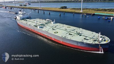
NISSOS KYTHNOS
Tanker
Current Trip
CN GLE
| Time Travelled | 5 days |
|---|---|
| Remaining Time | --- |
| Distance Travelled | 1836.05 nm |
| Remaining Distance | --- |
| AVG Speed | 12.8 Knots |
| MAX Speed | 15.4 Knots |
| AVG Wind | 13.9 knots |
| MAX Wind | 22.4 knots |
| MIN Temp | 27.4°C / 81.32°F |
| MAX Temp | 32.2°C / 89.96°F |
| Draught | 11.7 m |
| Position Received | 17 h, 52 m ago |
Current Position
| Longitude | 77.55659° |
|---|---|
| Latitude | 7.27431° |
| Status | Under way using engine |
| Speed | 13.4 Knots |
| Course | 121.3° |
| Area | Laccadive Sea |
| Station | T-AIS |
| Position Received | 17 h, 52 m ago |
Info
Information
The current position of NISSOS KYTHNOS is in Laccadive Sea with coordinates 7.27431° / 77.55659° as reported on 2024-06-21 02:45 by AIS to our vessel tracker app. The vessel's current speed is 13.4 Knots
The vessel NISSOS KYTHNOS (IMO: 9853852, MMSI: 538008314) is a Tanker It's sailing under the flag of [MH] Marshall Is.
In this page you can find informations about the vessels current position, last detected port calls, and current voyage information. If the vessels is not in coverage by AIS you will find the latest position.
The current position of NISSOS KYTHNOS is detected by our AIS receivers and we are not responsible for the reliability of the data. The last position was recorded while the vessel was in Coverage by the Ais receivers of our vessel tracking app.
The current draught of NISSOS KYTHNOS as reported by AIS is 11.7 meters
Weather
| Temperature | 27.9°C / 82.22°F |
|---|---|
| Wind Speed | 20 knots |
| Direction | 260° W |
| Pressure | 1007.6 hPa |
| Humidity | 82.6 % |
| Cloud Coverage | 82 % |
Featured Company
Most Visited Ports (Last year)
| Port | Arrivals | |
|---|---|---|
| 4 | ||
| 3 | ||
| 3 | ||
| 1 | ||
| 1 |
Last Trips
| Origin | Departure | Destination | Arrival | Distance |
|---|
Events
| Time | Event | Details | Position / Dest | Info |
|---|---|---|---|---|
| 2024-06-21 02:48 | Status Changed | Default Under way using engine |
7.26846 / 77.56615
CN GLE
|
Speed: 13.4 kn Course: 121.3° |
| 2024-06-21 02:45 | Status Changed | Under way using engine Default |
7.27431 / 77.55659
CN GLE
|
Speed: 13.2 kn Course: 121° |
| 2024-06-21 02:45 | OUT of Coverage |
7.27431 / 77.55659
Laccadive Sea
CN GLE
|
Speed: 13.4 kn Course: 121.3° |
|
| 2024-06-21 02:18 | Status Changed | Default Under way using engine |
7.32663 / 77.47103
CN GLE
|
Speed: 13.1 kn Course: 121.7° |
| 2024-06-21 02:09 | Status Changed | Under way using engine Default |
7.34320 / 77.44408
CN GLE
|
Speed: 13 kn Course: 122° |
| 2024-06-21 01:32 | Status Changed | Default Under way using engine |
7.41275 / 77.33074
CN GLE
|
Speed: 12.9 kn Course: 121.3° |
| 2024-06-20 22:51 | ETA Changed | 2024/07/01 20:00 2024/07/01 21:00 |
7.70535 / 76.83958
CN GLE
|
Speed: 12.7 kn Course: 121.4° |
| 2024-06-20 21:54 | ETA Changed | 2024/07/01 21:00 2024/07/01 23:00 |
7.80959 / 76.66722
CN GLE
|
Speed: 13 kn Course: 120.7° |
| 2024-06-20 21:12 | Change Sea Area | Indian part of the Laccadive Sea Omani part of the Gulf of Oman |
7.88994 / 76.53698
Laccadive Sea
CN GLE
|
Speed: 12.9 kn Course: 120.5° |
| 2024-06-20 21:12 | Status Changed | Under way using engine Default |
7.88994 / 76.53698
CN GLE
|
Speed: 12.9 kn Course: 121° |