
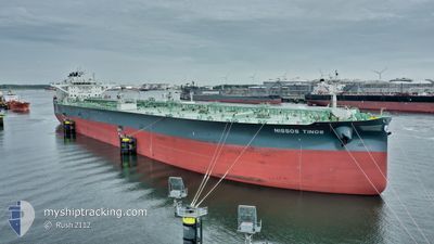
NISSOS TINOS
Tanker
Current Trip
| Time Travelled | --- |
|---|---|
| Remaining Time | --- |
| Distance Travelled | 10014.04 nm |
| Remaining Distance | --- |
| AVG Speed | 11.6 Knots |
| MAX Speed | 15.2 Knots |
| AVG Wind | 14.1 knots |
| MAX Wind | 33 knots |
| MIN Temp | 15.2°C / 59.36°F |
| MAX Temp | 30°C / 86°F |
| Draught | 15 m |
| Position Received | 12 h, 53 m ago |
Current Position
| Longitude | 8.46025° |
|---|---|
| Latitude | 44.27891° |
| Status | Under way using engine |
| Speed | |
| Course | 158° |
| Area | Ligurian Sea |
| Station | T-AIS |
| Position Received | 12 h, 53 m ago |
Info
Information
The current position of NISSOS TINOS is in Ligurian Sea with coordinates 44.27891° / 8.46025° as reported on 2024-06-21 07:26 by AIS to our vessel tracker app. The vessel's current speed is 0 Knots
The vessel NISSOS TINOS (IMO: 9886782, MMSI: 538008916) is a Tanker It's sailing under the flag of [MH] Marshall Is.
In this page you can find informations about the vessels current position, last detected port calls, and current voyage information. If the vessels is not in coverage by AIS you will find the latest position.
The current position of NISSOS TINOS is detected by our AIS receivers and we are not responsible for the reliability of the data. The last position was recorded while the vessel was in Coverage by the Ais receivers of our vessel tracking app.
The current draught of NISSOS TINOS as reported by AIS is 15 meters
Weather
| Temperature | 19.8°C / 67.64°F |
|---|---|
| Wind Speed | 6 knots |
| Direction | 151° SSE |
| Pressure | 1013.7 hPa |
| Humidity | 88.4 % |
| Cloud Coverage | 54 % |
Featured Company
Last Port Calls
Most Visited Ports (Last year)
| Port | Arrivals | |
|---|---|---|
| 1 | ||
| 1 | ||
| 1 | ||
| 1 | ||
| 1 |
Last Trips
| Origin | Departure | Destination | Arrival | Distance |
|---|
Events
| Time | Event | Details | Position / Dest | Info |
|---|---|---|---|---|
| 2024-06-21 07:29 | Status Changed | Default Under way using engine |
44.27900 / 8.46032
IT SVN
|
Speed: Course: 158° |
| 2024-06-21 07:26 | OUT of Coverage |
44.27891 / 8.46025
Ligurian Sea
|
Speed: Course: 218.8° |
|
| 2024-06-21 06:11 | STOP Moving | 0.53 nm, North East of VADO LIGURE |
44.27246 / 8.46171
IT SVN
|
Speed: 0.3 kn Course: 335° |
| 2024-06-21 03:55 | START Moving | 8.24 nm, South East of SAVONA |
44.22292 / 8.63678
IT SVN
|
Speed: 3.1 kn Course: 285° |
| 2024-06-21 02:33 | STOP Moving | 8.69 nm, South East of SAVONA |
44.21599 / 8.64221
IT SVN
|
Speed: 0.3 kn Course: 350° |
| 2024-06-20 21:10 | Detected in Sea | Italian part of the Ligurian Sea |
43.51910 / 8.20227
Ligurian Sea
IT SVN
|
Speed: 12.9 kn Course: 23.3° |
| 2024-06-20 18:53 | Change Sea Area | Italian part of the Mediterranean Sea - Western Basin French part of the Mediterranean Sea - Western Basin |
43.06619 / 7.95120
Mediterranean Sea - Western Basin
IT SVN
|
Speed: 13.1 kn Course: 22.6° |
| 2024-06-20 15:09 | Detected in Sea | French part of the Mediterranean Sea - Western Basin |
42.39312 / 7.33698
Mediterranean Sea - Western Basin
IT SVN
|
Speed: 12.9 kn Course: 36.2° |
| 2024-06-20 15:09 | Status Changed | Under way using engine Default |
42.39312 / 7.33698
IT SVN
|
Speed: 12.9 kn Course: 36° |
| 2024-06-20 14:50 | IN Coverage |
42.39312 / 7.33698
Mediterranean Sea - Western Basin
IT SVN
|
Speed: 12.9 kn Course: 36.2° |