
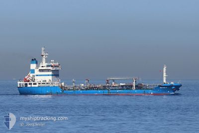
NISYROS
Oil Products Tanker
Current Trip
| Time Travelled | 11 h, 8 mins |
|---|---|
| Remaining Time | --- |
| Distance Travelled | 17.80 nm |
| Remaining Distance | 0.58 nm |
| AVG Speed | 9.3 Knots |
| MAX Speed | 12 Knots |
| AVG Wind | 9.7 knots |
| MAX Wind | 17 knots |
| MIN Temp | 12.1°C / 53.78°F |
| MAX Temp | 16.8°C / 62.24°F |
| Draught | 7.2 m |
| Position Received | 1 m ago |
Current Position
| Longitude | -5.37653° |
|---|---|
| Latitude | 36.15424° |
| Status | At anchor |
| Speed | |
| Course | 279° |
| Area | Strait of Gibraltar |
| Station | T-AIS |
| Position Received | 1 m ago |
Info
Information
The current position of NISYROS is in Strait of Gibraltar with coordinates 36.15424° / -5.37653° as reported on 2024-05-17 06:34 by AIS to our vessel tracker app. The vessel's current speed is 0 Knots and is heading at the port of GIBRALTAR. The estimated time of arrival as calculated by vessel tracking app is 2024-05-16 22:30 LT
The vessel NISYROS (IMO: 9382138, MMSI: 236590000) is a Oil Products Tanker that was built in 2010 ( 14 years old ). It's sailing under the flag of [GI] Gibraltar.
In this page you can find informations about the vessels current position, last detected port calls, and current voyage information. If the vessels is not in coverage by AIS you will find the latest position.
The current position of NISYROS is detected by our AIS receivers and we are not responsible for the reliability of the data. The last position was recorded while the vessel was in Coverage by the Ais receivers of our vessel tracking app.
The current draught of NISYROS as reported by AIS is 7.2 meters
Weather
| Temperature | 14.6°C / 58.28°F |
|---|---|
| Wind Speed | 4 knots |
| Direction | 286° WNW |
| Pressure | 1012.5 hPa |
| Humidity | 91.2 % |
| Cloud Coverage | 67 % |
Featured Company
Last Port Calls
| Port | Arrival | Departure | Time In Port |
|---|---|---|---|
| 2024-05-16 10:01 | 2024-05-16 19:27 | 9 h | |
| 2024-05-15 10:07 | 2024-05-15 21:10 | 11 h | |
| 2024-05-14 15:44 | 2024-05-15 00:14 | 8 h | |
| 2024-05-12 18:29 | 2024-05-13 02:11 | 7 h | |
| 2024-05-10 21:56 | 2024-05-10 22:23 | 26 m | |
| 2024-05-10 13:52 | 2024-05-10 19:54 | 6 h | |
| 2024-05-10 12:51 | 2024-05-10 13:35 | 44 m | |
| 2024-05-09 07:29 | 2024-05-09 14:34 | 7 h | |
| 2024-05-08 00:43 | 2024-05-08 07:51 | 7 h | |
| 2024-05-05 11:18 | 2024-05-05 18:59 | 7 h |
Most Visited Ports (Last year)
| Port | Arrivals | |
|---|---|---|
| 175 | ||
| 110 | ||
| 4 | ||
| 3 | ||
| 2 | ||
| 1 |
Last Trips
| Origin | Departure | Destination | Arrival | Distance | |
|---|---|---|---|---|---|
| 2024-05-15 23:10 | 2024-05-16 11:01 | 30.54 nm | |||
| 2024-05-15 02:14 | 2024-05-15 12:07 | 7.84 nm | |||
| 2024-05-13 03:11 | 2024-05-14 17:44 | 36.35 nm | |||
| 2024-05-11 00:23 | 2024-05-12 19:29 | 40.92 nm | |||
| 2024-05-10 21:54 | 2024-05-10 23:56 | 1.01 nm | |||
| 2024-05-10 15:35 | 2024-05-10 15:52 | 0.79 nm | |||
| 2024-05-09 15:34 | 2024-05-10 14:51 | 26.41 nm | |||
| 2024-05-08 09:51 | 2024-05-09 08:29 | 31.69 nm | |||
| 2024-05-05 19:59 | 2024-05-08 02:43 | 35.77 nm | |||
| 2024-05-05 03:18 | 2024-05-05 12:18 | 22.57 nm |
Events
| Time | Event | Details | Position / Dest | Info |
|---|---|---|---|---|
| 2024-05-16 21:28 | Status Changed | At anchor Under way using engine |
36.15397 / -5.37752
GIBRALTAR
|
Speed: 0.7 kn Course: 320° |
| 2024-05-16 21:26 | STOP Moving | 0.83 nm, North West of GIBRALTAR |
36.15417 / -5.37778
GIBRALTAR
|
Speed: 0.3 kn Course: 311° |
| 2024-05-16 21:20 | Change Sea Area | Spanish part of the Strait of Gibraltar Gibraltarian part of the Strait of Gibraltar |
36.15235 / -5.37654
Strait of Gibraltar
GIBRALTAR
|
Speed: 1.8 kn Course: 351.6° |
| 2024-05-16 20:32 | Change Sea Area | Gibraltarian part of the Strait of Gibraltar Spanish part of the Strait of Gibraltar |
36.06860 / -5.36708
Strait of Gibraltar
GIBRALTAR
|
Speed: 9.9 kn Course: 1.6° |
| 2024-05-16 20:05 | Change Sea Area | Spanish part of the Strait of Gibraltar Moroccan part of the Strait of Gibraltar |
35.99178 / -5.40638
Strait of Gibraltar
GIBRALTAR
|
Speed: 11.8 kn Course: 36.5° |
| 2024-05-16 19:32 | Destination Changed | GIBRALTAR TANGERMED |
35.91946 / -5.49354
GIBRALTAR
|
Speed: 9.5 kn Course: 5.8° |
| 2024-05-16 19:32 | ETA Changed | 2024/05/16 22:30 2024/05/16 00:10 |
35.91946 / -5.49354
GIBRALTAR
|
Speed: 9.5 kn Course: 5.8° |
| 2024-05-16 19:27 | PORT DEPARTURE |
|
35.90686 / -5.49255
TANGERMED
|
Speed: 6.5 kn Course: 358° |
| 2024-05-16 19:22 | START Moving |
35.89817 / -5.49489
[MA] TANGER MED
|
Speed: 6.2 kn Course: 46° |
|
| 2024-05-16 19:14 | Status Changed | Under way using engine Default |
35.89405 / -5.50139
[MA] TANGER MED
|
Speed: Course: 36° |