
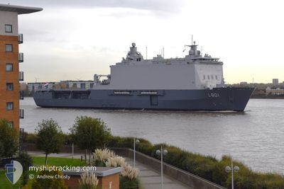
NATO WARSHIP L801
Combat Vessel
Current Trip
MILITARY OPERATIONS
| Time Travelled | 23 h, 34 mins |
|---|---|
| Remaining Time | --- |
| Distance Travelled | 214.78 nm |
| Remaining Distance | --- |
| AVG Speed | 10.7 Knots |
| MAX Speed | 17.4 Knots |
| AVG Wind | 19.6 knots |
| MAX Wind | 24 knots |
| MIN Temp | 13.6°C / 56.48°F |
| MAX Temp | 14.9°C / 58.82°F |
| Draught | 0 m |
| Position Received | 2 m ago |
Current Position
| Longitude | 6.27517° |
|---|---|
| Latitude | 55.95182° |
| Status | Under way using engine |
| Speed | 13.7 Knots |
| Course | 18.9° |
| Area | North Sea |
| Station | T-AIS |
| Position Received | 2 m ago |
Info
Information
The current position of NATO WARSHIP L801 is in North Sea with coordinates 55.95182° / 6.27517° as reported on 2024-06-01 07:55 by AIS to our vessel tracker app. The vessel's current speed is 13.7 Knots
The vessel NATO WARSHIP L801 (IMO: 9280768, MMSI: 244527000) is a Combat Vessel that was built in 2007 ( 17 years old ). It's sailing under the flag of [NL] Netherlands.
In this page you can find informations about the vessels current position, last detected port calls, and current voyage information. If the vessels is not in coverage by AIS you will find the latest position.
The current position of NATO WARSHIP L801 is detected by our AIS receivers and we are not responsible for the reliability of the data. The last position was recorded while the vessel was in Coverage by the Ais receivers of our vessel tracking app.
Weather
| Temperature | 13.6°C / 56.48°F |
|---|---|
| Wind Speed | 20 knots |
| Direction | 354° N |
| Pressure | 1017.4 hPa |
| Humidity | 90.8 % |
| Cloud Coverage | 7 % |
Featured Company
Last Port Calls
| Port | Arrival | Departure | Time In Port |
|---|---|---|---|
| 2024-05-30 18:46 | 2024-05-31 08:23 | 13 h | |
| 2024-04-24 06:00 | 2024-05-29 08:28 | ||
| 2024-04-19 11:13 | 2024-04-22 08:24 | 2 d | |
| 2024-04-12 07:59 | 2024-04-15 08:41 | 3 d | |
| 2024-04-08 08:13 |
Last Trips
| Origin | Departure | Destination | Arrival | Distance | |
|---|---|---|---|---|---|
| 2024-05-29 10:28 | 2024-05-30 20:46 | 194.59 nm | |||
| 2024-04-22 10:24 | 2024-04-24 08:00 | 570.15 nm | |||
| 2024-04-15 10:41 | 2024-04-19 13:13 | 185.96 nm | |||
| 2024-04-08 10:13 | 2024-04-12 09:59 | 751.86 nm |
Events
| Time | Event | Details | Position / Dest | Info |
|---|---|---|---|---|
| 2024-06-01 03:35 | Change Sea Area | Danish part of the North Sea German part of the North Sea |
55.54874 / 6.16172
North Sea
|
Speed: 6.1 kn Course: 4.8° |
| 2024-06-01 03:32 | IN Coverage |
55.54874 / 6.16172
North Sea
|
Speed: 6.1 kn Course: 4.8° |
|
| 2024-06-01 01:52 | OUT of Coverage |
55.34179 / 6.00152
North Sea
|
Speed: 9.6 kn Course: 357.7° |
|
| 2024-06-01 00:17 | Detected in Sea | German part of the North Sea |
55.03536 / 5.86699
North Sea
|
Speed: 13.4 kn Course: 16.1° |
| 2024-06-01 00:17 | IN Coverage |
55.03536 / 5.86699
North Sea
|
Speed: 13.4 kn Course: 16.1° |
|
| 2024-05-31 18:31 | OUT of Coverage |
53.86141 / 5.01168
North Sea
|
Speed: 13.8 kn Course: 18.8° |
|
| 2024-05-31 13:24 | START Moving | 1.71 nm, North West of DEN HELDER |
52.98384 / 4.76389
MILITARY OPERATIONS
|
Speed: 7.3 kn Course: 235.3° |
| 2024-05-31 13:00 | Status Changed | Under way using engine Restricted manoeuverability |
52.98624 / 4.76610
MILITARY OPERATIONS
|
Speed: 0.2 kn Course: 249° |
| 2024-05-31 08:59 | Status Changed | Restricted manoeuverability Under way using engine |
52.98636 / 4.76604
MILITARY OPERATIONS
|
Speed: 0.2 kn Course: 255° |
| 2024-05-31 08:53 | STOP Moving | 1.78 nm, North West of DEN HELDER |
52.98579 / 4.76596
MILITARY OPERATIONS
|
Speed: 0.3 kn Course: 256° |