
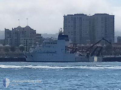
NOAAS REUBEN LASKER
Fishery Research Vessel
Current Trip
| Time Travelled | 1 day |
|---|---|
| Remaining Time | --- |
| Distance Travelled | 72.00 nm |
| Remaining Distance | --- |
| AVG Speed | 5.2 Knots |
| MAX Speed | 10.2 Knots |
| AVG Wind | 7.4 knots |
| MAX Wind | 9.4 knots |
| MIN Temp | 18.2°C / 64.76°F |
| MAX Temp | 21.6°C / 70.88°F |
| Draught | 6 m |
| Position Received | Now |
Current Position
| Longitude | -117.72741° |
|---|---|
| Latitude | 32.84265° |
| Status | Under way using engine |
| Speed | 3.3 Knots |
| Course | 76° |
| Area | North Pacific Ocean |
| Station | T-AIS |
| Position Received | Now |
Info
Information
The current position of NOAAS REUBEN LASKER is in North Pacific Ocean with coordinates 32.84265° / -117.72741° as reported on 2024-06-27 07:26 by AIS to our vessel tracker app. The vessel's current speed is 3.3 Knots
The vessel NOAAS REUBEN LASKER (IMO: 9664988, MMSI: 369970573) is a Fishery Research Vessel that was built in 2013 ( 11 years old ). It's sailing under the flag of [US] USA.
In this page you can find informations about the vessels current position, last detected port calls, and current voyage information. If the vessels is not in coverage by AIS you will find the latest position.
The current position of NOAAS REUBEN LASKER is detected by our AIS receivers and we are not responsible for the reliability of the data. The last position was recorded while the vessel was in Coverage by the Ais receivers of our vessel tracking app.
The current draught of NOAAS REUBEN LASKER as reported by AIS is 6 meters
Weather
| Temperature | 18.2°C / 64.76°F |
|---|---|
| Wind Speed | 7 knots |
| Direction | 275° W |
| Pressure | 1013.3 hPa |
| Humidity | 82 % |
| Cloud Coverage | --- |
Featured Company
Last Port Calls
Most Visited Ports (Last year)
| Port | Arrivals | |
|---|---|---|
| 10 | ||
| 9 | ||
| 1 | ||
| 1 | ||
| 1 | ||
| 1 |
Last Trips
| Origin | Departure | Destination | Arrival | Distance | |
|---|---|---|---|---|---|
| 2024-05-30 14:49 | 2024-06-18 07:38 | 2248.91 nm | |||
| 2024-05-20 10:35 | 2024-05-20 11:33 | 7.02 nm | |||
| 2024-04-30 17:34 | 2024-05-15 13:20 | 2208.28 nm | |||
| 2024-04-19 08:49 | 2024-04-20 14:21 | 89.74 nm | |||
| 2024-03-27 13:41 | 2024-04-04 05:44 | 948.16 nm |
Events
| Time | Event | Details | Position / Dest | Info |
|---|---|---|---|---|
| 2024-06-27 04:25 | Status Changed | Under way using engine Engaged in Fishing |
32.89190 / -117.60917
SAN DIEGO, CA
|
Speed: 5.9 kn Course: 100.3° |
| 2024-06-27 01:46 | Status Changed | Engaged in Fishing Under way using engine |
32.80839 / -117.56472
SAN DIEGO, CA
|
Speed: 3 kn Course: 290° |
| 2024-06-27 00:02 | Change Sea Area | United States part of the North Pacific Ocean Mexican part of the North Pacific Ocean |
32.60748 / -117.55852
North Pacific Ocean
SAN DIEGO, CA
|
Speed: 10.1 kn Course: 357.3° |
| 2024-06-26 23:53 | Status Changed | Under way using engine Restricted manoeuverability |
32.59254 / -117.55536
SAN DIEGO, CA
|
Speed: 2.4 kn Course: 232° |
| 2024-06-26 23:43 | Change Sea Area | Mexican part of the North Pacific Ocean United States part of the North Pacific Ocean |
32.59808 / -117.55154
North Pacific Ocean
SAN DIEGO, CA
|
Speed: 2.2 kn Course: 205.2° |
| 2024-06-26 23:28 | Status Changed | Restricted manoeuverability Engaged in Fishing |
32.60721 / -117.54565
SAN DIEGO, CA
|
Speed: 2.3 kn Course: 230° |
| 2024-06-26 21:31 | ETA Changed | 2024/07/17 16:00 |
32.65960 / -117.45640
SAN DIEGO, CA
|
Speed: 5.4 kn Course: 284.5° |
| 2024-06-26 21:26 | Status Changed | Engaged in Fishing Under way using engine |
32.65725 / -117.44700
SAN DIEGO, CA
|
Speed: 2.4 kn Course: 314° |
| 2024-06-26 18:43 | ETA Changed | 2024/07/17 16:00 |
32.65776 / -117.39231
SAN DIEGO, CA
|
Speed: 7.8 kn Course: 281° |
| 2024-06-26 18:07 | ETA Changed | 2024/07/17 16:00 |
32.62997 / -117.30229
SAN DIEGO, CA
|
Speed: 8.1 kn Course: 289.2° |