
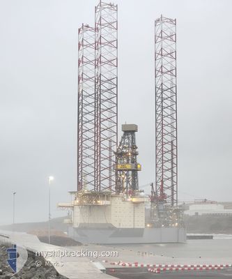
NOBLE INTREPID
Drilling Jack Up
Current Position
| Longitude | 2.33542° |
|---|---|
| Latitude | 56.69634° |
| Status | Restricted manoeuverability |
| Speed | |
| Course | 247° |
| Area | North Sea |
| Station | T-AIS |
| Position Received | 13 h, 33 m ago |
Info
Information
The current position of NOBLE INTREPID is in North Sea with coordinates 56.69634° / 2.33542° as reported on 2024-06-20 01:35 by AIS to our vessel tracker app. The vessel's current speed is 0 Knots
The vessel NOBLE INTREPID (IMO: 8771540, MMSI: 538010631) is a Drilling Jack Up that was built in 2014 ( 10 years old ). It's sailing under the flag of [MH] Marshall Is.
In this page you can find informations about the vessels current position, last detected port calls, and current voyage information. If the vessels is not in coverage by AIS you will find the latest position.
The current position of NOBLE INTREPID is detected by our AIS receivers and we are not responsible for the reliability of the data. The last position was recorded while the vessel was in Coverage by the Ais receivers of our vessel tracking app.
Weather
| Temperature | 12.5°C / 54.5°F |
|---|---|
| Wind Speed | 19 knots |
| Direction | 217° SW |
| Pressure | 1019.3 hPa |
| Humidity | 86.2 % |
| Cloud Coverage | 36 % |
Featured Company
Last Port Calls
Most Visited Ports (Last year)
| Port | Arrivals |
|---|
Last Trips
| Origin | Departure | Destination | Arrival | Distance |
|---|
Events
| Time | Event | Details | Position / Dest | Info |
|---|---|---|---|---|
| 2024-06-20 01:35 | OUT of Coverage |
56.69634 / 2.33542
North Sea
|
Speed: Course: 255.6° |
|
| 2024-06-19 22:38 | IN Coverage |
56.69625 / 2.33539
North Sea
|
Speed: Course: 255.6° |
|
| 2024-06-19 19:40 | OUT of Coverage |
56.69621 / 2.33541
North Sea
|
Speed: Course: 255.6° |
|
| 2024-06-19 19:05 | IN Coverage |
56.69621 / 2.33563
North Sea
|
Speed: Course: 255.6° |