
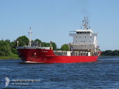
NOORDDIJK
General Cargo
Current Trip
| Time Travelled | 1 day |
|---|---|
| Remaining Time | 14 h, 8 mins |
| Distance Travelled | 258.36 nm |
| Remaining Distance | 210.95 nm |
| AVG Speed | 8.5 Knots |
| MAX Speed | 11.5 Knots |
| AVG Wind | 5.2 knots |
| MAX Wind | 16.5 knots |
| MIN Temp | 14.5°C / 58.1°F |
| MAX Temp | 21.7°C / 71.06°F |
| Draught | 5.7 m |
| Position Received | Now |
Current Position
| Longitude | 29.17679° |
|---|---|
| Latitude | 40.72606° |
| Status | Under way using engine |
| Speed | 0.5 Knots |
| Course | 113° |
| Area | Sea of Marmara |
| Station | T-AIS |
| Position Received | Now |
Info
Information
The current position of NOORDDIJK is in Sea of Marmara with coordinates 40.72606° / 29.17679° as reported on 2024-05-18 17:05 by AIS to our vessel tracker app. The vessel's current speed is 0.5 Knots and is heading at the port of CONSTANTA. The estimated time of arrival as calculated by vessel tracking app is 2024-05-19 07:14 LT
The vessel NOORDDIJK (IMO: 9591820, MMSI: 246737000) is a General Cargo that was built in 2011 ( 13 years old ). It's sailing under the flag of [NL] Netherlands.
In this page you can find informations about the vessels current position, last detected port calls, and current voyage information. If the vessels is not in coverage by AIS you will find the latest position.
The current position of NOORDDIJK is detected by our AIS receivers and we are not responsible for the reliability of the data. The last position was recorded while the vessel was in Coverage by the Ais receivers of our vessel tracking app.
The current draught of NOORDDIJK as reported by AIS is 5.7 meters
Weather
| Temperature | 18.8°C / 65.84°F |
|---|---|
| Wind Speed | 7 knots |
| Direction | 50° NE |
| Pressure | 1016.2 hPa |
| Humidity | 67 % |
| Cloud Coverage | 4 % |
Featured Company
Last Port Calls
| Port | Arrival | Departure | Time In Port |
|---|---|---|---|
| 2024-05-13 15:55 | 2024-05-16 17:20 | 3 d | |
| 2024-05-08 14:51 | 2024-05-10 03:32 | 1 d | |
| 2024-05-01 02:48 | 2024-05-04 02:25 | 2 d | |
| 2024-04-21 17:11 | 2024-04-24 01:38 | 2 d | |
| 2024-04-14 21:20 | 2024-04-18 15:11 | 3 d | |
| 2024-03-31 07:12 | 2024-04-03 04:24 | 2 d | |
| 2024-03-24 21:33 | 2024-03-27 15:33 | 2 d | |
| 2024-03-12 05:07 | 2024-03-14 22:47 | 2 d | |
| 2024-03-06 02:10 | 2024-03-08 22:39 | 2 d | |
| 2024-03-04 02:19 | 2024-03-05 02:42 | 1 d |
Last Trips
| Origin | Departure | Destination | Arrival | Distance | |
|---|---|---|---|---|---|
| 2024-05-10 06:32 | 2024-05-13 18:55 | 470.92 nm | |||
| 2024-05-04 05:25 | 2024-05-08 17:51 | 507.27 nm | |||
| 2024-04-24 04:38 | 2024-05-01 05:48 | 456.62 nm | |||
| 2024-04-18 18:11 | 2024-04-21 20:11 | 496.04 nm | |||
| 2024-04-03 07:24 | 2024-04-15 00:20 | 490.31 nm | |||
| 2024-03-27 18:33 | 2024-03-31 10:12 | 498.62 nm | |||
| 2024-03-14 23:47 | 2024-03-25 00:33 | 2598.70 nm | |||
| 2024-03-08 22:39 | 2024-03-12 06:07 | 853.73 nm | |||
| 2024-03-05 03:42 | 2024-03-06 02:10 | 212.84 nm | |||
| 2024-03-01 18:29 | 2024-03-04 03:19 | 124.13 nm |
Events
| Time | Event | Details | Position / Dest | Info |
|---|---|---|---|---|
| 2024-05-18 05:35 | STOP Moving | 9.9 nm, West of YALOVA |
40.70783 / 29.06685
ROCND
|
Speed: 0.3 kn Course: 194° |
| 2024-05-17 19:50 | Status Changed | Under way using engine Default |
40.57087 / 27.20681
ROCND
|
Speed: 9.1 kn Course: 66° |
| 2024-05-17 19:40 | Status Changed | Default Under way using engine |
40.55970 / 27.17615
ROCND
|
Speed: 9.1 kn Course: 65.9° |
| 2024-05-17 19:10 | Status Changed | Under way using engine Default |
40.53090 / 27.07937
ROCND
|
Speed: 9.4 kn Course: 70° |
| 2024-05-17 18:53 | IN Coverage |
40.53148 / 27.08156
Sea of Marmara
ROCND
|
Speed: 9.5 kn Course: 70.8° |
|
| 2024-05-17 16:56 | Status Changed | Default Under way using engine |
40.36833 / 26.67500
ROCND
|
Speed: 7.8 kn Course: 40° |
| 2024-05-17 16:47 | OUT of Coverage |
40.35719 / 26.66332
Sea of Marmara
ROCND
|
Speed: 7.8 kn Course: 40° |
|
| 2024-05-17 16:38 | Status Changed | Under way using engine Default |
40.33780 / 26.64210
ROCND
|
Speed: 10.5 kn Course: 49° |
| 2024-05-17 16:22 | Status Changed | Default Under way using engine |
40.30747 / 26.59825
ROCND
|
Speed: 10.6 kn Course: 48.8° |
| 2024-05-17 13:39 | Change Sea Area | Turkish part of the Sea of Marmara Turkish part of the Aegean Sea |
40.01655 / 26.19402
Sea of Marmara
ROCND
|
Speed: 6.9 kn Course: 70.8° |