
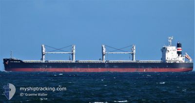
NORD MAGELLAN
Cargo
Current Trip
| Trip Time | 26 days |
|---|---|
| Trip Distance | 6084.73 nm |
| AVG Speed | 12 Knots |
| MAX Speed | 16.1 Knots |
| Draught | 8.8 m |
| AVG Wind | 8.3 knots |
| MAX Wind | 25.3 knots |
| MIN Temp | 15.4°C / 59.72°F |
| MAX Temp | 29.5°C / 85.1°F |
| Position Received | 8 d ago |
Current Position
| Longitude | 29.95025° |
|---|---|
| Latitude | 41.26863° |
| Status | Under way using engine |
| Speed | 13.7 Knots |
| Course | 88.9° |
| Area | Black Sea |
| Station | T-AIS |
| Position Received | 8 d ago |
Info
Information
The current position of NORD MAGELLAN is in Black Sea with coordinates 41.26863° / 29.95025° as reported on 2024-06-14 05:26 by AIS to our vessel tracker app. The vessel's current speed is 13.7 Knots and is currently inside the port of EREGLI.
The vessel NORD MAGELLAN (IMO: 9874961, MMSI: 372164000) is a Cargo It's sailing under the flag of [PA] Panama.
In this page you can find informations about the vessels current position, last detected port calls, and current voyage information. If the vessels is not in coverage by AIS you will find the latest position.
The current position of NORD MAGELLAN is detected by our AIS receivers and we are not responsible for the reliability of the data. The last position was recorded while the vessel was in Coverage by the Ais receivers of our vessel tracking app.
The current draught of NORD MAGELLAN as reported by AIS is 8.8 meters
Weather
| Temperature | 14.2°C / 57.56°F |
|---|---|
| Wind Speed | 4 knots |
| Direction | 135° SE |
| Pressure | 1009.9 hPa |
| Humidity | 77.6 % |
| Cloud Coverage | --- |
Featured Company
Last Port Calls
| Port | Arrival | Departure | Time In Port |
|---|---|---|---|
| 2024-06-21 08:28 | |||
| 2024-05-20 12:31 | 2024-05-25 12:49 | 5 d | |
| 2024-05-05 18:34 | 2024-05-11 14:41 | 5 d | |
| 2024-04-09 11:34 | 2024-04-23 20:29 | 14 d | |
| 2024-04-09 08:42 |
Most Visited Ports (Last year)
| Port | Arrivals | |
|---|---|---|
| 3 | ||
| 2 | ||
| 1 | ||
| 1 | ||
| 1 | ||
| 1 |
Last Trips
| Origin | Departure | Destination | Arrival | Distance | |
|---|---|---|---|---|---|
| 2024-05-25 07:49 | 2024-06-21 11:28 | 6084.73 nm | |||
| 2024-05-11 09:41 | 2024-05-20 07:31 | 736.18 nm | |||
| 2024-04-23 15:29 | 2024-05-05 13:34 | 1675.98 nm | |||
| 2024-04-09 03:42 | 2024-04-09 06:34 | 34.00 nm |
Events
| Time | Event | Details | Position / Dest | Info |
|---|---|---|---|---|
| 2024-06-21 08:37 | STOP Moving |
41.26884 / 31.40661
[TR] EREGLI
|
Speed: 0.2 kn Course: 154° |
|
| 2024-06-21 08:28 | PORT ARRIVAL |
|
41.27030 / 31.40680
[TR] EREGLI
|
Speed: 4.3 kn Course: 112° |
| 2024-06-21 07:22 | START Moving | 2.24 nm, South West of EREGLI |
41.25676 / 31.36609
TR ERE
|
Speed: 7.5 kn Course: 232° |
| 2024-06-14 10:47 | STOP Moving | 1.74 nm, South West of EREGLI |
41.26253 / 31.37431
TR ERE
|
Speed: 0.3 kn Course: 337° |
| 2024-06-14 05:34 | Status Changed | Default Under way using engine |
41.26946 / 29.99319
TR ERE
|
Speed: 13.7 kn Course: 88.9° |
| 2024-06-14 05:26 | OUT of Coverage |
41.26863 / 29.95025
Black Sea
TR ERE
|
Speed: 13.7 kn Course: 88.9° |
|
| 2024-06-14 05:19 | Status Changed | Under way using engine Default |
41.26830 / 29.91819
TR ERE
|
Speed: 13.8 kn Course: 93° |
| 2024-06-14 04:55 | Status Changed | Default Under way using engine |
41.27428 / 29.79318
TR ERE
|
Speed: 13.8 kn Course: 93.1° |
| 2024-06-14 02:35 | Change Sea Area | Turkish part of the Black Sea Turkish part of the Sea of Marmara |
41.23487 / 29.14562
Black Sea
TR ERE
|
Speed: 8.1 kn Course: 33.1° |
| 2024-06-13 22:08 | ETA Changed | 2024/06/14 14:00 2024/06/13 21:00 |
40.63286 / 28.86133
TR ERE
|
Speed: 3.6 kn Course: 330° |