
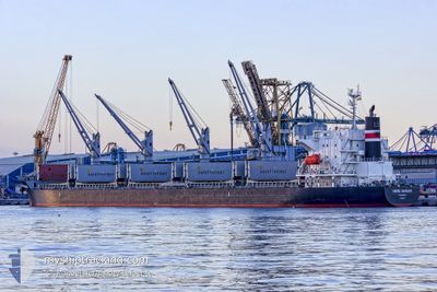
NORD NANAMI
Bulk Carrier
Current Trip
| Time Travelled | 17 h, 14 mins |
|---|---|
| Remaining Time | 7 h, 21 mins |
| Distance Travelled | 204.99 nm |
| Remaining Distance | 99.78 nm |
| AVG Speed | 11.6 Knots |
| MAX Speed | 13.8 Knots |
| AVG Wind | 11.2 knots |
| MAX Wind | 13 knots |
| MIN Temp | 15.1°C / 59.18°F |
| MAX Temp | 23°C / 73.4°F |
| Draught | 7 m |
| Position Received | 6 m ago |
Current Position
| Longitude | 1.49920° |
|---|---|
| Latitude | 54.18563° |
| Status | Under way using engine |
| Speed | 12.1 Knots |
| Course | 294.9° |
| Area | North Sea |
| Station | T-AIS |
| Position Received | 6 m ago |
Info
Information
The current position of NORD NANAMI is in North Sea with coordinates 54.18563° / 1.49920° as reported on 2024-06-26 08:49 by AIS to our vessel tracker app. The vessel's current speed is 12.1 Knots and is heading at the port of TEES. The estimated time of arrival as calculated by vessel tracking app is 2024-06-26 16:17 LT
The vessel NORD NANAMI (IMO: 9624627, MMSI: 373694000) is a Bulk Carrier that was built in 2012 ( 12 years old ). It's sailing under the flag of [PA] Panama.
In this page you can find informations about the vessels current position, last detected port calls, and current voyage information. If the vessels is not in coverage by AIS you will find the latest position.
The current position of NORD NANAMI is detected by our AIS receivers and we are not responsible for the reliability of the data. The last position was recorded while the vessel was in Coverage by the Ais receivers of our vessel tracking app.
The current draught of NORD NANAMI as reported by AIS is 7 meters
Weather
| Temperature | 15.5°C / 59.9°F |
|---|---|
| Wind Speed | 9 knots |
| Direction | 73° ENE |
| Pressure | 1015 hPa |
| Humidity | 85.3 % |
| Cloud Coverage | 6 % |
Featured Company
Most Visited Ports (Last year)
| Port | Arrivals | |
|---|---|---|
| 2 | ||
| 2 | ||
| 2 | ||
| 1 | ||
| 1 | ||
| 1 |
Last Trips
| Origin | Departure | Destination | Arrival | Distance | |
|---|---|---|---|---|---|
| 2024-06-17 19:33 | 2024-06-25 02:19 | 1942.94 nm | |||
| 2024-05-30 20:14 | 2024-06-15 03:00 | 1414.74 nm | |||
| 2024-04-05 16:52 | 2024-05-29 10:28 | 15490.12 nm | |||
| 2024-04-03 16:37 | 2024-04-05 07:10 | 312.91 nm | |||
| 2024-03-13 17:33 | 2024-04-02 07:57 | 671.66 nm |
Events
| Time | Event | Details | Position / Dest | Info |
|---|---|---|---|---|
| 2024-06-26 08:41 | Status Changed | Under way using engine Default |
54.17398 / 1.54266
GB TEE
|
Speed: 12.2 kn Course: 295° |
| 2024-06-26 08:38 | Status Changed | Default Under way using engine |
54.16953 / 1.55906
GB TEE
|
Speed: 12.2 kn Course: 295° |
| 2024-06-26 08:27 | Status Changed | Under way using engine Default |
54.15376 / 1.61656
GB TEE
|
Speed: 12.5 kn Course: 295° |
| 2024-06-26 08:22 | Status Changed | Default Under way using engine |
54.14608 / 1.64401
GB TEE
|
Speed: 12.5 kn Course: 295.9° |
| 2024-06-26 08:02 | Status Changed | Under way using engine Default |
54.11692 / 1.74532
GB TEE
|
Speed: 12.6 kn Course: 297° |
| 2024-06-26 07:58 | Status Changed | Default Under way using engine |
54.10968 / 1.77031
GB TEE
|
Speed: 12.8 kn Course: 296.6° |
| 2024-06-26 07:48 | Status Changed | Under way using engine Default |
54.09507 / 1.82109
GB TEE
|
Speed: 12.8 kn Course: 298° |
| 2024-06-26 07:09 | Status Changed | Default Under way using engine |
54.03118 / 2.03690
GB TEE
|
Speed: 12.9 kn Course: 296.8° |
| 2024-06-26 06:55 | Status Changed | Under way using engine Default |
54.00467 / 2.10481
GB TEE
|
Speed: 13.2 kn Course: 317° |
| 2024-06-26 06:49 | Status Changed | Default Under way using engine |
53.98904 / 2.12947
GB TEE
|
Speed: 13.1 kn Course: 317.4° |