
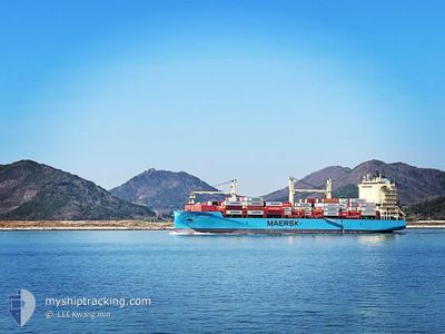
NORDAGER MAERSK
Cargo
Current Trip
| Time Travelled | 4 days |
|---|---|
| Remaining Time | --- |
| Distance Travelled | 1380.16 nm |
| Remaining Distance | 1682.48 nm |
| AVG Speed | 13.8 Knots |
| MAX Speed | 17.4 Knots |
| AVG Wind | 7 knots |
| MAX Wind | 17 knots |
| MIN Temp | 20.4°C / 68.72°F |
| MAX Temp | 30.7°C / 87.26°F |
| Draught | 7.9 m |
| Position Received | 2 d ago |
Current Position
| Longitude | 117.97003° |
|---|---|
| Latitude | 23.33405° |
| Status | Under way using engine |
| Speed | 17.3 Knots |
| Course | 232° |
| Area | South China Sea |
| Station | T-AIS |
| Position Received | 2 d ago |
Info
Information
The current position of NORDAGER MAERSK is in South China Sea with coordinates 23.33405° / 117.97003° as reported on 2024-05-24 18:56 by AIS to our vessel tracker app. The vessel's current speed is 17.3 Knots and is heading at the port of GWANGYANG. The estimated time of arrival as calculated by vessel tracking app is 2024-05-19 11:00 LT
The vessel NORDAGER MAERSK (IMO: 9885154, MMSI: 219027759) is a Cargo It's sailing under the flag of [DK] Denmark.
In this page you can find informations about the vessels current position, last detected port calls, and current voyage information. If the vessels is not in coverage by AIS you will find the latest position.
The current position of NORDAGER MAERSK is detected by our AIS receivers and we are not responsible for the reliability of the data. The last position was recorded while the vessel was in Coverage by the Ais receivers of our vessel tracking app.
The current draught of NORDAGER MAERSK as reported by AIS is 7.9 meters
Weather
| Temperature | 30.5°C / 86.9°F |
|---|---|
| Wind Speed | 17 knots |
| Direction | 205° SSW |
| Pressure | 1003.7 hPa |
| Humidity | 82.1 % |
| Cloud Coverage | 74 % |
Featured Company
Last Port Calls
| Port | Arrival | Departure | Time In Port |
|---|---|---|---|
| 2024-05-22 16:08 | 2024-05-23 07:36 | 15 h | |
| 2024-05-21 10:56 | 2024-05-21 22:56 | 12 h | |
| 2024-05-19 11:26 | 2024-05-19 21:53 | 10 h | |
| 2024-05-18 08:57 | 2024-05-19 04:22 | 19 h | |
| 2024-05-17 09:44 | 2024-05-17 21:19 | 11 h | |
| 2024-05-15 13:52 | 2024-05-17 07:23 | 1 d | |
| 2024-05-14 09:08 | 2024-05-14 14:32 | 5 h | |
| 2024-05-14 00:08 | 2024-05-14 08:08 | 7 h | |
| 2024-05-12 22:22 | 2024-05-13 07:29 | 9 h | |
| 2024-05-11 22:31 | 2024-05-12 05:32 | 7 h |
Last Trips
| Origin | Departure | Destination | Arrival | Distance | |
|---|---|---|---|---|---|
| 2024-05-22 06:56 | 2024-05-23 00:08 | 218.59 nm | |||
| 2024-05-20 06:53 | 2024-05-21 18:56 | 449.44 nm | |||
| 2024-05-19 13:22 | 2024-05-19 20:26 | 99.07 nm | |||
| 2024-05-18 06:19 | 2024-05-18 17:57 | 126.39 nm | |||
| 2024-05-17 16:23 | 2024-05-17 18:44 | 24.02 nm | |||
| 2024-05-14 23:32 | 2024-05-15 22:52 | 325.83 nm | |||
| 2024-05-14 17:08 | 2024-05-14 18:08 | 8.68 nm | |||
| 2024-05-13 16:29 | 2024-05-14 09:08 | 241.19 nm | |||
| 2024-05-12 14:32 | 2024-05-13 07:22 | 197.59 nm | |||
| 2024-05-07 14:52 | 2024-05-12 07:31 | 1680.57 nm |
Events
| Time | Event | Details | Position / Dest | Info |
|---|---|---|---|---|
| 2024-05-27 09:56 | START Moving |
11.72002 / 109.82665
KR KAN
|
Speed: 5.4 kn Course: 154° |
|
| 2024-05-27 08:24 | STOP Moving |
11.69833 / 109.79166
KR KAN
|
Speed: Course: -1° |
|
| 2024-05-24 19:00 | Status Changed | Default Under way using engine |
23.32128 / 117.95283
KR KAN
|
Speed: 17.3 kn Course: 232° |
| 2024-05-24 18:56 | OUT of Coverage |
23.33405 / 117.97003
South China Sea
|
Speed: 17.3 kn Course: 232° |
|
| 2024-05-24 17:40 | Status Changed | Under way using engine Default |
23.56152 / 118.28005
KR KAN
|
Speed: 16.7 kn Course: 236° |
| 2024-05-24 17:32 | Status Changed | Default Under way using engine |
23.58194 / 118.30920
KR KAN
|
Speed: 16 kn Course: 235° |
| 2024-05-24 16:50 | Change Sea Area | Chinese part of the South China Sea South Korean part of the Japan Sea |
23.70700 / 118.47666
South China Sea
|
Speed: 16.4 kn Course: 228.8° |
| 2024-05-24 16:48 | Status Changed | Under way using engine Default |
23.71039 / 118.48073
KR KAN
|
Speed: 16 kn Course: 229° |
| 2024-05-24 16:48 | IN Coverage |
23.70700 / 118.47666
South China Sea
|
Speed: 16.4 kn Course: 228.8° |
|
| 2024-05-23 07:36 | PORT DEPARTURE |
|
29.94421 / 121.87166
KR KAN
|
Speed: 3.8 kn Course: 14° |