
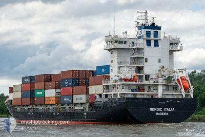
NORDIC ITALIA
Container Ship
Current Trip
| Time Travelled | 17 h, 18 mins |
|---|---|
| Remaining Time | 12 h, 16 mins |
| Distance Travelled | 211.67 nm |
| Remaining Distance | 155.18 nm |
| AVG Speed | 12.9 Knots |
| MAX Speed | 15.3 Knots |
| AVG Wind | 5.9 knots |
| MAX Wind | 9 knots |
| MIN Temp | 8.1°C / 46.58°F |
| MAX Temp | 20.7°C / 69.26°F |
| Draught | 7.3 m |
| Position Received | 1 m ago |
Current Position
| Longitude | 22.73604° |
|---|---|
| Latitude | 59.42601° |
| Status | Under way using engine |
| Speed | 12.2 Knots |
| Course | 74.1° |
| Area | Baltic Sea |
| Station | T-AIS |
| Position Received | 1 m ago |
Info
Information
The current position of NORDIC ITALIA is in Baltic Sea with coordinates 59.42601° / 22.73604° as reported on 2024-05-18 06:45 by AIS to our vessel tracker app. The vessel's current speed is 12.2 Knots and is heading at the port of KOTKA. The estimated time of arrival as calculated by vessel tracking app is 2024-05-18 19:02 LT
The vessel NORDIC ITALIA (IMO: 9474395, MMSI: 255806451) is a Container Ship that was built in 2012 ( 12 years old ). It's sailing under the flag of [PT] Portugal.
In this page you can find informations about the vessels current position, last detected port calls, and current voyage information. If the vessels is not in coverage by AIS you will find the latest position.
The current position of NORDIC ITALIA is detected by our AIS receivers and we are not responsible for the reliability of the data. The last position was recorded while the vessel was in Coverage by the Ais receivers of our vessel tracking app.
The current draught of NORDIC ITALIA as reported by AIS is 7.3 meters
Weather
| Temperature | 8.7°C / 47.66°F |
|---|---|
| Wind Speed | 7 knots |
| Direction | 104° ESE |
| Pressure | 1019.8 hPa |
| Humidity | 77.7 % |
| Cloud Coverage | 13 % |
Featured Company
Last Port Calls
| Port | Arrival | Departure | Time In Port |
|---|---|---|---|
| 2024-05-17 04:07 | 2024-05-17 13:28 | 9 h | |
| 2024-05-13 11:54 | 2024-05-14 23:25 | 1 d | |
| 2024-05-11 22:28 | 2024-05-12 23:40 | 1 d | |
| 2024-05-11 06:16 | 2024-05-11 07:08 | 51 m | |
| 2024-05-08 16:37 | 2024-05-09 13:06 | 20 h | |
| 2024-05-07 00:21 | 2024-05-07 00:24 | 3 m | |
| 2024-05-04 21:15 | 2024-05-06 07:16 | 1 d | |
| 2024-05-02 21:33 | 2024-05-04 04:27 | 1 d | |
| 2024-04-27 14:12 | 2024-04-28 11:54 | 21 h | |
| 2024-04-10 07:30 | 2024-04-24 20:23 | 14 d |
Most Visited Ports (Last year)
| Port | Arrivals | |
|---|---|---|
| 33 | ||
| 32 | ||
| 16 | ||
| 14 | ||
| 10 | ||
| 6 |
Last Trips
| Origin | Departure | Destination | Arrival | Distance | |
|---|---|---|---|---|---|
| 2024-05-15 01:25 | 2024-05-17 06:07 | 557.40 nm | |||
| 2024-05-13 01:40 | 2024-05-13 13:54 | 125.35 nm | |||
| 2024-05-11 09:08 | 2024-05-12 00:28 | 133.57 nm | |||
| 2024-05-09 16:06 | 2024-05-11 08:16 | 627.43 nm | |||
| 2024-05-07 02:24 | 2024-05-08 19:37 | 624.34 nm | |||
| 2024-05-06 09:16 | 2024-05-07 02:21 | 131.27 nm | |||
| 2024-05-04 06:27 | 2024-05-04 23:15 | 122.19 nm | |||
| 2024-04-28 14:54 | 2024-05-02 23:33 | 871.54 nm | |||
| 2024-04-24 22:23 | 2024-04-27 17:12 | 759.30 nm | |||
| 2024-04-09 23:16 | 2024-04-10 09:30 | 115.97 nm |
Events
| Time | Event | Details | Position / Dest | Info |
|---|---|---|---|---|
| 2024-05-18 06:25 | Change Sea Area | Finnish part of the Baltic Sea Estonian part of the Baltic Sea |
59.40713 / 22.60739
Baltic Sea
FIKTK
|
Speed: 12 kn Course: 73.9° |
| 2024-05-18 05:30 | Status Changed | Under way using engine Default |
59.35204 / 22.26520
FIKTK
|
Speed: 11.8 kn Course: 71° |
| 2024-05-18 05:12 | Status Changed | Default Under way using engine |
59.33469 / 22.15975
FIKTK
|
Speed: 12.1 kn Course: 73.1° |
| 2024-05-18 04:33 | Status Changed | Under way using engine Default |
59.29603 / 21.91310
FIKTK
|
Speed: 12.2 kn Course: 72° |
| 2024-05-18 04:26 | Status Changed | Default Under way using engine |
59.28818 / 21.86735
FIKTK
|
Speed: 12.1 kn Course: 71.2° |
| 2024-05-18 04:22 | Status Changed | Under way using engine Default |
59.28386 / 21.84220
FIKTK
|
Speed: 11.9 kn Course: 71° |
| 2024-05-18 04:12 | Status Changed | Default Under way using engine |
59.27328 / 21.77973
FIKTK
|
Speed: 12 kn Course: 69.7° |
| 2024-05-18 03:00 | Detected in Sea | Estonian part of the Baltic Sea |
59.19182 / 21.34051
Baltic Sea
FIKTK
|
Speed: 11.7 kn Course: 67.6° |
| 2024-05-18 03:00 | Status Changed | Under way using engine Default |
59.19182 / 21.34051
FIKTK
|
Speed: 11.9 kn Course: 69° |
| 2024-05-18 02:12 | Status Changed | Default Under way using engine |
59.13604 / 21.05200
FIKTK
|
Speed: 11.9 kn Course: 70.1° |