
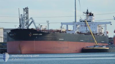
NORDIC LUNA
Crude Oil Tanker
Current Trip
| Time Travelled | 7 days |
|---|---|
| Remaining Time | --- |
| Distance Travelled | 1571.57 nm |
| Remaining Distance | --- |
| AVG Speed | 9.1 Knots |
| MAX Speed | 14.8 Knots |
| AVG Wind | 12.5 knots |
| MAX Wind | 21.9 knots |
| MIN Temp | 24.9°C / 76.82°F |
| MAX Temp | 30.4°C / 86.72°F |
| Draught | 8.6 m |
| Position Received | 8 m ago |
Current Position
| Longitude | 77.70343° |
|---|---|
| Latitude | 7.31117° |
| Status | Under way using engine |
| Speed | 9.8 Knots |
| Course | 305° |
| Area | Laccadive Sea |
| Station | T-AIS |
| Position Received | 8 m ago |
Info
Information
The current position of NORDIC LUNA is in Laccadive Sea with coordinates 7.31117° / 77.70343° as reported on 2024-06-12 09:14 by AIS to our vessel tracker app. The vessel's current speed is 9.8 Knots
The vessel NORDIC LUNA (IMO: 9290933, MMSI: 319098500) is a Crude Oil Tanker that was built in 2004 ( 20 years old ). It's sailing under the flag of [KY] Cayman Is.
In this page you can find informations about the vessels current position, last detected port calls, and current voyage information. If the vessels is not in coverage by AIS you will find the latest position.
The current position of NORDIC LUNA is detected by our AIS receivers and we are not responsible for the reliability of the data. The last position was recorded while the vessel was in Coverage by the Ais receivers of our vessel tracking app.
The current draught of NORDIC LUNA as reported by AIS is 8.6 meters
Weather
| Temperature | 27.7°C / 81.86°F |
|---|---|
| Wind Speed | 17 knots |
| Direction | 261° W |
| Pressure | 1010 hPa |
| Humidity | 85.5 % |
| Cloud Coverage | 82 % |
Featured Company
Last Port Calls
| Port | Arrival | Departure | Time In Port |
|---|---|---|---|
| 2024-06-04 19:54 | 2024-06-04 21:06 | 1 h | |
| 2024-06-04 06:36 | 2024-06-04 07:18 | 41 m | |
| 2024-06-03 05:24 | 2024-06-03 06:27 | 1 h |
Most Visited Ports (Last year)
| Port | Arrivals | |
|---|---|---|
| 5 | ||
| 4 | ||
| 3 | ||
| 1 | ||
| 1 | ||
| 1 |
Last Trips
| Origin | Departure | Destination | Arrival | Distance | |
|---|---|---|---|---|---|
| 2024-06-04 15:18 | 2024-06-05 03:54 | 0.79 nm | |||
| 2024-06-03 14:27 | 2024-06-04 14:36 | 1.99 nm | |||
| 2024-03-20 06:52 | 2024-06-03 13:24 | 7637.74 nm |
Events
| Time | Event | Details | Position / Dest | Info |
|---|---|---|---|---|
| 2024-06-12 09:14 | Status Changed | Under way using engine Default |
7.31117 / 77.70343
MY PDI=>AE FJR
|
Speed: 10.3 kn Course: 305° |
| 2024-06-12 08:55 | IN Coverage |
7.31117 / 77.70343
Laccadive Sea
MY PDI=>AE FJR
|
Speed: 9.8 kn Course: 305° |
|
| 2024-06-12 07:33 | Status Changed | Default Under way using engine |
7.12178 / 77.93515
MY PDI=>AE FJR
|
Speed: 10.6 kn Course: 310° |
| 2024-06-12 07:24 | OUT of Coverage |
7.10292 / 77.95230
Laccadive Sea
MY PDI=>AE FJR
|
Speed: 10.6 kn Course: 310° |
|
| 2024-06-12 07:15 | Draught Changed | 8.6 13.4 |
7.08457 / 77.97328
MY PDI=>AE FJR
|
Speed: 10.5 kn Course: 311° |
| 2024-06-12 07:15 | Destination Changed | MY PDI=>AE FJR AE JED=>MY PDI |
7.08457 / 77.97328
MY PDI=>AE FJR
|
Speed: 10.5 kn Course: 311° |
| 2024-06-12 07:15 | ETA Changed | 2024/06/19 08:00 2024/06/03 00:01 |
7.08457 / 77.97328
MY PDI=>AE FJR
|
Speed: 10.5 kn Course: 311° |
| 2024-06-12 07:07 | Status Changed | Under way using engine Default |
7.06925 / 77.99073
AE JED=>MY PDI
|
Speed: 10.3 kn Course: 312° |
| 2024-06-12 07:07 | IN Coverage |
7.06925 / 77.99073
Laccadive Sea
|
Speed: 10.5 kn Course: 311° |
|
| 2024-06-12 05:47 | Status Changed | Default Under way using engine |
6.91345 / 78.16537
AE JED=>MY PDI
|
Speed: 10.6 kn Course: 307° |