
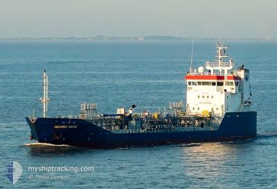
NORDIC SAGA
Oil/Chemical Tanker
Current Trip
| Time Travelled | 3 days |
|---|---|
| Remaining Time | 1 h, 39 mins |
| Distance Travelled | 522.45 nm |
| Remaining Distance | 23.18 nm |
| AVG Speed | 9.4 Knots |
| MAX Speed | 13.9 Knots |
| AVG Wind | 7.5 knots |
| MAX Wind | 14 knots |
| MIN Temp | 8.1°C / 46.58°F |
| MAX Temp | 24.1°C / 75.38°F |
| Draught | 4.3 m |
| Position Received | Now |
Current Position
| Longitude | 9.29125° |
|---|---|
| Latitude | 53.86140° |
| Status | Under way using engine |
| Speed | 14.2 Knots |
| Course | 120.5° |
| Area | North Sea |
| Station | T-AIS |
| Position Received | Now |
Info
Information
The current position of NORDIC SAGA is in North Sea with coordinates 53.86140° / 9.29125° as reported on 2024-05-20 20:01 by AIS to our vessel tracker app. The vessel's current speed is 14.2 Knots and is heading at the port of STADE. The estimated time of arrival as calculated by vessel tracking app is 2024-05-20 21:41 LT
The vessel NORDIC SAGA (IMO: 9346512, MMSI: 257942000) is a Oil/Chemical Tanker that was built in 2007 ( 17 years old ). It's sailing under the flag of [NO] Norway.
In this page you can find informations about the vessels current position, last detected port calls, and current voyage information. If the vessels is not in coverage by AIS you will find the latest position.
The current position of NORDIC SAGA is detected by our AIS receivers and we are not responsible for the reliability of the data. The last position was recorded while the vessel was in Coverage by the Ais receivers of our vessel tracking app.
The current draught of NORDIC SAGA as reported by AIS is 4.3 meters
Weather
| Temperature | 14.4°C / 57.92°F |
|---|---|
| Wind Speed | 7 knots |
| Direction | 72° ENE |
| Pressure | 1011.9 hPa |
| Humidity | 95.9 % |
| Cloud Coverage | 100 % |
Featured Company
Last Port Calls
| Port | Arrival | Departure | Time In Port |
|---|---|---|---|
| 2024-05-16 03:56 | 2024-05-17 00:12 | 20 h | |
| 2024-05-11 17:44 | 2024-05-13 09:08 | 1 d | |
| 2024-05-10 03:53 | 2024-05-10 22:15 | 18 h | |
| 2024-05-07 13:57 | 2024-05-08 16:12 | 1 d | |
| 2024-05-03 17:24 | 2024-05-04 12:47 | 19 h | |
| 2024-05-01 10:02 | 2024-05-02 06:10 | 20 h | |
| 2024-04-28 12:19 | 2024-04-29 18:57 | 1 d | |
| 2024-04-25 15:54 | 2024-04-26 23:02 | 1 d | |
| 2024-04-24 06:04 | 2024-04-24 22:06 | 16 h | |
| 2024-04-21 18:54 | 2024-04-22 15:05 | 20 h |
Most Visited Ports (Last year)
| Port | Arrivals | |
|---|---|---|
| 17 | ||
| 15 | ||
| 11 | ||
| 8 | ||
| 7 | ||
| 6 |
Last Trips
| Origin | Departure | Destination | Arrival | Distance | |
|---|---|---|---|---|---|
| 2024-05-13 11:08 | 2024-05-16 05:56 | 630.70 nm | |||
| 2024-05-10 23:15 | 2024-05-11 19:44 | 170.74 nm | |||
| 2024-05-08 18:12 | 2024-05-10 04:53 | 167.85 nm | |||
| 2024-05-04 14:47 | 2024-05-07 15:57 | 203.41 nm | |||
| 2024-05-02 07:10 | 2024-05-03 19:24 | 400.11 nm | |||
| 2024-04-29 20:57 | 2024-05-01 11:02 | 406.64 nm | |||
| 2024-04-27 00:02 | 2024-04-28 14:19 | 405.56 nm | |||
| 2024-04-24 23:06 | 2024-04-25 16:54 | 141.82 nm | |||
| 2024-04-22 17:05 | 2024-04-24 07:04 | 392.34 nm | |||
| 2024-04-18 21:46 | 2024-04-21 20:54 | 386.56 nm |
Events
| Time | Event | Details | Position / Dest | Info |
|---|---|---|---|---|
| 2024-05-20 16:44 | Status Changed | Under way using engine Default |
53.98893 / 8.33328
DE STA
|
Speed: 13 kn Course: 102° |
| 2024-05-20 16:40 | Status Changed | Default Under way using engine |
53.99159 / 8.31091
DE STA
|
Speed: 13 kn Course: 97.4° |
| 2024-05-20 15:34 | START Moving | 13.39 nm, South East of HELGOLAND |
54.03695 / 8.19637
DE STA
|
Speed: 4 kn Course: 323° |
| 2024-05-20 15:31 | Status Changed | Under way using engine Default |
54.03578 / 8.19480
DE STA
|
Speed: Course: 134° |
| 2024-05-20 15:31 | IN Coverage |
54.03582 / 8.19489
North Sea
|
Speed: 0.7 kn Course: 44.2° |
|
| 2024-05-20 12:06 | Status Changed | Default At anchor |
54.03569 / 8.19323
DE STA
|
Speed: 0.1 kn Course: 74° |
| 2024-05-20 11:59 | Status Changed | At anchor Default |
54.03556 / 8.19336
DE STA
|
Speed: Course: 81° |
| 2024-05-20 11:59 | IN Coverage |
54.03556 / 8.19336
North Sea
|
Speed: 0.1 kn Course: 350° |
|
| 2024-05-20 11:59 | OUT of Coverage |
54.03556 / 8.19336
North Sea
|
Speed: 0.1 kn Course: 350° |
|
| 2024-05-20 08:20 | OUT of Coverage |
54.03502 / 8.19595
North Sea
|
Speed: Course: 3.2° |