
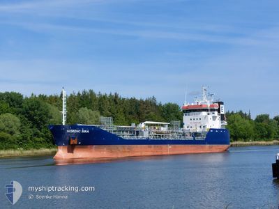
NORDIC SIRA
Oil/Chemical Tanker
Current Trip
| Trip Time | 1 day |
|---|---|
| Trip Distance | 269.50 nm |
| AVG Speed | 10 Knots |
| MAX Speed | 12.4 Knots |
| Draught | 5.3 m |
| AVG Wind | 17.7 knots |
| MAX Wind | 24.8 knots |
| MIN Temp | 10.9°C / 51.62°F |
| MAX Temp | 16.2°C / 61.16°F |
| Position Received | Now |
Current Position
| Longitude | -1.16372° |
|---|---|
| Latitude | 54.60987° |
| Status | Under way using engine |
| Speed | |
| Course | 92° |
| Area | North Sea |
| Station | T-AIS |
| Position Received | Now |
Info
Information
The current position of NORDIC SIRA is in North Sea with coordinates 54.60987° / -1.16372° as reported on 2024-06-01 13:24 by AIS to our vessel tracker app. The vessel's current speed is 0 Knots and is currently inside the port of TEES.
The vessel NORDIC SIRA (IMO: 9346500, MMSI: 257941000) is a Oil/Chemical Tanker that was built in 2006 ( 18 years old ). It's sailing under the flag of [NO] Norway.
In this page you can find informations about the vessels current position, last detected port calls, and current voyage information. If the vessels is not in coverage by AIS you will find the latest position.
The current position of NORDIC SIRA is detected by our AIS receivers and we are not responsible for the reliability of the data. The last position was recorded while the vessel was in Coverage by the Ais receivers of our vessel tracking app.
The current draught of NORDIC SIRA as reported by AIS is 5.3 meters
Weather
| Temperature | 13.8°C / 56.84°F |
|---|---|
| Wind Speed | 14 knots |
| Direction | 16° NNE |
| Pressure | 1028.5 hPa |
| Humidity | 74.3 % |
| Cloud Coverage | 11 % |
Featured Company
Last Port Calls
| Port | Arrival | Departure | Time In Port |
|---|---|---|---|
| 2024-06-01 12:35 | |||
| 2024-05-30 14:55 | 2024-05-31 10:14 | 19 h | |
| 2024-05-29 14:12 | 2024-05-30 14:25 | 1 d | |
| 2024-05-27 00:19 | 2024-05-27 17:51 | 17 h | |
| 2024-05-23 12:55 | 2024-05-24 16:17 | 1 d | |
| 2024-05-20 04:10 | 2024-05-20 18:08 | 13 h | |
| 2024-05-17 09:31 | 2024-05-19 23:48 | 2 d | |
| 2024-05-15 09:32 | 2024-05-15 23:19 | 13 h | |
| 2024-05-12 09:34 | 2024-05-13 16:43 | 1 d | |
| 2024-05-04 11:32 | 2024-05-05 23:56 | 1 d |
Most Visited Ports (Last year)
| Port | Arrivals | |
|---|---|---|
| 16 | ||
| 12 | ||
| 12 | ||
| 10 | ||
| 9 | ||
| 7 |
Last Trips
| Origin | Departure | Destination | Arrival | Distance | |
|---|---|---|---|---|---|
| 2024-05-31 12:14 | 2024-06-01 13:35 | 269.50 nm | |||
| 2024-05-30 16:25 | 2024-05-30 16:55 | 0.89 nm | |||
| 2024-05-27 18:51 | 2024-05-29 16:12 | 427.78 nm | |||
| 2024-05-24 18:17 | 2024-05-27 01:19 | 398.73 nm | |||
| 2024-05-20 20:08 | 2024-05-23 14:55 | 316.24 nm | |||
| 2024-05-20 01:48 | 2024-05-20 06:10 | 33.94 nm | |||
| 2024-05-16 01:19 | 2024-05-17 11:31 | 364.77 nm | |||
| 2024-05-13 18:43 | 2024-05-15 11:32 | 448.35 nm | |||
| 2024-05-06 01:56 | 2024-05-12 11:34 | 1253.46 nm | |||
| 2024-05-04 13:09 | 2024-05-04 13:32 | 1.73 nm |
Events
| Time | Event | Details | Position / Dest | Info |
|---|---|---|---|---|
| 2024-06-01 13:24 | Status Changed | Moored Under way using engine |
54.60985 / -1.16369
[GB] TEES
|
Speed: Course: 92° |
| 2024-06-01 13:10 | STOP Moving |
54.60960 / -1.16354
[GB] TEES
|
Speed: 0.3 kn Course: 94° |
|
| 2024-06-01 12:35 | PORT ARRIVAL |
|
54.64632 / -1.14321
[GB] TEES
|
Speed: 10.7 kn Course: 210.4° |
| 2024-06-01 10:29 | ETA Changed | 2024/06/01 12:10 2024/06/01 10:00 |
54.58850 / -.62339
GB TEE
|
Speed: 9.7 kn Course: 295.5° |
| 2024-06-01 09:41 | Status Changed | Under way using engine Default |
54.52201 / -.44023
GB TEE
|
Speed: 9 kn Course: 323° |
| 2024-06-01 09:27 | IN Coverage |
54.52472 / -.44419
North Sea
GB TEE
|
Speed: 9.6 kn Course: 320° |
|
| 2024-06-01 07:27 | Status Changed | Default Under way using engine |
54.22833 / -.04833
GB TEE
|
Speed: 10.3 kn Course: 321.6° |
| 2024-06-01 07:22 | OUT of Coverage |
54.21784 / -.03531
North Sea
GB TEE
|
Speed: 10.3 kn Course: 321.6° |
|
| 2024-06-01 04:47 | Status Changed | Under way using engine Default |
53.82384 / .33010
GB TEE
|
Speed: 10.5 kn Course: 332° |
| 2024-06-01 04:34 | Status Changed | Default Under way using engine |
53.78740 / .35922
GB TEE
|
Speed: 11.1 kn Course: 333.5° |