
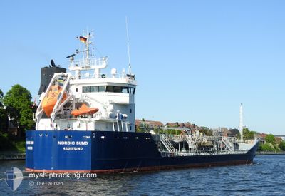
NORDIC SUND
Oil/Chemical Tanker
Current Trip
KRISTINEHAM
| Time Travelled | 3 days |
|---|---|
| Remaining Time | --- |
| Distance Travelled | 506.55 nm |
| Remaining Distance | --- |
| AVG Speed | 9.5 Knots |
| MAX Speed | 12.7 Knots |
| AVG Wind | 9.2 knots |
| MAX Wind | 23 knots |
| MIN Temp | 12.7°C / 54.86°F |
| MAX Temp | 18°C / 64.4°F |
| Draught | 5.4 m |
| Position Received | 1 m ago |
Current Position
| Longitude | 11.95322° |
|---|---|
| Latitude | 57.70610° |
| Status | Under way using engine |
| Speed | 6.7 Knots |
| Course | 40° |
| Area | Kattegat |
| Station | T-AIS |
| Position Received | 1 m ago |
Info
Information
The current position of NORDIC SUND is in Kattegat with coordinates 57.70610° / 11.95322° as reported on 2024-06-26 00:07 by AIS to our vessel tracker app. The vessel's current speed is 6.7 Knots
The vessel NORDIC SUND (IMO: 9375977, MMSI: 258714000) is a Oil/Chemical Tanker that was built in 2007 ( 17 years old ). It's sailing under the flag of [NO] Norway.
In this page you can find informations about the vessels current position, last detected port calls, and current voyage information. If the vessels is not in coverage by AIS you will find the latest position.
The current position of NORDIC SUND is detected by our AIS receivers and we are not responsible for the reliability of the data. The last position was recorded while the vessel was in Coverage by the Ais receivers of our vessel tracking app.
The current draught of NORDIC SUND as reported by AIS is 5.4 meters
Weather
| Temperature | 12.7°C / 54.86°F |
|---|---|
| Wind Speed | 3 knots |
| Direction | 166° SSE |
| Pressure | 1018.5 hPa |
| Humidity | 81 % |
| Cloud Coverage | 2 % |
Featured Company
Last Port Calls
| Port | Arrival | Departure | Time In Port |
|---|---|---|---|
| 2024-06-21 08:22 | 2024-06-22 14:59 | 1 d | |
| 2024-06-18 13:58 | 2024-06-21 07:06 | 2 d | |
| 2024-06-15 23:07 | 2024-06-16 12:44 | 13 h | |
| 2024-06-12 04:19 | 2024-06-12 22:41 | 18 h | |
| 2024-06-09 18:59 | 2024-06-10 20:39 | 1 d | |
| 2024-06-07 01:36 | 2024-06-07 20:54 | 19 h | |
| 2024-05-30 13:40 | 2024-05-31 13:25 | 23 h | |
| 2024-05-22 09:04 | 2024-05-23 05:27 | 20 h | |
| 2024-05-22 06:21 | 2024-05-22 06:25 | 4 m | |
| 2024-05-13 18:58 | 2024-05-13 19:02 | 3 m |
Most Visited Ports (Last year)
| Port | Arrivals | |
|---|---|---|
| 10 | ||
| 8 | ||
| 8 | ||
| 7 | ||
| 6 | ||
| 4 |
Last Trips
| Origin | Departure | Destination | Arrival | Distance | |
|---|---|---|---|---|---|
| 2024-06-21 09:06 | 2024-06-21 10:22 | 9.49 nm | |||
| 2024-06-16 13:44 | 2024-06-18 15:58 | 414.32 nm | |||
| 2024-06-12 23:41 | 2024-06-16 00:07 | 170.07 nm | |||
| 2024-06-10 21:39 | 2024-06-12 05:19 | 232.92 nm | |||
| 2024-06-07 22:54 | 2024-06-09 19:59 | 357.95 nm | |||
| 2024-05-31 15:25 | 2024-06-07 03:36 | 1282.50 nm | |||
| 2024-05-23 07:27 | 2024-05-30 15:40 | 1641.75 nm | |||
| 2024-05-22 08:25 | 2024-05-22 11:04 | 12.05 nm | |||
| 2024-05-13 21:02 | 2024-05-22 08:21 | 1516.44 nm | |||
| 2024-05-13 06:57 | 2024-05-13 20:58 | 86.85 nm |
Events
| Time | Event | Details | Position / Dest | Info |
|---|---|---|---|---|
| 2024-06-25 22:47 | START Moving | 2.69 nm, West of SANDVIK |
57.60463 / 11.69243
KRISTINEHAM
|
Speed: 3.7 kn Course: 315° |
| 2024-06-25 22:41 | Status Changed | Under way using engine At anchor |
57.60281 / 11.69396
KRISTINEHAM
|
Speed: 0.3 kn Course: 56° |
| 2024-06-24 15:57 | STOP Moving | 2.62 nm, South West of SANDVIK |
57.60362 / 11.69553
KRISTINEHAM
|
Speed: 0.3 kn Course: 192° |
| 2024-06-24 15:56 | Status Changed | At anchor Moored |
57.60370 / 11.69559
KRISTINEHAM
|
Speed: 0.6 kn Course: 193° |
| 2024-06-24 15:56 | Status Changed | Moored Under way using engine |
57.60372 / 11.69562
KRISTINEHAM
|
Speed: 0.7 kn Course: 194° |
| 2024-06-24 14:11 | Change Sea Area | Swedish part of the Kattegat Danish part of the Kattegat |
57.66499 / 11.19700
Kattegat
KRISTINEHAM
|
Speed: 10.5 kn Course: 111.8° |
| 2024-06-24 12:59 | Change Sea Area | Danish part of the Kattegat Danish part of the Skaggerak |
57.78415 / 10.87559
Kattegat
KRISTINEHAM
|
Speed: 11.4 kn Course: 133.5° |
| 2024-06-24 04:35 | Change Sea Area | Danish part of the Skaggerak Danish part of the North Sea |
57.28187 / 8.32860
Skaggerak
KRISTINEHAM
|
Speed: 10.3 kn Course: 30.3° |
| 2024-06-24 01:53 | ETA Changed | 2024/06/24 15:00 2024/06/24 17:00 |
56.90091 / 7.91672
KRISTINEHAM
|
Speed: 8.1 kn Course: 30.9° |
| 2024-06-23 14:13 | Detected in Sea | Danish part of the North Sea |
55.41288 / 6.39525
North Sea
KRISTINEHAM
|
Speed: 9.3 kn Course: 28° |