
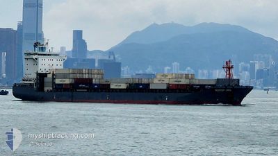
NORDPUMA
Cargo A
Current Trip
| Trip Time | 13 h, 57 mins |
|---|---|
| Trip Distance | 71.86 nm |
| AVG Speed | 13.5 Knots |
| MAX Speed | 16.8 Knots |
| Draught | 8.3 m |
| AVG Wind | 21.6 knots |
| MAX Wind | 26 knots |
| MIN Temp | 24.4°C / 75.92°F |
| MAX Temp | 27.3°C / 81.14°F |
| Position Received | 30 m ago |
Current Position
| Longitude | 113.68954° |
|---|---|
| Latitude | 22.61266° |
| Status | Moored |
| Speed | |
| Course | 346° |
| Area | South China Sea |
| Station | T-AIS |
| Position Received | 30 m ago |
Info
Information
The current position of NORDPUMA is in South China Sea with coordinates 22.61266° / 113.68954° as reported on 2024-05-30 16:30 by AIS to our vessel tracker app. The vessel's current speed is 0 Knots and is currently inside the port of NANSHA.
The vessel NORDPUMA (IMO: 9626259, MMSI: 212289000) is a Cargo A It's sailing under the flag of [CY] Cyprus.
In this page you can find informations about the vessels current position, last detected port calls, and current voyage information. If the vessels is not in coverage by AIS you will find the latest position.
The current position of NORDPUMA is detected by our AIS receivers and we are not responsible for the reliability of the data. The last position was recorded while the vessel was in Coverage by the Ais receivers of our vessel tracking app.
The current draught of NORDPUMA as reported by AIS is 8.3 meters
Weather
| Temperature | 26.5°C / 79.7°F |
|---|---|
| Wind Speed | 14 knots |
| Direction | 84° E |
| Pressure | 1006.4 hPa |
| Humidity | 89.8 % |
| Cloud Coverage | 97 % |
Featured Company
Last Port Calls
| Port | Arrival | Departure | Time In Port |
|---|---|---|---|
| 2024-05-30 10:49 | |||
| 2024-05-29 10:46 | 2024-05-29 20:52 | 10 h | |
| 2024-05-22 21:12 | 2024-05-23 19:15 | 22 h | |
| 2024-05-20 23:26 | 2024-05-21 11:29 | 12 h | |
| 2024-05-17 00:16 | 2024-05-17 10:48 | 10 h | |
| 2024-05-16 06:44 | 2024-05-16 16:00 | 9 h | |
| 2024-05-07 21:50 | 2024-05-08 19:27 | 21 h | |
| 2024-05-02 15:04 | 2024-05-03 00:04 | 8 h | |
| 2024-05-01 19:55 | 2024-05-02 09:48 | 13 h | |
| 2024-04-24 00:35 | 2024-04-24 21:59 | 21 h |
Last Trips
| Origin | Departure | Destination | Arrival | Distance | |
|---|---|---|---|---|---|
| 2024-05-30 04:52 | 2024-05-30 18:49 | 71.86 nm | |||
| 2024-05-24 03:15 | 2024-05-29 18:46 | 1255.93 nm | |||
| 2024-05-21 19:29 | 2024-05-23 05:12 | 525.65 nm | |||
| 2024-05-17 18:48 | 2024-05-21 07:26 | 671.47 nm | |||
| 2024-05-17 00:00 | 2024-05-17 08:16 | 67.02 nm | |||
| 2024-05-09 03:27 | 2024-05-16 14:44 | 1290.91 nm | |||
| 2024-05-03 08:04 | 2024-05-08 05:50 | 1141.57 nm | |||
| 2024-05-02 17:48 | 2024-05-02 23:04 | 66.95 nm | |||
| 2024-04-25 05:59 | 2024-05-02 03:55 | 1259.14 nm | |||
| 2024-04-20 05:20 | 2024-04-24 08:35 | 1140.34 nm |
Events
| Time | Event | Details | Position / Dest | Info |
|---|---|---|---|---|
| 2024-05-30 16:33 | Status Changed | Default Moored |
22.61167 / 113.68833
[CN] NANSHA
|
Speed: Course: 346° |
| 2024-05-30 16:12 | Status Changed | Moored Default |
22.61276 / 113.68944
[CN] NANSHA
|
Speed: 0.1 kn Course: 345° |
| 2024-05-30 15:54 | IN Coverage |
22.61276 / 113.68944
South China Sea
[CN] NANSHA
|
Speed: Course: 265.3° |
|
| 2024-05-30 11:06 | STOP Moving |
22.61266 / 113.68959
[CN] NANSHA
|
Speed: Course: 345° |
|
| 2024-05-30 10:49 | PORT ARRIVAL |
|
22.61194 / 113.69154
[CN] NANSHA
|
Speed: 5.1 kn Course: 311° |
| 2024-05-30 10:26 | Status Changed | Default Under way using engine |
22.57800 / 113.71773
CNNSA
|
Speed: 12.7 kn Course: 342.3° |
| 2024-05-30 10:21 | Status Changed | Under way using engine Default |
22.56198 / 113.72375
CNNSA
|
Speed: 14.8 kn Course: 341° |
| 2024-05-30 10:21 | OUT of Coverage |
22.56198 / 113.72375
South China Sea
[CN] NANSHA
|
Speed: 12.7 kn Course: 342.3° |
|
| 2024-05-30 10:18 | Status Changed | Default Under way using engine |
22.54969 / 113.72796
CNNSA
|
Speed: 14.7 kn Course: 341° |
| 2024-05-30 10:00 | Status Changed | Under way using engine Default |
22.48204 / 113.75105
CNNSA
|
Speed: 15.2 kn Course: 351° |