
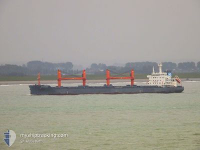
NORDSEINE
Cargo
Aktuelle Reise
| Bisherige Reisezeit | 5 Tage |
|---|---|
| Verbleibende Reisezeit | --- |
| Zurückgelegte Distanz | 959.10 nm |
| Verbleibende Distanz | --- |
| Durchschnittliche Geschwindigkeit | 10.4 Knoten |
| Maximale Geschwindigkeit | 13.1 Knoten |
| Durchschnittliche Windgeschwindigkeit | 11.6 Knoten |
| Maximale Windgeschwindigkeit | 24.9 Knoten |
| Minimale Temperatur | 12.8°C / 55.04°F |
| Maximale Temperatur | 28.5°C / 83.3°F |
| Tiefgang | 9.5 m |
| Position erhalten | 2 h, 25 m alt |
Aktuelle Position
| Länge | -45.42763° |
|---|---|
| Breite | -29.89384° |
| Zustand | Under way using engine |
| Geschwindigkeit | 11.5 Knoten |
| Kurs | 58.6° |
| Gebiet | South Atlantic Ocean |
| Station | T-AIS |
| Position erhalten | 2 h, 25 m alt |
Schiffsdetails
Information
Die NORDSEINE befindet sich derzeit in South Atlantic Ocean mit den Koordinaten -29.89384° / -45.42763°, Diese Position wurde am 2024-09-23 23:10 von unserer Schiffsverfolgungs-App über AIS erfasst. Das Schiff fährt momentan mit einer Geschwindigkeit von 11.5 Knoten und fahrt in den Hafen von BEJAIA. Die geschatzte Ankunftszeit, berechnet von der -App zur Schiffsverfolgung, ist 2024-10-11 12:00 LT
Das Schiff NORDSEINE (IMO: 9596052, MMSI: 255806298) ist Cargo und fährt unter der Flagge von [PT] Portugal.
Auf dieser Seite erhalten Sie Informationen zur aktuellen Position des Schiffes, zu den letzten bekannten Hafenanläufen und zu den aktuellen Reiseinformationen. Sollte das Schiff nicht durch AIS abgedeckt sein, wird die zuletzt erfasste Position angezeigt.
Die NORDSEINE wird durch unsere AIS-Empfänger ermittelt. Wir übernehmen keine Gewähr für die Richtigkeit der Daten. Die letzte Position wurde von unseren AIS-Empfängern aufgezeichnet, während das Schiff in Reichweite war.
Der aktuelle Entwurf von NORDSEINE, wie von AIS gemeldet, betragt 9.5 meter
Wetter
| Temperatur | --- |
|---|---|
| Windgeschwindigkeit | --- |
| Windrichtung | --- |
| Luftdruck | --- |
| Luftfeuchtigkeit | --- |
| Wolken | --- |
Featured Company
Letzte Hafenanläufe
| Hafen | Ankunft | Abfahrt | Time In Port |
|---|---|---|---|
| 2024-09-03 05:47 | 2024-09-18 04:58 | 14 d | |
| 2024-08-20 13:26 | 2024-08-26 00:29 | 5 d | |
| 2024-08-20 09:35 | 2024-08-20 10:08 | 32 m | |
| 2024-07-06 22:07 | 2024-07-13 06:22 | 6 d |
Letzte Reisen
| Herkunft | Abfahrt | Ziel | Ankunft | Distanz | |
|---|---|---|---|---|---|
| 2024-08-25 21:29 | 2024-09-03 02:47 | 1168.66 nm | |||
| 2024-08-20 07:08 | 2024-08-20 10:26 | 0.23 nm | |||
| 2024-07-13 07:22 | 2024-08-20 06:35 | 4413.62 nm | |||
| 2024-06-29 14:14 | 2024-07-06 23:07 | 826.02 nm |
Events
| Zeit | Ereignis | Details | Position / Ziel | Information |
|---|---|---|---|---|
| 2024-09-23 23:16 | geänderter Status | Default Under way using engine |
-29.88284 / -45.40774
BEJAIA
|
Geschwindigkeit: 11.5 kn Kurs: 58.6° |
| 2024-09-23 23:10 | außerhalb Abdeckung |
-29.89384 / -45.42763
South Atlantic Ocean
BEJAIA
|
Geschwindigkeit: 11.5 kn Kurs: 58.6° |
|
| 2024-09-23 23:07 | geänderter Status | Under way using engine Default |
-29.89963 / -45.43808
BEJAIA
|
Geschwindigkeit: 11.5 kn Kurs: 57° |
| 2024-09-23 22:35 | geänderter Status | Default Under way using engine |
-29.95386 / -45.53670
BEJAIA
|
Geschwindigkeit: 11.6 kn Kurs: 58.5° |
| 2024-09-23 22:26 | geänderter Status | Under way using engine Default |
-29.96974 / -45.56642
BEJAIA
|
Geschwindigkeit: 11.9 kn Kurs: 56° |
| 2024-09-23 22:07 | geänderter Status | Default Under way using engine |
-30.00447 / -45.62753
BEJAIA
|
Geschwindigkeit: 11.9 kn Kurs: 56.9° |
| 2024-09-23 21:45 | geänderter Status | Under way using engine Default |
-30.04490 / -45.69784
BEJAIA
|
Geschwindigkeit: 11.8 kn Kurs: 57° |
| 2024-09-23 21:32 | geänderter Status | Default Under way using engine |
-30.06886 / -45.73976
BEJAIA
|
Geschwindigkeit: 12 kn Kurs: 56.3° |
| 2024-09-23 21:24 | geänderter Status | Under way using engine Default |
-30.08309 / -45.76445
BEJAIA
|
Geschwindigkeit: 11.9 kn Kurs: 57° |
| 2024-09-23 21:13 | geänderter Status | Default Under way using engine |
-30.10391 / -45.79963
BEJAIA
|
Geschwindigkeit: 12 kn Kurs: 55.6° |