
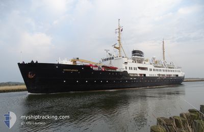
NORDSTJERNEN
Passenger/Cargo Ship
Current Trip
LONGYEARBEAN
| Time Travelled | 48 days |
|---|---|
| Remaining Time | --- |
| Distance Travelled | 7098.43 nm |
| Remaining Distance | --- |
| AVG Speed | 10.8 Knots |
| MAX Speed | 14.6 Knots |
| AVG Wind | 7.6 knots |
| MAX Wind | 29 knots |
| MIN Temp | -11°C / 12.2°F |
| MAX Temp | 16.9°C / 62.42°F |
| Draught | 4.6 m |
| Position Received | 1 m ago |
Current Position
| Longitude | 15.62555° |
|---|---|
| Latitude | 78.22712° |
| Status | Moored |
| Speed | |
| Course | 86° |
| Area | Greenland Sea |
| Station | T-AIS |
| Position Received | 1 m ago |
Info
Information
The current position of NORDSTJERNEN is in Greenland Sea with coordinates 78.22712° / 15.62555° as reported on 2024-06-20 13:55 by AIS to our vessel tracker app. The vessel's current speed is 0 Knots
The vessel NORDSTJERNEN (IMO: 5255777, MMSI: 257276000) is a Passenger/Cargo Ship that was built in 1956 ( 68 years old ). It's sailing under the flag of [NO] Norway.
In this page you can find informations about the vessels current position, last detected port calls, and current voyage information. If the vessels is not in coverage by AIS you will find the latest position.
The current position of NORDSTJERNEN is detected by our AIS receivers and we are not responsible for the reliability of the data. The last position was recorded while the vessel was in Coverage by the Ais receivers of our vessel tracking app.
The current draught of NORDSTJERNEN as reported by AIS is 4.6 meters
Weather
| Temperature | 5.2°C / 41.36°F |
|---|---|
| Wind Speed | 9 knots |
| Direction | 109° ESE |
| Pressure | 1012.5 hPa |
| Humidity | 82.8 % |
| Cloud Coverage | 100 % |
Featured Company
Events
| Time | Event | Details | Position / Dest | Info |
|---|---|---|---|---|
| 2024-06-20 08:08 | Status Changed | Moored Under way using engine |
78.22710 / 15.62545
LONGYEARBEAN
|
Speed: Course: 85° |
| 2024-06-20 07:49 | STOP Moving |
78.22754 / 15.62542
LONGYEARBEAN
|
Speed: 0.3 kn Course: 129° |
|
| 2024-06-20 03:09 | Status Changed | Under way using engine Default |
78.15419 / 11.64818
LONGYEARBEAN
|
Speed: 11.6 kn Course: 84° |
| 2024-06-20 03:03 | Status Changed | Default Under way using engine |
78.15236 / 11.56549
LONGYEARBEAN
|
Speed: 11.9 kn Course: 83.7° |
| 2024-06-20 00:28 | Status Changed | Under way using engine Default |
78.45914 / 9.94832
LONGYEARBEAN
|
Speed: 11.5 kn Course: 160° |
| 2024-06-20 00:20 | IN Coverage |
78.45755 / 9.95109
Greenland Sea
LONGYEARBEAN
|
Speed: 11.7 kn Course: 161.2° |
|
| 2024-06-19 23:26 | Status Changed | Default Under way using engine |
78.65334 / 9.61538
LONGYEARBEAN
|
Speed: 12.5 kn Course: 166.9° |
| 2024-06-19 23:18 | OUT of Coverage |
78.67848 / 9.57644
Greenland Sea
LONGYEARBEAN
|
Speed: 12.5 kn Course: 166.9° |
|
| 2024-06-19 23:05 | Status Changed | Under way using engine Default |
78.72211 / 9.52802
LONGYEARBEAN
|
Speed: 12.6 kn Course: 217° |
| 2024-06-19 22:32 | Status Changed | Default Under way using engine |
78.81288 / 9.88801
LONGYEARBEAN
|
Speed: 12.6 kn Course: 219.5° |