
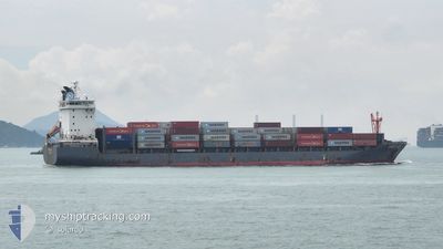
NORDTIGER
Cargo
Current Trip
| Time Travelled | 21 days |
|---|---|
| Remaining Time | --- |
| Distance Travelled | 8722.90 nm |
| Remaining Distance | --- |
| AVG Speed | 16.7 Knots |
| MAX Speed | 21.2 Knots |
| AVG Wind | 12.2 knots |
| MAX Wind | 25 knots |
| MIN Temp | 15.9°C / 60.62°F |
| MAX Temp | 31°C / 87.8°F |
| Draught | 8 m |
| Position Received | 1 h, 20 m ago |
Current Position
| Longitude | 3.80256° |
|---|---|
| Latitude | -18.41685° |
| Status | Under way using engine |
| Speed | 17.9 Knots |
| Course | 319.8° |
| Area | South Atlantic Ocean |
| Station | T-AIS |
| Position Received | 1 h, 20 m ago |
Info
Information
The current position of NORDTIGER is in South Atlantic Ocean with coordinates -18.41685° / 3.80256° as reported on 2024-05-17 04:01 by AIS to our vessel tracker app. The vessel's current speed is 17.9 Knots and is heading at the port of BARCELONA. The estimated time of arrival as calculated by vessel tracking app is 2024-05-28 20:00 LT
The vessel NORDTIGER (IMO: 9626247, MMSI: 212283000) is a Cargo It's sailing under the flag of [CY] Cyprus.
In this page you can find informations about the vessels current position, last detected port calls, and current voyage information. If the vessels is not in coverage by AIS you will find the latest position.
The current position of NORDTIGER is detected by our AIS receivers and we are not responsible for the reliability of the data. The last position was recorded while the vessel was in Coverage by the Ais receivers of our vessel tracking app.
The current draught of NORDTIGER as reported by AIS is 8 meters
Weather
| Temperature | 22.2°C / 71.96°F |
|---|---|
| Wind Speed | 19 knots |
| Direction | 148° SSE |
| Pressure | 1015.6 hPa |
| Humidity | 83.9 % |
| Cloud Coverage | --- |
Featured Company
Last Port Calls
| Port | Arrival | Departure | Time In Port |
|---|---|---|---|
| 2024-04-24 21:22 | 2024-04-25 11:00 | 13 h | |
| 2024-04-21 00:24 | 2024-04-21 12:56 | 12 h | |
| 2024-03-21 05:36 | 2024-03-21 15:21 | 9 h | |
| 2024-03-17 07:48 | 2024-03-17 08:16 | 27 m | |
| 2024-03-11 04:26 | 2024-03-11 12:04 | 7 h | |
| 2024-03-09 15:17 | 2024-03-10 03:03 | 11 h | |
| 2024-03-08 12:19 | 2024-03-08 17:28 | 5 h | |
| 2024-03-07 19:08 | 2024-03-08 03:20 | 8 h | |
| 2024-03-06 08:52 | 2024-03-06 18:19 | 9 h | |
| 2024-03-03 08:19 | 2024-03-03 19:20 | 11 h |
Last Trips
| Origin | Departure | Destination | Arrival | Distance | |
|---|---|---|---|---|---|
| 2024-04-21 20:56 | 2024-04-25 05:22 | 800.86 nm | |||
| 2024-03-21 23:21 | 2024-04-21 08:24 | 1046.00 nm | |||
| 2024-03-17 16:16 | 2024-03-21 13:36 | 1470.77 nm | |||
| 2024-03-11 20:04 | 2024-03-17 15:48 | 1612.62 nm | |||
| 2024-03-10 11:03 | 2024-03-11 12:26 | 356.53 nm | |||
| 2024-03-09 01:28 | 2024-03-09 23:17 | 179.09 nm | |||
| 2024-03-08 11:20 | 2024-03-08 20:19 | 125.48 nm | |||
| 2024-03-07 02:19 | 2024-03-08 03:08 | 352.71 nm | |||
| 2024-03-04 03:20 | 2024-03-06 16:52 | 891.32 nm | |||
| 2024-03-02 08:12 | 2024-03-03 16:19 | 494.12 nm |
Events
| Time | Event | Details | Position / Dest | Info |
|---|---|---|---|---|
| 2024-05-17 04:07 | Status Changed | Default Under way using engine |
-18.39333 / 3.78167
BARCELONA
|
Speed: 17.9 kn Course: 319.8° |
| 2024-05-17 04:01 | Change Sea Area | High seas of the South Atlantic Ocean South African part of the South Atlantic Ocean |
-18.41685 / 3.80256
South Atlantic Ocean
BARCELONA
|
Speed: 17.9 kn Course: 319.8° |
| 2024-05-17 04:01 | OUT of Coverage |
-18.41685 / 3.80256
South Atlantic Ocean
BARCELONA
|
Speed: 17.9 kn Course: 319.8° |
|
| 2024-05-17 04:00 | Status Changed | Under way using engine Default |
-18.42226 / 3.80727
BARCELONA
|
Speed: 18.2 kn Course: 321° |
| 2024-05-17 03:43 | IN Coverage |
-18.41685 / 3.80256
South Atlantic Ocean
BARCELONA
|
Speed: 17.9 kn Course: 319.8° |
|
| 2024-05-14 18:51 | Status Changed | Default Under way using engine |
-31.99923 / 15.95899
BARCELONA
|
Speed: 18.6 kn Course: 326.4° |
| 2024-05-14 18:44 | OUT of Coverage |
-32.02504 / 15.98244
South Atlantic Ocean
BARCELONA
|
Speed: 18.6 kn Course: 326.4° |
|
| 2024-05-14 18:41 | Status Changed | Under way using engine Default |
-32.04011 / 15.99437
BARCELONA
|
Speed: 18.5 kn Course: 326° |
| 2024-05-14 18:38 | Status Changed | Default Under way using engine |
-32.05087 / 16.00286
BARCELONA
|
Speed: 18.7 kn Course: 325.9° |
| 2024-05-14 13:25 | Status Changed | Under way using engine Default |
-33.28031 / 17.18240
BARCELONA
|
Speed: 17.7 kn Course: 320° |