
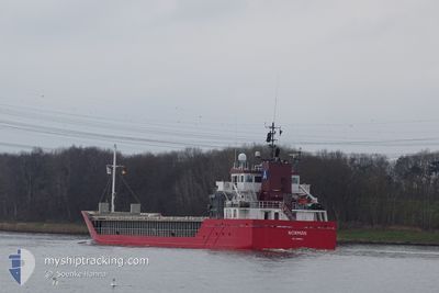
NORMAN
General Cargo
Current Trip
| Time Travelled | 3 days |
|---|---|
| Remaining Time | 2 days |
| Distance Travelled | 925.48 nm |
| Remaining Distance | 579.60 nm |
| AVG Speed | 10.5 Knots |
| MAX Speed | 15.1 Knots |
| AVG Wind | 10 knots |
| MAX Wind | 20 knots |
| MIN Temp | 12°C / 53.6°F |
| MAX Temp | 23.7°C / 74.66°F |
| Draught | 6 m |
| Position Received | 1 d ago |
Current Position
| Longitude | -4.20624° |
|---|---|
| Latitude | 49.48129° |
| Status | Under way using engine |
| Speed | 10.7 Knots |
| Course | 242.6° |
| Area | English Channel |
| Station | T-AIS |
| Position Received | 1 d ago |
Info
Information
The current position of NORMAN is in English Channel with coordinates 49.48129° / -4.20624° as reported on 2024-05-17 03:05 by AIS to our vessel tracker app. The vessel's current speed is 10.7 Knots and is heading at the port of SETUBAL. The estimated time of arrival as calculated by vessel tracking app is 2024-05-20 12:46 LT
The vessel NORMAN (IMO: 9361342, MMSI: 304491000) is a General Cargo that was built in 2007 ( 17 years old ). It's sailing under the flag of [AG] Antigua Barbuda.
In this page you can find informations about the vessels current position, last detected port calls, and current voyage information. If the vessels is not in coverage by AIS you will find the latest position.
The current position of NORMAN is detected by our AIS receivers and we are not responsible for the reliability of the data. The last position was recorded while the vessel was in Coverage by the Ais receivers of our vessel tracking app.
The current draught of NORMAN as reported by AIS is 6 meters
Weather
| Temperature | 13.9°C / 57.02°F |
|---|---|
| Wind Speed | 14 knots |
| Direction | 31° NNE |
| Pressure | 1013.4 hPa |
| Humidity | 87 % |
| Cloud Coverage | 29 % |
Featured Company
Last Port Calls
| Port | Arrival | Departure | Time In Port |
|---|---|---|---|
| 2024-05-13 02:45 | 2024-05-14 15:39 | 1 d | |
| 2024-05-05 09:26 | 2024-05-07 19:10 | 2 d | |
| 2024-04-27 16:21 | 2024-04-30 07:18 | 2 d | |
| 2024-04-24 15:03 | 2024-04-27 06:22 | 2 d | |
| 2024-04-17 08:37 | 2024-04-19 14:39 | 2 d | |
| 2024-04-14 20:50 | 2024-04-16 21:07 | 2 d | |
| 2024-04-13 13:06 | 2024-04-13 14:25 | 1 h | |
| 2024-03-29 08:44 | 2024-04-02 15:40 | 4 d | |
| 2024-03-16 09:37 | 2024-03-22 22:26 | 6 d | |
| 2024-03-06 19:34 | 2024-03-08 07:34 | 1 d |
Last Trips
| Origin | Departure | Destination | Arrival | Distance | |
|---|---|---|---|---|---|
| 2024-05-07 20:10 | 2024-05-13 04:45 | 972.80 nm | |||
| 2024-04-30 08:18 | 2024-05-05 10:26 | 1044.48 nm | |||
| 2024-04-27 07:22 | 2024-04-27 17:21 | 48.39 nm | |||
| 2024-04-19 16:39 | 2024-04-24 16:03 | 1256.82 nm | |||
| 2024-04-16 23:07 | 2024-04-17 10:37 | 148.84 nm | |||
| 2024-04-13 16:25 | 2024-04-14 22:50 | 171.83 nm | |||
| 2024-04-02 17:40 | 2024-04-13 15:06 | 1542.52 nm | |||
| 2024-03-22 22:26 | 2024-03-29 09:44 | 1430.84 nm | |||
| 2024-03-08 09:34 | 2024-03-16 09:37 | 1659.44 nm | |||
| 2024-03-05 02:13 | 2024-03-06 21:34 | 476.51 nm |
Events
| Time | Event | Details | Position / Dest | Info |
|---|---|---|---|---|
| 2024-05-17 03:10 | Status Changed | Default Under way using engine |
49.47340 / -4.22868
SETUBAL
|
Speed: 10.7 kn Course: 242.6° |
| 2024-05-17 03:05 | OUT of Coverage |
49.48129 / -4.20624
English Channel
SETUBAL
|
Speed: 10.7 kn Course: 242.6° |
|
| 2024-05-17 02:35 | Detected in Sea | French part of the English Channel |
49.52720 / -4.08638
English Channel
SETUBAL
|
Speed: 10.6 kn Course: 239° |
| 2024-05-16 22:17 | Change Sea Area | United Kingdom part of the English Channel Guernsey part of the English Channel |
49.90953 / -3.07163
English Channel
SETUBAL
|
Speed: 11.4 kn Course: 241° |
| 2024-05-16 20:56 | Change Sea Area | Guernsey part of the English Channel United Kingdom part of the English Channel |
50.00170 / -2.68974
English Channel
SETUBAL
|
Speed: 12 kn Course: 250.4° |
| 2024-05-16 20:54 | IN Coverage |
50.00170 / -2.68974
English Channel
SETUBAL
|
Speed: 12 kn Course: 250.4° |
|
| 2024-05-16 11:43 | OUT of Coverage |
50.47988 / -.23660
English Channel
SETUBAL
|
Speed: 11.1 kn Course: 255° |
|
| 2024-05-16 10:37 | Status Changed | Under way using engine Default |
50.53827 / .08163
SETUBAL
|
Speed: 11.7 kn Course: 255° |
| 2024-05-16 10:25 | Status Changed | Default Under way using engine |
50.54905 / .14301
SETUBAL
|
Speed: 11.6 kn Course: 254° |
| 2024-05-16 09:29 | Status Changed | Under way using engine Default |
50.60086 / .41481
SETUBAL
|
Speed: 11.7 kn Course: 253° |