
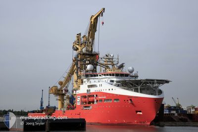
NORMAND MAXIMUS
Cargo
Current Trip
| Time Travelled | 16 days |
|---|---|
| Remaining Time | --- |
| Distance Travelled | 3587.27 nm |
| Remaining Distance | --- |
| AVG Speed | 6.7 Knots |
| MAX Speed | 15.5 Knots |
| AVG Wind | 11.5 knots |
| MAX Wind | 23 knots |
| MIN Temp | 15.7°C / 60.26°F |
| MAX Temp | 30.1°C / 86.18°F |
| Draught | 7.9 m |
| Position Received | 2 m ago |
Current Position
| Longitude | -43.16198° |
|---|---|
| Latitude | -23.02683° |
| Status | Restricted manoeuverability |
| Speed | 0.2 Knots |
| Course | 175° |
| Area | South Atlantic Ocean |
| Station | T-AIS |
| Position Received | 2 m ago |
Info
Information
The current position of NORMAND MAXIMUS is in South Atlantic Ocean with coordinates -23.02683° / -43.16198° as reported on 2024-06-28 18:51 by AIS to our vessel tracker app. The vessel's current speed is 0.2 Knots
The vessel NORMAND MAXIMUS (IMO: 9744518, MMSI: 258987000) is a Cargo It's sailing under the flag of [NO] Norway.
In this page you can find informations about the vessels current position, last detected port calls, and current voyage information. If the vessels is not in coverage by AIS you will find the latest position.
The current position of NORMAND MAXIMUS is detected by our AIS receivers and we are not responsible for the reliability of the data. The last position was recorded while the vessel was in Coverage by the Ais receivers of our vessel tracking app.
The current draught of NORMAND MAXIMUS as reported by AIS is 7.9 meters
Weather
| Temperature | 27.4°C / 81.32°F |
|---|---|
| Wind Speed | 6 knots |
| Direction | 128° SE |
| Pressure | 1010.2 hPa |
| Humidity | 56.5 % |
| Cloud Coverage | 99 % |
Featured Company
Last Port Calls
| Port | Arrival | Departure | Time In Port |
|---|---|---|---|
| 2024-06-07 06:13 | 2024-06-12 17:24 | 5 d | |
| 2024-05-23 02:22 | 2024-05-28 18:43 | 5 d |
Most Visited Ports (Last year)
| Port | Arrivals | |
|---|---|---|
| 2 | ||
| 2 | ||
| 1 | ||
| 1 |
Last Trips
| Origin | Departure | Destination | Arrival | Distance | |
|---|---|---|---|---|---|
| 2024-05-28 20:43 | 2024-06-07 07:13 | 1843.13 nm |
Events
| Time | Event | Details | Position / Dest | Info |
|---|---|---|---|---|
| 2024-06-28 11:33 | IN Coverage |
-23.02681 / -43.16187
South Atlantic Ocean
SANTOS
|
Speed: 0.3 kn Course: 121.8° |
|
| 2024-06-28 10:10 | OUT of Coverage |
-23.02682 / -43.16210
South Atlantic Ocean
SANTOS
|
Speed: 0.1 kn Course: 76.7° |
|
| 2024-06-27 22:17 | IN Coverage |
-23.02678 / -43.16215
South Atlantic Ocean
SANTOS
|
Speed: 0.1 kn Course: 118.9° |
|
| 2024-06-27 21:17 | OUT of Coverage |
-23.02679 / -43.16213
South Atlantic Ocean
SANTOS
|
Speed: 0.2 kn Course: 148° |
|
| 2024-06-27 19:42 | IN Coverage |
-23.02687 / -43.16210
South Atlantic Ocean
SANTOS
|
Speed: 0.1 kn Course: 131.2° |
|
| 2024-06-27 18:13 | OUT of Coverage |
-23.02683 / -43.16210
South Atlantic Ocean
SANTOS
|
Speed: 0.2 kn Course: 264.8° |
|
| 2024-06-27 17:55 | STOP Moving | 7.47 nm, South of RIO DE JANEIRO |
-23.02686 / -43.16205
SANTOS
|
Speed: 0.2 kn Course: 179° |
| 2024-06-27 16:32 | START Moving | 1.38 nm, South East of RIO DE JANEIRO |
-22.91102 / -43.14009
SANTOS
|
Speed: 5.4 kn Course: 172.5° |
| 2024-06-27 15:22 | ETA Changed | 2024/06/28 11:00 2024/06/28 07:00 |
-22.90832 / -43.14059
SANTOS
|
Speed: 0.1 kn Course: 165° |
| 2024-06-27 15:19 | Destination Changed | SANTOS RIO DE JANEIRO |
-22.90833 / -43.14059
SANTOS
|
Speed: 0.1 kn Course: 166° |