
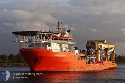
NORMAND PIONEER
Pipe Layer
Current Trip
| Time Travelled | 17 days |
|---|---|
| Remaining Time | --- |
| Distance Travelled | 105.31 nm |
| Remaining Distance | --- |
| AVG Speed | 7.8 Knots |
| MAX Speed | 17.1 Knots |
| AVG Wind | 4.1 knots |
| MAX Wind | 10.1 knots |
| MIN Temp | 21.1°C / 69.98°F |
| MAX Temp | 37.1°C / 98.78°F |
| Draught | 7 m |
| Position Received | 49 m ago |
Current Position
| Longitude | -43.14672° |
|---|---|
| Latitude | -22.83756° |
| Status | At anchor |
| Speed | |
| Course | 130° |
| Area | South Atlantic Ocean |
| Station | T-AIS |
| Position Received | 49 m ago |
Info
Information
The current position of NORMAND PIONEER is in South Atlantic Ocean with coordinates -22.83756° / -43.14672° as reported on 2024-05-18 17:50 by AIS to our vessel tracker app. The vessel's current speed is 0 Knots
The vessel NORMAND PIONEER (IMO: 9179751, MMSI: 257039230) is a Pipe Layer that was built in 1999 ( 25 years old ). It's sailing under the flag of [NO] Norway.
In this page you can find informations about the vessels current position, last detected port calls, and current voyage information. If the vessels is not in coverage by AIS you will find the latest position.
The current position of NORMAND PIONEER is detected by our AIS receivers and we are not responsible for the reliability of the data. The last position was recorded while the vessel was in Coverage by the Ais receivers of our vessel tracking app.
The current draught of NORMAND PIONEER as reported by AIS is 7 meters
Weather
| Temperature | 32.9°C / 91.22°F |
|---|---|
| Wind Speed | 6 knots |
| Direction | 142° SE |
| Pressure | 1013.2 hPa |
| Humidity | 41.8 % |
| Cloud Coverage | 3 % |
Featured Company
Last Port Calls
| Port | Arrival | Departure | Time In Port |
|---|---|---|---|
| 2024-04-27 17:55 | 2024-04-30 22:26 | 3 d | |
| 2024-04-21 09:06 | 2024-04-24 15:09 | 3 d | |
| 2024-04-13 08:48 | 2024-04-16 21:41 | 3 d |
Most Visited Ports (Last year)
| Port | Arrivals | |
|---|---|---|
| 19 | ||
| 9 | ||
| 2 | ||
| 1 |
Last Trips
| Origin | Departure | Destination | Arrival | Distance | |
|---|---|---|---|---|---|
| 2024-04-24 12:09 | 2024-04-27 14:55 | 9.00 nm | |||
| 2024-04-16 18:41 | 2024-04-21 06:06 | 79.46 nm | |||
| 2024-02-18 19:15 | 2024-04-13 05:48 | 23.60 nm |
Events
| Time | Event | Details | Position / Dest | Info |
|---|---|---|---|---|
| 2024-05-18 17:56 | Status Changed | Default At anchor |
-22.83755 / -43.14671
RIO DE JANEIRO
|
Speed: Course: 130° |
| 2024-05-18 17:50 | Status Changed | At anchor Default |
-22.83756 / -43.14672
RIO DE JANEIRO
|
Speed: Course: -1° |
| 2024-05-18 17:38 | IN Coverage |
-22.83756 / -43.14672
South Atlantic Ocean
|
Speed: Course: 341.5° |
|
| 2024-05-18 16:56 | Status Changed | Default At anchor |
-22.83756 / -43.14673
RIO DE JANEIRO
|
Speed: Course: 122° |
| 2024-05-18 16:50 | Status Changed | At anchor Default |
-22.83771 / -43.14668
RIO DE JANEIRO
|
Speed: Course: 117° |
| 2024-05-18 16:50 | OUT of Coverage |
-22.83771 / -43.14668
South Atlantic Ocean
|
Speed: Course: 324.3° |
|
| 2024-05-18 16:32 | Status Changed | Default At anchor |
-22.83778 / -43.14676
RIO DE JANEIRO
|
Speed: Course: 118° |
| 2024-05-18 16:29 | Status Changed | At anchor Default |
-22.83781 / -43.14677
RIO DE JANEIRO
|
Speed: Course: 121° |
| 2024-05-18 16:20 | Status Changed | Default At anchor |
-22.83789 / -43.14661
RIO DE JANEIRO
|
Speed: Course: 118° |
| 2024-05-18 15:35 | Status Changed | At anchor Default |
-22.83802 / -43.14671
RIO DE JANEIRO
|
Speed: Course: 119° |