
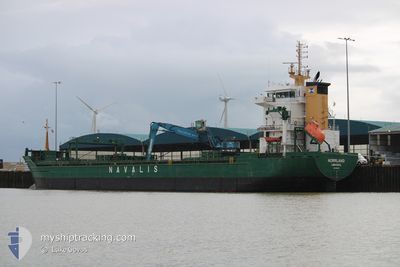
NORRLAND
General Cargo
Current Trip
SKULTE
| Time Travelled | 10 h, 7 mins |
|---|---|
| Remaining Time | --- |
| Distance Travelled | 103.09 nm |
| Remaining Distance | --- |
| AVG Speed | 10.8 Knots |
| MAX Speed | 11.2 Knots |
| AVG Wind | 9.1 knots |
| MAX Wind | 11 knots |
| MIN Temp | 12.8°C / 55.04°F |
| MAX Temp | 16.3°C / 61.34°F |
| Draught | 4.4 m |
| Position Received | 1 d ago |
Current Position
| Longitude | 20.88031° |
|---|---|
| Latitude | 58.65279° |
| Status | Under way using engine |
| Speed | 10.9 Knots |
| Course | 153.7° |
| Area | Baltic Sea |
| Station | T-AIS |
| Position Received | 1 d ago |
Info
Information
The current position of NORRLAND is in Baltic Sea with coordinates 58.65279° / 20.88031° as reported on 2024-06-28 04:07 by AIS to our vessel tracker app. The vessel's current speed is 10.9 Knots
The vessel NORRLAND (IMO: 9358278, MMSI: 212521000) is a General Cargo that was built in 2006 ( 18 years old ). It's sailing under the flag of [CY] Cyprus.
In this page you can find informations about the vessels current position, last detected port calls, and current voyage information. If the vessels is not in coverage by AIS you will find the latest position.
The current position of NORRLAND is detected by our AIS receivers and we are not responsible for the reliability of the data. The last position was recorded while the vessel was in Coverage by the Ais receivers of our vessel tracking app.
The current draught of NORRLAND as reported by AIS is 4.4 meters
Weather
| Temperature | 15.4°C / 59.72°F |
|---|---|
| Wind Speed | 10 knots |
| Direction | 197° SSW |
| Pressure | 1014.9 hPa |
| Humidity | 85.1 % |
| Cloud Coverage | 28 % |
Featured Company
Last Port Calls
| Port | Arrival | Departure | Time In Port |
|---|---|---|---|
| 2024-06-28 18:13 | 2024-06-29 17:10 | 22 h | |
| 2024-06-23 08:17 | 2024-06-24 18:50 | 1 d | |
| 2024-06-21 13:04 | 2024-06-21 13:13 | 9 m | |
| 2024-06-20 01:22 | |||
| 2024-06-12 22:53 | 2024-06-15 14:09 | 2 d | |
| 2024-06-11 07:37 | 2024-06-12 15:41 | 1 d | |
| 2024-06-07 11:16 | 2024-06-08 15:08 | 1 d | |
| 2024-06-03 10:11 | 2024-06-04 17:19 | 1 d | |
| 2024-05-27 08:18 | 2024-05-29 09:06 | 2 d | |
| 2024-05-21 17:53 | 2024-05-24 09:39 | 2 d |
Most Visited Ports (Last year)
| Port | Arrivals | |
|---|---|---|
| 9 | ||
| 8 | ||
| 7 | ||
| 6 | ||
| 5 | ||
| 5 |
Last Trips
| Origin | Departure | Destination | Arrival | Distance | |
|---|---|---|---|---|---|
| 2024-06-24 20:50 | 2024-06-28 21:13 | 940.53 nm | |||
| 2024-06-21 15:13 | 2024-06-23 10:17 | 419.70 nm | |||
| 2024-06-15 16:09 | 2024-06-21 15:04 | 1040.71 nm | |||
| 2024-06-15 16:09 | 2024-06-20 03:22 | 1040.37 nm | |||
| 2024-06-12 17:41 | 2024-06-13 00:53 | 83.92 nm | |||
| 2024-06-08 18:08 | 2024-06-11 09:37 | 445.28 nm | |||
| 2024-06-04 19:19 | 2024-06-07 14:16 | 603.84 nm | |||
| 2024-05-29 11:06 | 2024-06-03 12:11 | 1060.45 nm | |||
| 2024-05-24 11:39 | 2024-05-27 10:18 | 767.64 nm | |||
| 2024-05-20 01:44 | 2024-05-21 19:53 | 501.44 nm |
Events
| Time | Event | Details | Position / Dest | Info |
|---|---|---|---|---|
| 2024-06-29 17:10 | START Moving | 0.25 nm, West of SKULTE |
57.31725 / 24.39640
SKULTE
|
Speed: 4.5 kn Course: 279° |
| 2024-06-29 17:10 | PORT DEPARTURE |
|
57.31725 / 24.39640
SKULTE
|
Speed: 2.2 kn Course: 262° |
| 2024-06-28 18:22 | STOP Moving |
57.31733 / 24.40510
[LV] SKULTE
|
Speed: 0.1 kn Course: 271° |
|
| 2024-06-28 18:13 | PORT ARRIVAL |
|
57.31695 / 24.40121
[LV] SKULTE
|
Speed: 2.6 kn Course: 108° |
| 2024-06-28 04:14 | Status Changed | Default Under way using engine |
58.63517 / 20.89710
SKULTE
|
Speed: 10.9 kn Course: 153.7° |
| 2024-06-28 04:07 | OUT of Coverage |
58.65279 / 20.88031
Baltic Sea
SKULTE
|
Speed: 10.9 kn Course: 153.7° |
|
| 2024-06-28 04:06 | Status Changed | Under way using engine Default |
58.65550 / 20.87773
SKULTE
|
Speed: 11 kn Course: 154° |
| 2024-06-28 04:02 | Status Changed | Default Under way using engine |
58.66776 / 20.86617
SKULTE
|
Speed: 10.9 kn Course: 154.5° |
| 2024-06-28 03:57 | Status Changed | Under way using engine Default |
58.67918 / 20.85545
SKULTE
|
Speed: 11 kn Course: 154° |
| 2024-06-28 03:38 | Status Changed | Default Under way using engine |
58.73356 / 20.80318
SKULTE
|
Speed: 11.2 kn Course: 153.1° |