
NORTH SEA
Tanker
Current Trip
| Time Travelled | 22 days |
|---|---|
| Remaining Time | --- |
| Distance Travelled | 4292.96 nm |
| Remaining Distance | --- |
| AVG Speed | 11.5 Knots |
| MAX Speed | 15.8 Knots |
| AVG Wind | 10.7 knots |
| MAX Wind | 33.7 knots |
| MIN Temp | 9°C / 48.2°F |
| MAX Temp | 31.2°C / 88.16°F |
| Draught | 11.3 m |
| Position Received | 3 d ago |
Current Position
| Longitude | -76.66287° |
|---|---|
| Latitude | 25.89445° |
| Status | Under way using engine |
| Speed | 13.2 Knots |
| Course | 71.3° |
| Area | North Atlantic Ocean |
| Station | T-AIS |
| Position Received | 3 d ago |
Info
Information
The current position of NORTH SEA is in North Atlantic Ocean with coordinates 25.89445° / -76.66287° as reported on 2024-05-31 17:10 by AIS to our vessel tracker app. The vessel's current speed is 13.2 Knots and is heading at the port of CARTAGENA. The estimated time of arrival as calculated by vessel tracking app is 2024-06-13 16:00 LT
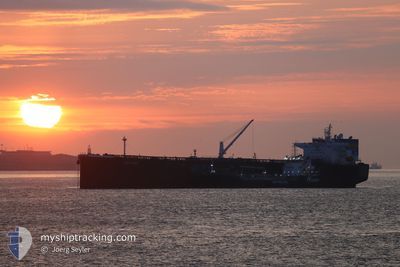
The vessel NORTH SEA (IMO: 9760495, MMSI: 636017501) is a Tanker It's sailing under the flag of [LR] Liberia.
In this page you can find informations about the vessels current position, last detected port calls, and current voyage information. If the vessels is not in coverage by AIS you will find the latest position.
The current position of NORTH SEA is detected by our AIS receivers and we are not responsible for the reliability of the data. The last position was recorded while the vessel was in Coverage by the Ais receivers of our vessel tracking app.
The current draught of NORTH SEA as reported by AIS is 11.3 meters
Weather
| Temperature | 21.7°C / 71.06°F |
|---|---|
| Wind Speed | 2 knots |
| Direction | 187° S |
| Pressure | 1020.8 hPa |
| Humidity | 48.9 % |
| Cloud Coverage | 100 % |
Featured Company
Events
| Time | Event | Details | Position / Dest | Info |
|---|---|---|---|---|
| 2024-05-31 17:13 | Status Changed | Default Under way using engine |
25.89853 / -76.64939
ESCAR
|
Speed: 13.2 kn Course: 71.3° |
| 2024-05-31 17:10 | OUT of Coverage |
25.89445 / -76.66287
North Atlantic Ocean
ESCAR
|
Speed: 13.2 kn Course: 71.3° |
|
| 2024-05-31 15:18 | Status Changed | Under way using engine Default |
25.73232 / -77.08181
ESCAR
|
Speed: 13.5 kn Course: 83° |
| 2024-05-31 15:04 | Status Changed | Default Under way using engine |
25.72151 / -77.13669
ESCAR
|
Speed: 13.8 kn Course: 85.4° |
| 2024-05-31 14:51 | Status Changed | Under way using engine Default |
25.71736 / -77.19257
ESCAR
|
Speed: 13.5 kn Course: 86° |
| 2024-05-31 14:17 | Status Changed | Default Under way using engine |
25.73420 / -77.32461
ESCAR
|
Speed: 13.6 kn Course: 123.3° |
| 2024-05-31 14:08 | Status Changed | Under way using engine Default |
25.75256 / -77.35535
ESCAR
|
Speed: 13.7 kn Course: 123° |
| 2024-05-31 14:00 | Status Changed | Default Under way using engine |
25.76988 / -77.38431
ESCAR
|
Speed: 13.7 kn Course: 123.8° |
| 2024-05-31 13:29 | Status Changed | Under way using engine Default |
25.83871 / -77.49448
ESCAR
|
Speed: 14.8 kn Course: 125° |
| 2024-05-31 13:21 | Status Changed | Default Under way using engine |
25.85846 / -77.52568
ESCAR
|
Speed: 14.8 kn Course: 124.4° |