
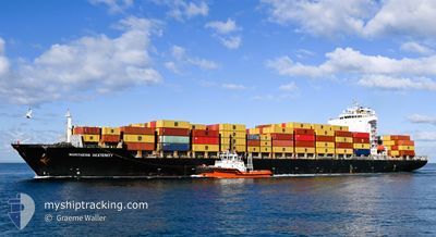
NORTHERN DEXTERITY
Container Ship
Current Trip
| Time Travelled | 2 days |
|---|---|
| Remaining Time | --- |
| Distance Travelled | 292.54 nm |
| Remaining Distance | 7.32 nm |
| AVG Speed | 8.5 Knots |
| MAX Speed | 10.5 Knots |
| AVG Wind | 8 knots |
| MAX Wind | 16 knots |
| MIN Temp | 10.8°C / 51.44°F |
| MAX Temp | 17°C / 62.6°F |
| Draught | 11 m |
| Position Received | 2 m ago |
Current Position
| Longitude | 176.28533° |
|---|---|
| Latitude | -37.61885° |
| Status | At anchor |
| Speed | 0.1 Knots |
| Course | 119° |
| Area | South Pacific Ocean |
| Station | T-AIS |
| Position Received | 2 m ago |
Info
Information
The current position of NORTHERN DEXTERITY is in South Pacific Ocean with coordinates -37.61885° / 176.28533° as reported on 2024-05-19 22:25 by AIS to our vessel tracker app. The vessel's current speed is 0.1 Knots and is heading at the port of TAURANGA. The estimated time of arrival as calculated by vessel tracking app is 2024-05-19 13:00 LT
The vessel NORTHERN DEXTERITY (IMO: 9345996, MMSI: 636093250) is a Container Ship that was built in 2008 ( 16 years old ). It's sailing under the flag of [LR] Liberia.
In this page you can find informations about the vessels current position, last detected port calls, and current voyage information. If the vessels is not in coverage by AIS you will find the latest position.
The current position of NORTHERN DEXTERITY is detected by our AIS receivers and we are not responsible for the reliability of the data. The last position was recorded while the vessel was in Coverage by the Ais receivers of our vessel tracking app.
The current draught of NORTHERN DEXTERITY as reported by AIS is 11 meters
Weather
| Temperature | 13.7°C / 56.66°F |
|---|---|
| Wind Speed | 9 knots |
| Direction | 128° SE |
| Pressure | 1016.5 hPa |
| Humidity | 69.3 % |
| Cloud Coverage | 100 % |
Featured Company
Last Port Calls
| Port | Arrival | Departure | Time In Port |
|---|---|---|---|
| 2024-05-15 22:55 | 2024-05-17 09:58 | 1 d | |
| 2024-05-13 00:21 | 2024-05-13 08:51 | 8 h | |
| 2024-05-10 04:26 | 2024-05-11 16:35 | 1 d | |
| 2024-05-04 15:03 | 2024-05-06 01:30 | 1 d | |
| 2024-05-02 08:43 | 2024-05-03 04:50 | 20 h | |
| 2024-04-27 01:31 | 2024-04-28 11:54 | 1 d | |
| 2024-04-19 01:41 | 2024-04-20 21:09 | 1 d | |
| 2024-04-06 09:09 | 2024-04-07 21:32 | 1 d | |
| 2024-03-28 04:02 | 2024-03-29 10:39 | 1 d | |
| 2024-03-15 01:43 | 2024-03-16 03:47 | 1 d |
Most Visited Ports (Last year)
| Port | Arrivals | |
|---|---|---|
| 5 | ||
| 3 | ||
| 2 | ||
| 2 | ||
| 2 | ||
| 1 |
Last Trips
| Origin | Departure | Destination | Arrival | Distance | |
|---|---|---|---|---|---|
| 2024-05-13 20:51 | 2024-05-16 10:55 | 233.40 nm | |||
| 2024-05-12 04:35 | 2024-05-13 12:21 | 463.13 nm | |||
| 2024-05-06 11:30 | 2024-05-10 16:26 | 1321.25 nm | |||
| 2024-05-03 14:20 | 2024-05-05 01:03 | 520.72 nm | |||
| 2024-04-28 19:54 | 2024-05-02 18:13 | 1399.05 nm | |||
| 2024-04-21 05:09 | 2024-04-27 09:31 | 2375.45 nm | |||
| 2024-04-08 05:32 | 2024-04-19 09:41 | 2906.82 nm | |||
| 2024-03-29 21:39 | 2024-04-06 17:09 | 1794.09 nm | |||
| 2024-03-16 11:47 | 2024-03-28 15:02 | 4405.51 nm | |||
| 2024-03-15 07:56 | 2024-03-15 09:43 | 9.45 nm |
Events
| Time | Event | Details | Position / Dest | Info |
|---|---|---|---|---|
| 2024-05-19 19:45 | ETA Changed | 2024/05/20 09:00 2024/05/19 13:00 |
-37.61864 / 176.28537
TAURANGA, NZ
|
Speed: 0.3 kn Course: 122° |
| 2024-05-18 16:59 | Status Changed | At anchor Under way using engine |
-37.61885 / 176.28812
TAURANGA, NZ
|
Speed: 0.4 kn Course: 194° |
| 2024-05-18 16:56 | STOP Moving | 5.8 nm, North East of TAURANGA |
-37.61902 / 176.28794
TAURANGA, NZ
|
Speed: 0.3 kn Course: 191° |
| 2024-05-18 07:48 | Status Changed | Under way using engine Default |
-37.40352 / 177.83516
TAURANGA, NZ
|
Speed: 8.9 kn Course: 275° |
| 2024-05-18 07:35 | Status Changed | Default Under way using engine |
-37.40526 / 177.87495
TAURANGA, NZ
|
Speed: 8.6 kn Course: 273° |
| 2024-05-18 07:30 | Status Changed | Under way using engine Default |
-37.40588 / 177.88857
TAURANGA, NZ
|
Speed: 8.6 kn Course: 274° |
| 2024-05-18 06:52 | Status Changed | Default Under way using engine |
-37.41111 / 178.00317
TAURANGA, NZ
|
Speed: 8.6 kn Course: 275.3° |
| 2024-05-18 06:48 | Status Changed | Under way using engine Default |
-37.41182 / 178.01460
TAURANGA, NZ
|
Speed: 8.5 kn Course: 275° |
| 2024-05-18 06:39 | Status Changed | Default Under way using engine |
-37.41333 / 178.04334
TAURANGA, NZ
|
Speed: 8.6 kn Course: 274.7° |
| 2024-05-18 06:32 | Status Changed | Under way using engine Default |
-37.41498 / 178.06334
TAURANGA, NZ
|
Speed: 8.5 kn Course: 274° |