
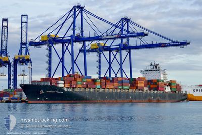
NORTHERN PRACTISE
Container Ship
Current Trip
KARACHI
| Time Travelled | 14 h, 11 mins |
|---|---|
| Remaining Time | --- |
| Distance Travelled | 130.87 nm |
| Remaining Distance | --- |
| AVG Speed | 10.1 Knots |
| MAX Speed | 11 Knots |
| AVG Wind | 12.7 knots |
| MAX Wind | 14.8 knots |
| MIN Temp | 28.1°C / 82.58°F |
| MAX Temp | 29.6°C / 85.28°F |
| Draught | 13 m |
| Position Received | 5 d ago |
Current Position
| Longitude | 57.35833° |
|---|---|
| Latitude | 25.15183° |
| Status | Under way using engine |
| Speed | 11 Knots |
| Course | 109.9° |
| Area | Gulf of Oman |
| Station | T-AIS |
| Position Received | 5 d ago |
Info
Information
The current position of NORTHERN PRACTISE is in Gulf of Oman with coordinates 25.15183° / 57.35833° as reported on 2024-05-27 09:42 by AIS to our vessel tracker app. The vessel's current speed is 11 Knots
The vessel NORTHERN PRACTISE (IMO: 9450301, MMSI: 636091717) is a Container Ship that was built in 2009 ( 15 years old ). It's sailing under the flag of [LR] Liberia.
In this page you can find informations about the vessels current position, last detected port calls, and current voyage information. If the vessels is not in coverage by AIS you will find the latest position.
The current position of NORTHERN PRACTISE is detected by our AIS receivers and we are not responsible for the reliability of the data. The last position was recorded while the vessel was in Coverage by the Ais receivers of our vessel tracking app.
The current draught of NORTHERN PRACTISE as reported by AIS is 13 meters
Weather
| Temperature | 29.3°C / 84.74°F |
|---|---|
| Wind Speed | 14 knots |
| Direction | 236° SW |
| Pressure | 1003.9 hPa |
| Humidity | 72.2 % |
| Cloud Coverage | 78 % |
Featured Company
Last Port Calls
| Port | Arrival | Departure | Time In Port |
|---|---|---|---|
| 2024-05-29 11:25 | 2024-06-01 10:53 | 2 d | |
| 2024-05-23 20:51 | 2024-05-26 11:01 | 2 d | |
| 2024-05-12 00:20 | 2024-05-12 17:56 | 17 h | |
| 2024-05-07 00:44 | 2024-05-07 23:00 | 22 h | |
| 2024-05-03 04:46 | 2024-05-04 12:17 | 1 d | |
| 2024-04-27 18:46 | 2024-04-29 20:20 | 2 d | |
| 2024-04-20 16:24 | 2024-04-21 11:40 | 19 h | |
| 2024-04-16 05:39 | 2024-04-16 23:30 | 17 h | |
| 2024-04-13 22:14 | 2024-04-15 10:10 | 1 d | |
| 2024-04-09 06:09 | 2024-04-11 00:19 | 1 d |
Most Visited Ports (Last year)
| Port | Arrivals | |
|---|---|---|
| 13 | ||
| 13 | ||
| 11 | ||
| 8 | ||
| 8 | ||
| 7 |
Last Trips
| Origin | Departure | Destination | Arrival | Distance | |
|---|---|---|---|---|---|
| 2024-05-26 15:01 | 2024-05-29 16:25 | 773.98 nm | |||
| 2024-05-12 23:26 | 2024-05-24 00:51 | 1983.88 nm | |||
| 2024-05-08 07:00 | 2024-05-12 05:50 | 1407.46 nm | |||
| 2024-05-04 20:17 | 2024-05-07 08:44 | 224.21 nm | |||
| 2024-04-30 03:20 | 2024-05-03 12:46 | 809.03 nm | |||
| 2024-04-21 17:10 | 2024-04-28 01:46 | 2397.39 nm | |||
| 2024-04-17 05:00 | 2024-04-20 21:54 | 1253.83 nm | |||
| 2024-04-15 15:10 | 2024-04-16 11:09 | 234.87 nm | |||
| 2024-04-11 04:19 | 2024-04-14 03:14 | 773.28 nm | |||
| 2024-04-03 21:31 | 2024-04-09 10:09 | 1972.31 nm |
Events
| Time | Event | Details | Position / Dest | Info |
|---|---|---|---|---|
| 2024-06-01 10:53 | PORT DEPARTURE |
|
24.79500 / 66.98167
KARACHI
|
Speed: 7.1 kn Course: 168° |
| 2024-06-01 10:35 | START Moving |
24.82779 / 66.97414
[PK] KARACHI
|
Speed: 6.5 kn Course: 208° |
|
| 2024-05-29 11:41 | STOP Moving |
24.83468 / 66.97649
[PK] KARACHI
|
Speed: 0.3 kn Course: 30° |
|
| 2024-05-29 11:25 | PORT ARRIVAL |
|
24.82434 / 66.97166
[PK] KARACHI
|
Speed: 7 kn Course: 345° |
| 2024-05-29 10:16 | START Moving | 6.68 nm, South West of SALEHAABAD ISLAND |
24.71378 / 66.89915
KARACHI
|
Speed: 3.9 kn Course: 110° |
| 2024-05-29 09:29 | STOP Moving | 7.46 nm, South West of SALEHAABAD ISLAND |
24.70833 / 66.88333
KARACHI
|
Speed: Course: -1° |
| 2024-05-27 09:45 | Status Changed | Default Under way using engine |
25.14783 / 57.36985
KARACHI
|
Speed: 11 kn Course: 109.9° |
| 2024-05-27 09:42 | OUT of Coverage |
25.15183 / 57.35833
Gulf of Oman
KARACHI
|
Speed: 11 kn Course: 109.9° |
|
| 2024-05-27 06:58 | Change Sea Area | Iranian part of the Gulf of Oman United Arab Emirates part of the Gulf of Oman |
25.44334 / 56.91542
Gulf of Oman
KARACHI
|
Speed: 10.2 kn Course: 133.7° |
| 2024-05-27 06:31 | Change Sea Area | United Arab Emirates part of the Gulf of Oman Iranian part of the Gulf of Oman |
25.51722 / 56.88547
Gulf of Oman
KARACHI
|
Speed: 10.6 kn Course: 169.2° |