
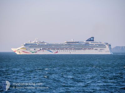
NORWEGIAN DAWN
Passengers Ship
Current Trip
| Time Travelled | 23 h, 43 mins |
|---|---|
| Remaining Time | 6 h, 14 mins |
| Distance Travelled | 442.70 nm |
| Remaining Distance | 113.11 nm |
| AVG Speed | 20.3 Knots |
| MAX Speed | 23.4 Knots |
| AVG Wind | 24.9 knots |
| MAX Wind | 32.2 knots |
| MIN Temp | 10.3°C / 50.54°F |
| MAX Temp | 13.6°C / 56.48°F |
| Draught | 8.6 m |
| Position Received | Now |
Current Position
| Longitude | -2.58423° |
|---|---|
| Latitude | 49.88424° |
| Status | Under way using engine |
| Speed | 18.4 Knots |
| Course | 74.4° |
| Area | English Channel |
| Station | T-AIS |
| Position Received | Now |
Info
Information
The current position of NORWEGIAN DAWN is in English Channel with coordinates 49.88424° / -2.58423° as reported on 2024-05-23 19:00 by AIS to our vessel tracker app. The vessel's current speed is 18.4 Knots and is heading at the port of LE HAVRE. The estimated time of arrival as calculated by vessel tracking app is 2024-05-24 01:14 LT
The vessel NORWEGIAN DAWN (IMO: 9195169, MMSI: 311307000) is a Passengers Ship that was built in 2002 ( 22 years old ). It's sailing under the flag of [BS] Bahamas.
In this page you can find informations about the vessels current position, last detected port calls, and current voyage information. If the vessels is not in coverage by AIS you will find the latest position.
The current position of NORWEGIAN DAWN is detected by our AIS receivers and we are not responsible for the reliability of the data. The last position was recorded while the vessel was in Coverage by the Ais receivers of our vessel tracking app.
The current draught of NORWEGIAN DAWN as reported by AIS is 8.6 meters
Weather
| Temperature | 13.1°C / 55.58°F |
|---|---|
| Wind Speed | 7 knots |
| Direction | 313° NW |
| Pressure | 1016.9 hPa |
| Humidity | 76.6 % |
| Cloud Coverage | 91 % |
Featured Company
Last Port Calls
| Port | Arrival | Departure | Time In Port |
|---|---|---|---|
| 2024-05-22 03:50 | 2024-05-22 19:17 | 15 h | |
| 2024-05-20 04:46 | 2024-05-20 19:24 | 14 h | |
| 2024-05-19 11:32 | 2024-05-19 19:01 | 7 h | |
| 2024-05-18 04:46 | 2024-05-18 15:12 | 10 h | |
| 2024-05-17 04:01 | 2024-05-17 19:37 | 15 h | |
| 2024-05-16 04:27 | 2024-05-16 20:42 | 16 h | |
| 2024-05-15 04:43 | 2024-05-15 15:35 | 10 h | |
| 2024-05-12 05:03 | 2024-05-12 16:16 | 11 h | |
| 2024-05-10 03:52 | 2024-05-10 20:53 | 17 h | |
| 2024-05-09 03:33 | 2024-05-09 18:07 | 14 h |
Most Visited Ports (Last year)
| Port | Arrivals | |
|---|---|---|
| 11 | ||
| 11 | ||
| 10 | ||
| 10 | ||
| 8 | ||
| 5 |
Last Trips
| Origin | Departure | Destination | Arrival | Distance | |
|---|---|---|---|---|---|
| 2024-05-20 20:24 | 2024-05-22 04:50 | 300.18 nm | |||
| 2024-05-19 20:01 | 2024-05-20 05:46 | 174.81 nm | |||
| 2024-05-18 16:12 | 2024-05-19 12:32 | 373.82 nm | |||
| 2024-05-17 20:37 | 2024-05-18 05:46 | 101.33 nm | |||
| 2024-05-16 22:42 | 2024-05-17 05:01 | 110.63 nm | |||
| 2024-05-15 17:35 | 2024-05-16 06:27 | 220.00 nm | |||
| 2024-05-12 17:16 | 2024-05-15 06:43 | 1072.94 nm | |||
| 2024-05-10 22:53 | 2024-05-12 06:03 | 299.44 nm | |||
| 2024-05-09 20:07 | 2024-05-10 05:52 | 151.43 nm | |||
| 2024-05-08 21:01 | 2024-05-09 05:33 | 74.47 nm |
Events
| Time | Event | Details | Position / Dest | Info |
|---|---|---|---|---|
| 2024-05-23 18:05 | Change Sea Area | Guernsey part of the English Channel United Kingdom part of the English Channel |
49.82114 / -2.99583
English Channel
LE HAVRE, FR
|
Speed: 17.4 kn Course: 89.2° |
| 2024-05-23 18:03 | Status Changed | Under way using engine Default |
49.82104 / -3.01146
LE HAVRE, FR
|
Speed: 17.4 kn Course: 89° |
| 2024-05-23 17:59 | IN Coverage |
49.82114 / -2.99583
English Channel
LE HAVRE, FR
|
Speed: 17.4 kn Course: 89.2° |
|
| 2024-05-23 17:03 | Status Changed | Default Under way using engine |
49.80247 / -3.45612
LE HAVRE, FR
|
Speed: 17.3 kn Course: 81.9° |
| 2024-05-23 16:57 | OUT of Coverage |
49.79971 / -3.49581
English Channel
LE HAVRE, FR
|
Speed: 17.3 kn Course: 81.9° |
|
| 2024-05-23 14:16 | Status Changed | Under way using engine Default |
49.65223 / -4.64887
LE HAVRE, FR
|
Speed: 16.7 kn Course: 76° |
| 2024-05-23 14:03 | Status Changed | Default Under way using engine |
49.64054 / -4.74591
LE HAVRE, FR
|
Speed: 16.7 kn Course: 92.3° |
| 2024-05-23 13:52 | Change Sea Area | United Kingdom part of the English Channel United Kingdom part of the Celtic Sea |
49.64105 / -4.82002
English Channel
LE HAVRE, FR
|
Speed: 16.7 kn Course: 95° |
| 2024-05-23 13:52 | Status Changed | Under way using engine Default |
49.64130 / -4.82430
LE HAVRE, FR
|
Speed: 17 kn Course: 95° |
| 2024-05-23 13:47 | IN Coverage |
49.64105 / -4.82002
English Channel
LE HAVRE, FR
|
Speed: 16.7 kn Course: 95° |