
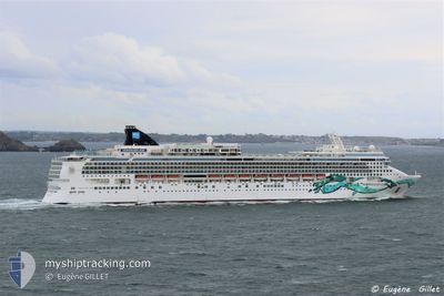
NORWEGIAN JADE
Passengers Ship
Current Trip
US PCV>BS GSC
| Time Travelled | 4 days |
|---|---|
| Remaining Time | --- |
| Distance Travelled | 1343.78 nm |
| Remaining Distance | --- |
| AVG Speed | 17.7 Knots |
| MAX Speed | 22 Knots |
| AVG Wind | 8.7 knots |
| MAX Wind | 19 knots |
| MIN Temp | 25.2°C / 77.36°F |
| MAX Temp | 29.2°C / 84.56°F |
| Draught | 8.6 m |
| Position Received | 3 d ago |
Current Position
| Longitude | -77.91194° |
|---|---|
| Latitude | 25.83321° |
| Status | At anchor |
| Speed | |
| Course | 305° |
| Area | North Atlantic Ocean |
| Station | T-AIS |
| Position Received | 3 d ago |
Info
Information
The current position of NORWEGIAN JADE is in North Atlantic Ocean with coordinates 25.83321° / -77.91194° as reported on 2024-06-16 13:46 by AIS to our vessel tracker app. The vessel's current speed is 0 Knots
The vessel NORWEGIAN JADE (IMO: 9304057, MMSI: 308416000) is a Passengers Ship that was built in 2006 ( 18 years old ). It's sailing under the flag of [BS] Bahamas.
In this page you can find informations about the vessels current position, last detected port calls, and current voyage information. If the vessels is not in coverage by AIS you will find the latest position.
The current position of NORWEGIAN JADE is detected by our AIS receivers and we are not responsible for the reliability of the data. The last position was recorded while the vessel was in Coverage by the Ais receivers of our vessel tracking app.
The current draught of NORWEGIAN JADE as reported by AIS is 8.6 meters
Weather
| Temperature | 28.4°C / 83.12°F |
|---|---|
| Wind Speed | 19 knots |
| Direction | 113° ESE |
| Pressure | 1010.3 hPa |
| Humidity | 78.3 % |
| Cloud Coverage | 35 % |
Featured Company
Last Port Calls
| Port | Arrival | Departure | Time In Port |
|---|---|---|---|
| 2024-06-15 10:40 | 2024-06-15 21:25 | 10 h | |
| 2024-06-12 09:23 | 2024-06-12 19:29 | 10 h | |
| 2024-06-11 14:34 | 2024-06-11 22:51 | 8 h | |
| 2024-06-10 10:52 | 2024-06-10 19:51 | 8 h | |
| 2024-06-08 10:38 | 2024-06-08 20:34 | 9 h | |
| 2024-06-05 10:08 | 2024-06-05 17:25 | 7 h | |
| 2024-06-04 11:17 | 2024-06-04 22:01 | 10 h | |
| 2024-06-02 10:20 | 2024-06-02 23:52 | 13 h | |
| 2024-05-30 13:43 | 2024-05-30 22:12 | 8 h | |
| 2024-05-28 09:55 | 2024-05-28 21:30 | 11 h |
Last Trips
| Origin | Departure | Destination | Arrival | Distance | |
|---|---|---|---|---|---|
| 2024-06-12 15:29 | 2024-06-15 06:40 | 1020.77 nm | |||
| 2024-06-11 18:51 | 2024-06-12 05:23 | 132.40 nm | |||
| 2024-06-10 15:51 | 2024-06-11 10:34 | 364.92 nm | |||
| 2024-06-08 16:34 | 2024-06-10 06:52 | 770.24 nm | |||
| 2024-06-05 13:25 | 2024-06-08 06:38 | 1080.08 nm | |||
| 2024-06-04 18:01 | 2024-06-05 06:08 | 196.61 nm | |||
| 2024-06-02 19:52 | 2024-06-04 07:17 | 535.90 nm | |||
| 2024-05-30 18:12 | 2024-06-02 06:20 | 630.43 nm | |||
| 2024-05-28 17:30 | 2024-05-30 09:43 | 770.17 nm | |||
| 2024-05-27 17:06 | 2024-05-28 05:55 | 156.60 nm |
Events
| Time | Event | Details | Position / Dest | Info |
|---|---|---|---|---|
| 2024-06-19 21:03 | START Moving |
19.30419 / -81.39905
US PCV>BS GSC
|
Speed: 11.3 kn Course: 288° |
|
| 2024-06-19 11:07 | STOP Moving |
19.30189 / -81.39018
US PCV>BS GSC
|
Speed: 0.3 kn Course: 103° |
|
| 2024-06-16 21:05 | START Moving | 1.7 nm, North East of COCOCAY |
25.83515 / -77.91004
US PCV>BS GSC
|
Speed: 5.3 kn Course: 54° |
| 2024-06-16 13:49 | Status Changed | Default At anchor |
25.83333 / -77.91167
US PCV>BS GSC
|
Speed: Course: 305° |
| 2024-06-16 13:46 | Status Changed | At anchor Default |
25.83321 / -77.91194
US PCV>BS GSC
|
Speed: Course: -1° |
| 2024-06-16 13:46 | OUT of Coverage |
25.83321 / -77.91194
North Atlantic Ocean
US PCV>BS GSC
|
Speed: Course: 0.2° |
|
| 2024-06-16 13:34 | Status Changed | Default At anchor |
25.83333 / -77.91167
US PCV>BS GSC
|
Speed: 0.1 kn Course: 307° |
| 2024-06-16 13:31 | Status Changed | At anchor Default |
25.83313 / -77.91178
US PCV>BS GSC
|
Speed: Course: -1° |
| 2024-06-16 13:22 | Status Changed | Default At anchor |
25.83333 / -77.91167
US PCV>BS GSC
|
Speed: Course: 291° |
| 2024-06-16 13:13 | Status Changed | At anchor Default |
25.83303 / -77.91187
US PCV>BS GSC
|
Speed: Course: -1° |