
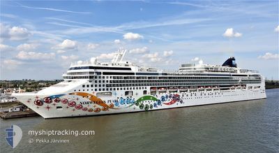
NORWEGIAN PEARL
Passengers Ship
Current Trip
| Time Travelled | 3 h, 23 mins |
|---|---|
| Remaining Time | --- |
| Distance Travelled | 59.83 nm |
| Remaining Distance | --- |
| AVG Speed | 19.4 Knots |
| MAX Speed | 20 Knots |
| AVG Wind | 16.2 knots |
| MAX Wind | 21.8 knots |
| MIN Temp | 19.8°C / 67.64°F |
| MAX Temp | 21.6°C / 70.88°F |
| Draught | 8.6 m |
| Position Received | 1 m ago |
Current Position
| Longitude | 18.52280° |
|---|---|
| Latitude | 41.68151° |
| Status | Under way using engine |
| Speed | 20 Knots |
| Course | 159.9° |
| Area | Adriatic Sea |
| Station | T-AIS |
| Position Received | 1 m ago |
Info
Information
The current position of NORWEGIAN PEARL is in Adriatic Sea with coordinates 41.68151° / 18.52280° as reported on 2024-06-01 18:16 by AIS to our vessel tracker app. The vessel's current speed is 20 Knots
The vessel NORWEGIAN PEARL (IMO: 9342281, MMSI: 309653000) is a Passengers Ship that was built in 2006 ( 18 years old ). It's sailing under the flag of [BS] Bahamas.
In this page you can find informations about the vessels current position, last detected port calls, and current voyage information. If the vessels is not in coverage by AIS you will find the latest position.
The current position of NORWEGIAN PEARL is detected by our AIS receivers and we are not responsible for the reliability of the data. The last position was recorded while the vessel was in Coverage by the Ais receivers of our vessel tracking app.
The current draught of NORWEGIAN PEARL as reported by AIS is 8.6 meters
Weather
| Temperature | 21.6°C / 70.88°F |
|---|---|
| Wind Speed | 10 knots |
| Direction | 121° ESE |
| Pressure | 1017.1 hPa |
| Humidity | 84.1 % |
| Cloud Coverage | 96 % |
Featured Company
Last Port Calls
| Port | Arrival | Departure | Time In Port |
|---|---|---|---|
| 2024-06-01 04:03 | 2024-06-01 14:54 | 10 h | |
| 2024-05-31 04:34 | 2024-05-31 15:56 | 11 h | |
| 2024-05-29 04:19 | 2024-05-29 14:16 | 9 h | |
| 2024-05-28 04:10 | 2024-05-28 17:39 | 13 h | |
| 2024-05-27 03:32 | 2024-05-27 18:15 | 14 h | |
| 2024-05-25 06:14 | 2024-05-25 13:58 | 7 h | |
| 2024-05-24 04:10 | 2024-05-24 14:26 | 10 h | |
| 2024-05-23 03:53 | 2024-05-23 17:59 | 14 h | |
| 2024-05-22 04:51 | 2024-05-22 19:05 | 14 h | |
| 2024-05-21 03:14 | 2024-05-21 17:35 | 14 h |
Last Trips
| Origin | Departure | Destination | Arrival | Distance | |
|---|---|---|---|---|---|
| 2024-05-31 17:56 | 2024-06-01 06:03 | 109.47 nm | |||
| 2024-05-29 16:16 | 2024-05-31 06:34 | 395.60 nm | |||
| 2024-05-28 19:39 | 2024-05-29 06:19 | 109.55 nm | |||
| 2024-05-27 20:15 | 2024-05-28 06:10 | 109.99 nm | |||
| 2024-05-25 16:58 | 2024-05-27 05:32 | 528.06 nm | |||
| 2024-05-24 16:26 | 2024-05-25 09:14 | 280.72 nm | |||
| 2024-05-23 19:59 | 2024-05-24 06:10 | 181.24 nm | |||
| 2024-05-22 21:05 | 2024-05-23 05:53 | 175.56 nm | |||
| 2024-05-21 19:35 | 2024-05-22 06:51 | 171.65 nm | |||
| 2024-05-19 18:37 | 2024-05-21 05:14 | 287.02 nm |
Events
| Time | Event | Details | Position / Dest | Info |
|---|---|---|---|---|
| 2024-06-01 17:40 | Destination Changed | CORFU, GREECE SPLIT, CROATIA |
41.87008 / 18.43088
CORFU, GREECE
|
Speed: 19.6 kn Course: 159.2° |
| 2024-06-01 17:40 | ETA Changed | 2024/06/02 03:15 2024/05/30 04:15 |
41.87008 / 18.43088
CORFU, GREECE
|
Speed: 19.6 kn Course: 159.2° |
| 2024-06-01 17:35 | Change Sea Area | Montenegrin part of the Adriatic Sea Croatian part of the Adriatic Sea |
41.89359 / 18.41880
Adriatic Sea
|
Speed: 19.7 kn Course: 159.1° |
| 2024-06-01 17:34 | Status Changed | Under way using engine Default |
41.89761 / 18.41676
SPLIT, CROATIA
|
Speed: 19.7 kn Course: 159° |
| 2024-06-01 17:21 | IN Coverage |
41.89359 / 18.41880
Adriatic Sea
|
Speed: 19.7 kn Course: 159.1° |
|
| 2024-06-01 14:54 | PORT DEPARTURE |
|
42.67122 / 18.04717
SPLIT, CROATIA
|
Speed: 6.2 kn Course: 282° |
| 2024-06-01 14:30 | START Moving |
42.66291 / 18.08044
[HR] DUBROVNIK
|
Speed: 3.5 kn Course: 134° |
|
| 2024-06-01 10:50 | Status Changed | Default Moored |
42.66197 / 18.08305
[HR] DUBROVNIK
|
Speed: Course: 141° |
| 2024-06-01 10:47 | Status Changed | Moored Default |
42.66198 / 18.08305
[HR] DUBROVNIK
|
Speed: Course: 141° |
| 2024-06-01 10:47 | OUT of Coverage |
42.66198 / 18.08305
Adriatic Sea
[HR] DUBROVNIK
|
Speed: Course: 248.7° |