
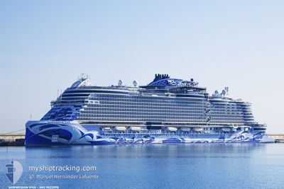
NORWEGIAN VIVA
Passenger
Current Trip
| Time Travelled | 3 h, 55 mins |
|---|---|
| Remaining Time | 16 h, 11 mins |
| Distance Travelled | 74.75 nm |
| Remaining Distance | 336.77 nm |
| AVG Speed | 20.3 Knots |
| MAX Speed | 20.9 Knots |
| AVG Wind | 4.8 knots |
| MAX Wind | 7.9 knots |
| MIN Temp | 26.3°C / 79.34°F |
| MAX Temp | 27.8°C / 82.04°F |
| Draught | 8.3 m |
| Position Received | 1 m ago |
Current Position
| Longitude | 15.77756° |
|---|---|
| Latitude | 36.70933° |
| Status | Under way using engine |
| Speed | 20.8 Knots |
| Course | 53.9° |
| Area | Ionian Sea |
| Station | T-AIS |
| Position Received | 1 m ago |
Info
Information
The current position of NORWEGIAN VIVA is in Ionian Sea with coordinates 36.70933° / 15.77756° as reported on 2024-06-29 16:18 by AIS to our vessel tracker app. The vessel's current speed is 20.8 Knots and is heading at the port of KERKYRA. The estimated time of arrival as calculated by vessel tracking app is 2024-06-30 08:30 LT
The vessel NORWEGIAN VIVA (IMO: 9823998, MMSI: 311001127) is a Passenger It's sailing under the flag of [BS] Bahamas.
In this page you can find informations about the vessels current position, last detected port calls, and current voyage information. If the vessels is not in coverage by AIS you will find the latest position.
The current position of NORWEGIAN VIVA is detected by our AIS receivers and we are not responsible for the reliability of the data. The last position was recorded while the vessel was in Coverage by the Ais receivers of our vessel tracking app.
The current draught of NORWEGIAN VIVA as reported by AIS is 8.3 meters
Weather
| Temperature | 27.8°C / 82.04°F |
|---|---|
| Wind Speed | 3 knots |
| Direction | 238° WSW |
| Pressure | 1014.7 hPa |
| Humidity | 56.9 % |
| Cloud Coverage | --- |
Featured Company
Last Port Calls
| Port | Arrival | Departure | Time In Port |
|---|---|---|---|
| 2024-06-29 03:12 | 2024-06-29 12:24 | 9 h | |
| 2024-06-28 03:50 | 2024-06-28 17:02 | 13 h | |
| 2024-06-27 05:44 | 2024-06-27 17:00 | 11 h | |
| 2024-06-26 07:32 | 2024-06-26 19:15 | 11 h | |
| 2024-06-25 03:36 | 2024-06-25 16:26 | 12 h | |
| 2024-06-24 03:21 | 2024-06-24 15:09 | 11 h | |
| 2024-06-23 03:23 | 2024-06-23 17:42 | 14 h | |
| 2024-06-21 05:11 | 2024-06-21 16:38 | 11 h | |
| 2024-06-20 04:02 | 2024-06-20 17:18 | 13 h | |
| 2024-06-19 05:10 | 2024-06-19 17:17 | 12 h |
Last Trips
| Origin | Departure | Destination | Arrival | Distance | |
|---|---|---|---|---|---|
| 2024-06-28 19:02 | 2024-06-29 05:12 | 102.07 nm | |||
| 2024-06-27 19:00 | 2024-06-28 05:50 | 105.03 nm | |||
| 2024-06-26 21:15 | 2024-06-27 07:44 | 183.62 nm | |||
| 2024-06-25 18:26 | 2024-06-26 09:32 | 308.44 nm | |||
| 2024-06-24 17:09 | 2024-06-25 05:36 | 173.43 nm | |||
| 2024-06-23 19:42 | 2024-06-24 05:21 | 165.88 nm | |||
| 2024-06-21 18:38 | 2024-06-23 05:23 | 299.63 nm | |||
| 2024-06-20 19:18 | 2024-06-21 07:11 | 197.52 nm | |||
| 2024-06-19 19:17 | 2024-06-20 06:02 | 133.54 nm | |||
| 2024-06-18 21:01 | 2024-06-19 07:10 | 95.63 nm |
Events
| Time | Event | Details | Position / Dest | Info |
|---|---|---|---|---|
| 2024-06-29 15:55 | Change Sea Area | Italian part of the Ionian Sea Italian part of the Mediterranean Sea - Eastern Basin |
36.63063 / 15.64326
Ionian Sea
CORFU, GREECE
|
Speed: 20.6 kn Course: 55.4° |
| 2024-06-29 15:55 | Status Changed | Under way using engine Default |
36.62865 / 15.63977
CORFU, GREECE
|
Speed: 20.5 kn Course: 50° |
| 2024-06-29 15:50 | Status Changed | Default Under way using engine |
36.61045 / 15.61261
CORFU, GREECE
|
Speed: 20.6 kn Course: 52.5° |
| 2024-06-29 15:44 | Status Changed | Under way using engine Default |
36.58826 / 15.57913
CORFU, GREECE
|
Speed: 20.6 kn Course: 52° |
| 2024-06-29 15:38 | Status Changed | Default Under way using engine |
36.56728 / 15.54627
CORFU, GREECE
|
Speed: 20.6 kn Course: 51.9° |
| 2024-06-29 13:55 | Change Sea Area | Italian part of the Mediterranean Sea - Eastern Basin Maltese part of the Mediterranean Sea - Eastern Basin |
36.20281 / 14.98617
Mediterranean Sea - Eastern Basin
CORFU, GREECE
|
Speed: 20.4 kn Course: 50.8° |
| 2024-06-29 12:24 | PORT DEPARTURE |
|
35.90219 / 14.52833
CORFU, GREECE
|
Speed: 5.8 kn Course: 69° |
| 2024-06-29 12:22 | Destination Changed | CORFU, GREECE VALLETA, MALTA |
35.90062 / 14.52353
[MT] VALLETTA
|
Speed: 6.3 kn Course: 54° |
| 2024-06-29 12:22 | ETA Changed | 2024/06/30 07:00 2024/06/29 03:00 |
35.90062 / 14.52353
[MT] VALLETTA
|
Speed: 6.3 kn Course: 54° |
| 2024-06-29 12:19 | Status Changed | Under way using engine Default |
35.89606 / 14.51902
[MT] VALLETTA
|
Speed: 2.7 kn Course: 49° |