
NOTRE DAME
Fishing
Current Trip
EN PECHE GAST!
| Time Travelled | 26 days |
|---|---|
| Remaining Time | --- |
| Distance Travelled | 673.66 nm |
| Remaining Distance | --- |
| AVG Speed | 5.7 Knots |
| MAX Speed | 11.6 Knots |
| AVG Wind | 16.2 knots |
| MAX Wind | 27 knots |
| MIN Temp | 10.6°C / 51.08°F |
| MAX Temp | 20.5°C / 68.9°F |
| Draught | 3.4 m |
| Position Received | 3 d ago |
Current Position
| Longitude | -6.57312° |
|---|---|
| Latitude | 47.54743° |
| Status | Engaged in Fishing |
| Speed | 3.6 Knots |
| Course | 212° |
| Area | Celtic Sea |
| Station | T-AIS |
| Position Received | 3 d ago |
Info
Information
The current position of NOTRE DAME is in Celtic Sea with coordinates 47.54743° / -6.57312° as reported on 2024-06-27 05:00 by AIS to our vessel tracker app. The vessel's current speed is 3.6 Knots
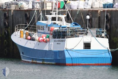
The vessel NOTRE DAME (MMSI: 227820000) is a Fishing It's sailing under the flag of [FR] France.
In this page you can find informations about the vessels current position, last detected port calls, and current voyage information. If the vessels is not in coverage by AIS you will find the latest position.
The current position of NOTRE DAME is detected by our AIS receivers and we are not responsible for the reliability of the data. The last position was recorded while the vessel was in Coverage by the Ais receivers of our vessel tracking app.
The current draught of NOTRE DAME as reported by AIS is 3.4 meters
Weather
| Temperature | 15.6°C / 60.08°F |
|---|---|
| Wind Speed | 10 knots |
| Direction | 282° WNW |
| Pressure | 1013.1 hPa |
| Humidity | 78.4 % |
| Cloud Coverage | 89 % |
Featured Company
Most Visited Ports (Last year)
| Port | Arrivals | |
|---|---|---|
| 20 |
Events
| Time | Event | Details | Position / Dest | Info |
|---|---|---|---|---|
| 2024-06-27 05:00 | OUT of Coverage |
47.54743 / -6.57312
Celtic Sea
|
Speed: 3.6 kn Course: 141.4° |
|
| 2024-06-27 04:41 | IN Coverage |
47.54607 / -6.60581
Celtic Sea
|
Speed: 8.8 kn Course: 93.2° |
|
| 2024-06-27 02:43 | OUT of Coverage |
47.58833 / -6.54309
Celtic Sea
|
Speed: 2.1 kn Course: 77.8° |
|
| 2024-06-27 01:52 | Destination Changed | EN PECHE GAST! DOUARNENEZ |
47.60683 / -6.62495
EN PECHE GAST!
|
Speed: 4.5 kn Course: 94° |
| 2024-06-27 00:35 | IN Coverage |
47.60190 / -6.66506
Celtic Sea
|
Speed: 2.8 kn Course: 308.9° |
|
| 2024-06-26 02:54 | OUT of Coverage |
47.76704 / -6.12878
Celtic Sea
|
Speed: 9.1 kn Course: 236.6° |
|
| 2024-06-26 02:54 | IN Coverage |
47.76704 / -6.12878
Celtic Sea
|
Speed: 9.1 kn Course: 236.6° |
|
| 2024-06-26 00:02 | OUT of Coverage |
47.97363 / -5.51644
Celtic Sea
|
Speed: 10.2 kn Course: 242° |
|
| 2024-06-25 19:05 | START Moving | 0.78 nm, North East of DOUARNENEZ |
48.09887 / -4.32068
DOUARNENEZ
|
Speed: 6.1 kn Course: 76.4° |
| 2024-06-25 16:47 | IN Coverage |
48.09782 / -4.32344
Celtic Sea
|
Speed: Course: 4.3° |