
NOUR STAR
Bulk Carrier
Current Trip
| Time Travelled | 6 days |
|---|---|
| Remaining Time | --- |
| Distance Travelled | 158.30 nm |
| Remaining Distance | --- |
| AVG Speed | 36.8 Knots |
| MAX Speed | 36.8 Knots |
| AVG Wind | 6.1 knots |
| MAX Wind | 11.6 knots |
| MIN Temp | 11.5°C / 52.7°F |
| MAX Temp | 27.2°C / 80.96°F |
| Draught | 9.7 m |
| Position Received | 6 d ago |
Current Position
| Longitude | 37.79279° |
|---|---|
| Latitude | 44.72591° |
| Status | Moored |
| Speed | 3.3 Knots |
| Course | 104° |
| Area | Black Sea |
| Station | T-AIS |
| Position Received | 6 d ago |
Info
Information
The current position of NOUR STAR is in Black Sea with coordinates 44.72591° / 37.79279° as reported on 2024-05-26 19:28 by AIS to our vessel tracker app. The vessel's current speed is 3.3 Knots and is heading at the port of KAVKAZ. The estimated time of arrival as calculated by vessel tracking app is 2024-05-27 06:09 LT
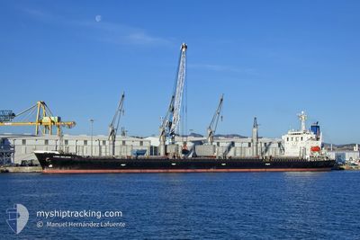
The vessel NOUR STAR (IMO: 9296315, MMSI: 371570000) is a Bulk Carrier that was built in 2005 ( 19 years old ). It's sailing under the flag of [PA] Panama.
In this page you can find informations about the vessels current position, last detected port calls, and current voyage information. If the vessels is not in coverage by AIS you will find the latest position.
The current position of NOUR STAR is detected by our AIS receivers and we are not responsible for the reliability of the data. The last position was recorded while the vessel was in Coverage by the Ais receivers of our vessel tracking app.
The current draught of NOUR STAR as reported by AIS is 9.7 meters
Weather
| Temperature | 27.7°C / 81.86°F |
|---|---|
| Wind Speed | 9 knots |
| Direction | 267° W |
| Pressure | 1018.6 hPa |
| Humidity | 29.8 % |
| Cloud Coverage | --- |
Featured Company
Last Port Calls
| Port | Arrival | Departure | Time In Port |
|---|---|---|---|
| 2024-05-22 00:49 | 2024-05-26 20:51 | 4 d | |
| 2024-05-12 22:21 | 2024-05-13 17:07 | 18 h | |
| 2024-04-02 05:08 |
Most Visited Ports (Last year)
| Port | Arrivals | |
|---|---|---|
| 2 | ||
| 2 | ||
| 2 | ||
| 1 | ||
| 1 | ||
| 1 |
Last Trips
| Origin | Departure | Destination | Arrival | Distance | |
|---|---|---|---|---|---|
| 2024-04-02 14:08 | 2024-05-22 03:49 | 9852.76 nm | |||
| 2024-04-02 14:08 | 2024-05-13 00:21 | 8188.98 nm |
Events
| Time | Event | Details | Position / Dest | Info |
|---|---|---|---|---|
| 2024-06-01 09:55 | START Moving |
45.03218 / 33.97273
KAVKAZ
|
Speed: 29 kn Course: 134° |
|
| 2024-06-01 09:46 | STOP Moving |
45.03286 / 33.96079
KAVKAZ
|
Speed: 0.1 kn Course: 257° |
|
| 2024-05-31 23:34 | START Moving |
45.07105 / 33.98035
KAVKAZ
|
Speed: 53.8 kn Course: 31° |
|
| 2024-05-30 04:23 | START Moving |
45.02730 / 33.97105
KAVKAZ
|
Speed: 53.5 kn Course: 115° |
|
| 2024-05-28 10:19 | START Moving |
45.03371 / 33.96541
KAVKAZ
|
Speed: 52 kn Course: 348° |
|
| 2024-05-28 04:22 | STOP Moving |
45.03253 / 33.96685
KAVKAZ
|
Speed: Course: 89° |
|
| 2024-05-26 20:51 | PORT DEPARTURE |
|
44.61014 / 37.09038
KAVKAZ
|
Speed: 3.3 kn Course: 104° |
| 2024-05-26 20:20 | Draught Changed | 9.7 9.8 |
44.72591 / 37.79279
[RU] NOVOROSSIYSK
|
Speed: 3.3 kn Course: 104° |
| 2024-05-26 20:20 | Destination Changed | KAVKAZ NOVOROSSIYSK |
44.72591 / 37.79279
[RU] NOVOROSSIYSK
|
Speed: 3.3 kn Course: 104° |
| 2024-05-26 19:28 | OUT of Coverage |
44.72591 / 37.79279
Black Sea
[RU] NOVOROSSIYSK
|
Speed: 3.3 kn Course: 88.8° |