
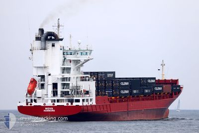
NOVA
Container Ship
Current Trip
| Time Travelled | 10 h, 46 mins |
|---|---|
| Remaining Time | 11 h, 29 mins |
| Distance Travelled | 169.11 nm |
| Remaining Distance | 207.03 nm |
| AVG Speed | 16.5 Knots |
| MAX Speed | 21.4 Knots |
| AVG Wind | 12.8 knots |
| MAX Wind | 18.1 knots |
| MIN Temp | 11.4°C / 52.52°F |
| MAX Temp | 14.3°C / 57.74°F |
| Draught | 7.4 m |
| Position Received | 41 m ago |
Current Position
| Longitude | 4.62993° |
|---|---|
| Latitude | 53.46262° |
| Status | Under way using engine |
| Speed | 18.1 Knots |
| Course | 247° |
| Area | North Sea |
| Station | T-AIS |
| Position Received | 41 m ago |
Info
Information
The current position of NOVA is in North Sea with coordinates 53.46262° / 4.62993° as reported on 2024-05-28 14:00 by AIS to our vessel tracker app. The vessel's current speed is 18.1 Knots and is heading at the port of TILBURY. The estimated time of arrival as calculated by vessel tracking app is 2024-05-29 02:10 LT
The vessel NOVA (IMO: 9250098, MMSI: 211870240) is a Container Ship that was built in 2002 ( 22 years old ). It's sailing under the flag of [DE] Germany.
In this page you can find informations about the vessels current position, last detected port calls, and current voyage information. If the vessels is not in coverage by AIS you will find the latest position.
The current position of NOVA is detected by our AIS receivers and we are not responsible for the reliability of the data. The last position was recorded while the vessel was in Coverage by the Ais receivers of our vessel tracking app.
The current draught of NOVA as reported by AIS is 7.4 meters
Weather
| Temperature | 13.6°C / 56.48°F |
|---|---|
| Wind Speed | 13 knots |
| Direction | 192° SSW |
| Pressure | 1013.4 hPa |
| Humidity | 83.5 % |
| Cloud Coverage | 56 % |
Featured Company
Last Port Calls
| Port | Arrival | Departure | Time In Port |
|---|---|---|---|
| 2024-05-28 02:32 | 2024-05-28 03:55 | 1 h | |
| 2024-05-25 12:07 | 2024-05-26 16:16 | 1 d | |
| 2024-05-22 04:44 | 2024-05-23 04:10 | 23 h | |
| 2024-05-20 15:58 | 2024-05-20 16:32 | 34 m | |
| 2024-05-19 03:03 | 2024-05-19 19:04 | 16 h | |
| 2024-05-18 03:51 | 2024-05-18 03:55 | 4 m | |
| 2024-05-15 18:29 | 2024-05-16 19:14 | 1 d | |
| 2024-05-14 12:08 | 2024-05-14 20:25 | 8 h | |
| 2024-05-11 11:22 | 2024-05-12 12:43 | 1 d | |
| 2024-05-08 12:52 | 2024-05-09 07:11 | 18 h |
Last Trips
| Origin | Departure | Destination | Arrival | Distance | |
|---|---|---|---|---|---|
| 2024-05-26 18:16 | 2024-05-28 04:32 | 402.42 nm | |||
| 2024-05-23 05:10 | 2024-05-25 14:07 | 991.38 nm | |||
| 2024-05-20 18:32 | 2024-05-22 05:44 | 438.49 nm | |||
| 2024-05-19 21:04 | 2024-05-20 17:58 | 354.13 nm | |||
| 2024-05-18 05:55 | 2024-05-19 05:03 | 347.80 nm | |||
| 2024-05-16 20:14 | 2024-05-18 05:51 | 435.97 nm | |||
| 2024-05-14 21:25 | 2024-05-15 19:29 | 322.62 nm | |||
| 2024-05-12 14:43 | 2024-05-14 13:08 | 868.32 nm | |||
| 2024-05-09 08:11 | 2024-05-11 13:22 | 786.33 nm | |||
| 2024-05-07 16:56 | 2024-05-08 13:52 | 301.41 nm |
Events
| Time | Event | Details | Position / Dest | Info |
|---|---|---|---|---|
| 2024-05-28 14:13 | Status Changed | Default Under way using engine |
53.41225 / 4.56079
GBTIL
|
Speed: 18.1 kn Course: 247° |
| 2024-05-28 11:06 | ETA Changed | 2024/05/28 23:00 2024/05/28 21:00 |
53.72982 / 5.92626
GBTIL
|
Speed: 15.8 kn Course: 254° |
| 2024-05-28 10:50 | Change Sea Area | Dutch part of the North Sea German part of the North Sea |
53.74968 / 6.03986
North Sea
GBTIL
|
Speed: 15.9 kn Course: 255° |
| 2024-05-28 10:50 | Status Changed | Under way using engine Default |
53.74968 / 6.03986
GBTIL
|
Speed: 15.8 kn Course: 255° |
| 2024-05-28 10:32 | IN Coverage |
53.74968 / 6.03986
North Sea
GBTIL
|
Speed: 15.9 kn Course: 255° |
|
| 2024-05-28 08:56 | Status Changed | Default Under way using engine |
53.88833 / 6.86500
GBTIL
|
Speed: 16.7 kn Course: 257° |
| 2024-05-28 08:54 | OUT of Coverage |
53.89156 / 6.88366
North Sea
GBTIL
|
Speed: 16.7 kn Course: 257° |
|
| 2024-05-28 07:52 | Status Changed | Under way using engine Default |
53.96385 / 7.37275
GBTIL
|
Speed: 18.4 kn Course: 254° |
| 2024-05-28 07:12 | Status Changed | Default Under way using engine |
54.01953 / 7.70935
GBTIL
|
Speed: 18.7 kn Course: 268° |
| 2024-05-28 07:02 | Status Changed | Under way using engine Default |
54.02225 / 7.79878
GBTIL
|
Speed: 19 kn Course: 273° |