
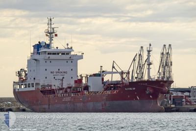
NQ LAELIA
Oil/Chemical Tanker
Current Trip
FOR ORDERS
| Time Travelled | 3 days |
|---|---|
| Remaining Time | --- |
| Distance Travelled | 402.15 nm |
| Remaining Distance | --- |
| AVG Speed | 9.2 Knots |
| MAX Speed | 13.2 Knots |
| AVG Wind | 10.4 knots |
| MAX Wind | 23 knots |
| MIN Temp | 12.1°C / 53.78°F |
| MAX Temp | 15.1°C / 59.18°F |
| Draught | 5.7 m |
| Position Received | 1 d ago |
Current Position
| Longitude | -7.78636° |
|---|---|
| Latitude | 44.32806° |
| Status | Under way using engine |
| Speed | 1 Knots |
| Course | 92° |
| Area | North Atlantic Ocean |
| Station | T-AIS |
| Position Received | 1 d ago |
Info
Information
The current position of NQ LAELIA is in North Atlantic Ocean with coordinates 44.32806° / -7.78636° as reported on 2024-05-18 03:35 by AIS to our vessel tracker app. The vessel's current speed is 1 Knots
The vessel NQ LAELIA (IMO: 9393383, MMSI: 249213000) is a Oil/Chemical Tanker that was built in 2008 ( 16 years old ). It's sailing under the flag of [MT] Malta.
In this page you can find informations about the vessels current position, last detected port calls, and current voyage information. If the vessels is not in coverage by AIS you will find the latest position.
The current position of NQ LAELIA is detected by our AIS receivers and we are not responsible for the reliability of the data. The last position was recorded while the vessel was in Coverage by the Ais receivers of our vessel tracking app.
The current draught of NQ LAELIA as reported by AIS is 5.7 meters
Weather
| Temperature | 13.7°C / 56.66°F |
|---|---|
| Wind Speed | 13 knots |
| Direction | 1° N |
| Pressure | 1012.6 hPa |
| Humidity | 88.3 % |
| Cloud Coverage | 40 % |
Featured Company
Last Port Calls
| Port | Arrival | Departure | Time In Port |
|---|---|---|---|
| 2024-05-14 09:43 | 2024-05-15 17:42 | 1 d | |
| 2024-05-09 22:13 | 2024-05-11 01:38 | 1 d | |
| 2024-05-07 08:06 | 2024-05-08 11:22 | 1 d | |
| 2024-05-03 01:23 | 2024-05-03 22:27 | 21 h | |
| 2024-04-30 05:02 | 2024-05-01 16:49 | 1 d | |
| 2024-04-23 13:24 | 2024-04-24 11:10 | 21 h | |
| 2024-04-20 17:08 | 2024-04-21 20:51 | 1 d | |
| 2024-04-18 05:31 | 2024-04-19 08:35 | 1 d | |
| 2024-04-15 04:30 | 2024-04-16 14:28 | 1 d | |
| 2024-04-08 21:51 | 2024-04-10 08:49 | 1 d |
Last Trips
| Origin | Departure | Destination | Arrival | Distance | |
|---|---|---|---|---|---|
| 2024-05-11 03:38 | 2024-05-14 11:43 | 869.90 nm | |||
| 2024-05-08 12:22 | 2024-05-10 00:13 | 417.76 nm | |||
| 2024-05-04 00:27 | 2024-05-07 09:06 | 951.19 nm | |||
| 2024-05-01 18:49 | 2024-05-03 03:23 | 350.85 nm | |||
| 2024-04-24 13:10 | 2024-04-30 07:02 | 1534.61 nm | |||
| 2024-04-21 21:51 | 2024-04-23 15:24 | 371.92 nm | |||
| 2024-04-19 10:35 | 2024-04-20 18:08 | 389.48 nm | |||
| 2024-04-16 15:28 | 2024-04-18 07:31 | 482.15 nm | |||
| 2024-04-10 10:49 | 2024-04-15 05:30 | 733.97 nm | |||
| 2024-04-06 17:55 | 2024-04-08 23:51 | 466.44 nm |
Events
| Time | Event | Details | Position / Dest | Info |
|---|---|---|---|---|
| 2024-05-18 20:56 | STOP Moving |
44.28988 / -7.61587
FOR ORDERS
|
Speed: 0.3 kn Course: 65° |
|
| 2024-05-18 15:36 | START Moving |
44.33467 / -7.65717
FOR ORDERS
|
Speed: 10.2 kn Course: 143° |
|
| 2024-05-18 03:39 | Status Changed | Default Under way using engine |
44.32817 / -7.78475
FOR ORDERS
|
Speed: 1 kn Course: 92° |
| 2024-05-18 03:35 | OUT of Coverage |
44.32806 / -7.78636
North Atlantic Ocean
|
Speed: 1 kn Course: 67.5° |
|
| 2024-05-18 03:26 | Status Changed | Under way using engine Default |
44.32762 / -7.78986
FOR ORDERS
|
Speed: 0.2 kn Course: 350° |
| 2024-05-18 03:26 | IN Coverage |
44.32762 / -7.78986
North Atlantic Ocean
|
Speed: 0.9 kn Course: 87.5° |
|
| 2024-05-17 22:09 | Status Changed | Default Under way using engine |
44.31944 / -7.84204
FOR ORDERS
|
Speed: 0.5 kn Course: 26° |
| 2024-05-17 21:58 | OUT of Coverage |
44.31984 / -7.84385
North Atlantic Ocean
|
Speed: 0.5 kn Course: 85.3° |
|
| 2024-05-17 21:49 | Change Sea Area | Spanish part of the North Atlantic Ocean Spanish part of the Bay of Biscay |
44.32014 / -7.84583
North Atlantic Ocean
|
Speed: 0.2 kn Course: 134.4° |
| 2024-05-17 21:47 | Status Changed | Under way using engine Default |
44.32020 / -7.84599
FOR ORDERS
|
Speed: 0.7 kn Course: 18° |