
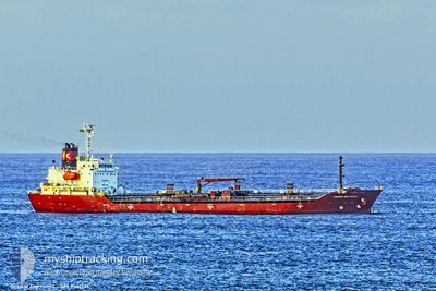
NQ VIOLA
Oil/Chemical Tanker
Current Trip
| Time Travelled | 4 days |
|---|---|
| Remaining Time | 50 mins |
| Distance Travelled | 1217.43 nm |
| Remaining Distance | 12.01 nm |
| AVG Speed | 10 Knots |
| MAX Speed | 12.1 Knots |
| AVG Wind | 17.9 knots |
| MAX Wind | 23 knots |
| MIN Temp | 13.3°C / 55.94°F |
| MAX Temp | 18.4°C / 65.12°F |
| Draught | 7.8 m |
| Position Received | 2 h, 21 m ago |
Current Position
| Longitude | -2.53882° |
|---|---|
| Latitude | 48.99115° |
| Status | Under way using engine |
| Speed | 10.2 Knots |
| Course | 138.5° |
| Area | English Channel |
| Station | T-AIS |
| Position Received | 2 h, 21 m ago |
Info
Information
The current position of NQ VIOLA is in English Channel with coordinates 48.99115° / -2.53882° as reported on 2024-05-31 21:21 by AIS to our vessel tracker app. The vessel's current speed is 10.2 Knots and is heading at the port of SAINT MALO. The estimated time of arrival as calculated by vessel tracking app is 2024-06-01 00:32 LT
The vessel NQ VIOLA (IMO: 9354571, MMSI: 249126000) is a Oil/Chemical Tanker that was built in 2006 ( 18 years old ). It's sailing under the flag of [MT] Malta.
In this page you can find informations about the vessels current position, last detected port calls, and current voyage information. If the vessels is not in coverage by AIS you will find the latest position.
The current position of NQ VIOLA is detected by our AIS receivers and we are not responsible for the reliability of the data. The last position was recorded while the vessel was in Coverage by the Ais receivers of our vessel tracking app.
The current draught of NQ VIOLA as reported by AIS is 7.8 meters
Weather
| Temperature | 14.5°C / 58.1°F |
|---|---|
| Wind Speed | 17 knots |
| Direction | 23° NNE |
| Pressure | 1022.4 hPa |
| Humidity | 84.5 % |
| Cloud Coverage | 76 % |
Featured Company
Last Port Calls
| Port | Arrival | Departure | Time In Port |
|---|---|---|---|
| 2024-05-24 20:45 | 2024-05-27 00:38 | 2 d | |
| 2024-05-14 19:08 | 2024-05-16 12:20 | 1 d | |
| 2024-05-10 04:39 | 2024-05-11 19:30 | 1 d | |
| 2024-05-05 15:08 | 2024-05-06 14:00 | 22 h | |
| 2024-05-03 15:37 | 2024-05-03 21:31 | 5 h | |
| 2024-05-01 22:53 | 2024-05-03 01:58 | 1 d | |
| 2024-04-28 15:54 | 2024-04-30 06:42 | 1 d | |
| 2024-04-26 12:26 | 2024-04-27 15:14 | 1 d | |
| 2024-04-21 19:24 | 2024-04-22 10:52 | 15 h | |
| 2024-04-20 06:08 |
Most Visited Ports (Last year)
| Port | Arrivals | |
|---|---|---|
| 10 | ||
| 6 | ||
| 5 | ||
| 4 | ||
| 4 | ||
| 4 |
Last Trips
| Origin | Departure | Destination | Arrival | Distance | |
|---|---|---|---|---|---|
| 2024-05-16 13:20 | 2024-05-24 21:45 | 400.38 nm | |||
| 2024-05-11 21:30 | 2024-05-14 20:08 | 730.00 nm | |||
| 2024-05-06 16:00 | 2024-05-10 06:39 | 295.34 nm | |||
| 2024-05-03 23:31 | 2024-05-05 17:08 | 494.70 nm | |||
| 2024-05-03 03:58 | 2024-05-03 17:37 | 131.43 nm | |||
| 2024-04-30 07:42 | 2024-05-02 00:53 | 271.93 nm | |||
| 2024-04-27 17:14 | 2024-04-28 16:54 | 176.61 nm | |||
| 2024-04-22 12:52 | 2024-04-26 14:26 | 512.78 nm | |||
| 2024-04-20 08:08 | 2024-04-21 21:24 | 5.97 nm | |||
| 2024-04-16 01:41 | 2024-04-18 06:09 | 189.77 nm |
Events
| Time | Event | Details | Position / Dest | Info |
|---|---|---|---|---|
| 2024-05-31 21:28 | Status Changed | Default Under way using engine |
48.97603 / -2.51906
FRSML
|
Speed: 10.2 kn Course: 138.5° |
| 2024-05-31 21:21 | OUT of Coverage |
48.99115 / -2.53882
English Channel
FRSML
|
Speed: 10.2 kn Course: 138.5° |
|
| 2024-05-31 21:20 | Status Changed | Under way using engine Default |
48.99250 / -2.54060
FRSML
|
Speed: 10.2 kn Course: 140° |
| 2024-05-31 21:16 | Status Changed | Default Under way using engine |
49.00144 / -2.55229
FRSML
|
Speed: 10.1 kn Course: 139.4° |
| 2024-05-31 20:22 | Change Sea Area | Jersey part of the English Channel Guernsey part of the English Channel |
49.11445 / -2.69634
English Channel
FRSML
|
Speed: 10.1 kn Course: 141.4° |
| 2024-05-31 19:22 | Change Sea Area | Guernsey part of the English Channel French part of the English Channel |
49.17605 / -2.92127
English Channel
FRSML
|
Speed: 10.3 kn Course: 85.3° |
| 2024-05-31 17:28 | Status Changed | Under way using engine Default |
49.14363 / -3.41570
FRSML
|
Speed: 10.4 kn Course: 84° |
| 2024-05-31 17:00 | Status Changed | Default Under way using engine |
49.13517 / -3.53724
FRSML
|
Speed: 10.3 kn Course: 84.6° |
| 2024-05-31 16:47 | Status Changed | Under way using engine Default |
49.13111 / -3.59580
FRSML
|
Speed: 10.3 kn Course: 84° |
| 2024-05-31 16:40 | Status Changed | Default Under way using engine |
49.12911 / -3.62402
FRSML
|
Speed: 10.2 kn Course: 84° |