
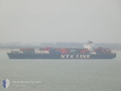
NYK RIGEL
Container Ship
Current Trip
| Trip Time | 7 days |
|---|---|
| Trip Distance | 2957.50 nm |
| AVG Speed | 15 Knots |
| MAX Speed | 19.7 Knots |
| Draught | 12.1 m |
| AVG Wind | 7.5 knots |
| MAX Wind | 18.8 knots |
| MIN Temp | 14.1°C / 57.38°F |
| MAX Temp | 30.1°C / 86.18°F |
| Position Received | 1 m ago |
Current Position
| Longitude | -118.27345° |
|---|---|
| Latitude | 33.76646° |
| Status | Moored |
| Speed | |
| Course | 82° |
| Area | North Pacific Ocean |
| Station | T-AIS |
| Position Received | 1 m ago |
Info
Information
The current position of NYK RIGEL is in North Pacific Ocean with coordinates 33.76646° / -118.27345° as reported on 2024-05-16 14:56 by AIS to our vessel tracker app. The vessel's current speed is 0 Knots and is currently inside the port of LOS ANGELES.
The vessel NYK RIGEL (IMO: 9416977, MMSI: 371449000) is a Container Ship that was built in 2009 ( 15 years old ). It's sailing under the flag of [PA] Panama.
In this page you can find informations about the vessels current position, last detected port calls, and current voyage information. If the vessels is not in coverage by AIS you will find the latest position.
The current position of NYK RIGEL is detected by our AIS receivers and we are not responsible for the reliability of the data. The last position was recorded while the vessel was in Coverage by the Ais receivers of our vessel tracking app.
The current draught of NYK RIGEL as reported by AIS is 12.1 meters
Weather
| Temperature | 15.1°C / 59.18°F |
|---|---|
| Wind Speed | 2 knots |
| Direction | 164° SSE |
| Pressure | 1014.1 hPa |
| Humidity | 78.1 % |
| Cloud Coverage | 100 % |
Featured Company
Last Port Calls
| Port | Arrival | Departure | Time In Port |
|---|---|---|---|
| 2024-05-15 12:03 | |||
| 2024-05-07 19:42 | 2024-05-08 04:06 | 8 h | |
| 2024-05-02 20:01 | 2024-05-03 09:09 | 13 h | |
| 2024-04-24 23:27 | 2024-04-25 09:28 | 10 h | |
| 2024-04-24 22:59 | 2024-04-24 23:13 | 14 m | |
| 2024-04-19 13:31 | 2024-04-19 21:29 | 7 h | |
| 2024-04-10 12:55 | 2024-04-11 06:33 | 17 h | |
| 2024-04-08 11:23 | 2024-04-09 05:05 | 17 h | |
| 2024-04-06 19:03 | 2024-04-07 14:33 | 19 h | |
| 2024-04-05 06:44 | 2024-04-06 05:02 | 22 h |
Most Visited Ports (Last year)
| Port | Arrivals | |
|---|---|---|
| 10 | ||
| 9 | ||
| 7 | ||
| 7 | ||
| 5 | ||
| 5 |
Last Trips
| Origin | Departure | Destination | Arrival | Distance | |
|---|---|---|---|---|---|
| 2024-05-07 23:06 | 2024-05-15 05:03 | 2957.50 nm | |||
| 2024-05-03 04:09 | 2024-05-07 14:42 | 349.45 nm | |||
| 2024-04-25 05:28 | 2024-05-02 15:01 | 1294.79 nm | |||
| 2024-04-24 19:13 | 2024-04-24 19:27 | 0.60 nm | |||
| 2024-04-19 18:29 | 2024-04-24 18:59 | 1566.76 nm | |||
| 2024-04-11 08:33 | 2024-04-19 10:31 | 2820.44 nm | |||
| 2024-04-09 07:05 | 2024-04-10 14:55 | 409.56 nm | |||
| 2024-04-07 16:33 | 2024-04-08 13:23 | 306.60 nm | |||
| 2024-04-06 07:02 | 2024-04-06 21:03 | 238.57 nm | |||
| 2024-04-04 21:54 | 2024-04-05 08:44 | 111.12 nm |
Events
| Time | Event | Details | Position / Dest | Info |
|---|---|---|---|---|
| 2024-05-15 13:08 | Status Changed | Moored Under way using engine |
33.76664 / -118.27350
[US] LOS ANGELES
|
Speed: 0.1 kn Course: 82° |
| 2024-05-15 12:58 | STOP Moving |
33.76605 / -118.27363
[US] LOS ANGELES
|
Speed: 0.3 kn Course: 75° |
|
| 2024-05-15 12:03 | PORT ARRIVAL |
|
33.70627 / -118.24711
[US] LOS ANGELES
|
Speed: 9.6 kn Course: 339.5° |
| 2024-05-15 05:02 | Change Sea Area | United States part of the North Pacific Ocean Mexican part of the North Pacific Ocean |
32.61863 / -117.74226
North Pacific Ocean
US LAX
|
Speed: 15.6 kn Course: 339.7° |
| 2024-05-15 02:07 | Draught Changed | 12.1 12 |
31.81539 / -117.42907
US LAX
|
Speed: 18 kn Course: 340.4° |
| 2024-05-15 02:07 | ETA Changed | 2024/05/15 12:00 |
31.81539 / -117.42907
US LAX
|
Speed: 18 kn Course: 340.4° |
| 2024-05-15 01:58 | Status Changed | Under way using engine Default |
31.77332 / -117.41232
US LAX
|
Speed: 18.3 kn Course: 341° |
| 2024-05-15 01:34 | Status Changed | Default Under way using engine |
31.65567 / -117.36711
US LAX
|
Speed: 18.2 kn Course: 345° |
| 2024-05-15 01:20 | Status Changed | Under way using engine Default |
31.58750 / -117.34126
US LAX
|
Speed: 18.3 kn Course: 344° |
| 2024-05-15 01:18 | IN Coverage |
31.58937 / -117.34195
North Pacific Ocean
|
Speed: 18.3 kn Course: 342.5° |