
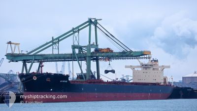
NYMPHE
Bulk Carrier
Current Trip
| Time Travelled | 24 days |
|---|---|
| Remaining Time | --- |
| Distance Travelled | 5051.67 nm |
| Remaining Distance | --- |
| AVG Speed | 9.7 Knots |
| MAX Speed | 15.7 Knots |
| AVG Wind | 11.8 knots |
| MAX Wind | 32 knots |
| MIN Temp | 5.6°C / 42.08°F |
| MAX Temp | 20.9°C / 69.62°F |
| Draught | 11.6 m |
| Position Received | 9 d ago |
Current Position
| Longitude | -31.04842° |
|---|---|
| Latitude | 40.39755° |
| Status | Under way using engine |
| Speed | 10.3 Knots |
| Course | 295° |
| Area | North Atlantic Ocean |
| Station | T-AIS |
| Position Received | 9 d ago |
Info
Information
The current position of NYMPHE is in North Atlantic Ocean with coordinates 40.39755° / -31.04842° as reported on 2024-05-28 07:31 by AIS to our vessel tracker app. The vessel's current speed is 10.3 Knots
The vessel NYMPHE (IMO: 9438781, MMSI: 240929000) is a Bulk Carrier that was built in 2009 ( 15 years old ). It's sailing under the flag of [GR] Greece.
In this page you can find informations about the vessels current position, last detected port calls, and current voyage information. If the vessels is not in coverage by AIS you will find the latest position.
The current position of NYMPHE is detected by our AIS receivers and we are not responsible for the reliability of the data. The last position was recorded while the vessel was in Coverage by the Ais receivers of our vessel tracking app.
The current draught of NYMPHE as reported by AIS is 11.6 meters
Weather
| Temperature | 13.2°C / 55.76°F |
|---|---|
| Wind Speed | 6 knots |
| Direction | 96° E |
| Pressure | 1009.8 hPa |
| Humidity | 80 % |
| Cloud Coverage | 84 % |
Featured Company
Most Visited Ports (Last year)
| Port | Arrivals | |
|---|---|---|
| 1 | ||
| 1 | ||
| 1 | ||
| 1 | ||
| 1 | ||
| 1 |
Events
| Time | Event | Details | Position / Dest | Info |
|---|---|---|---|---|
| 2024-06-05 06:50 | STOP Moving | 3.57 nm, South West of SEPT-ILES |
50.16832 / -66.46930
CA SEI
|
Speed: 0.1 kn Course: 111° |
| 2024-06-05 06:10 | START Moving | 3.16 nm, South West of SEPT-ILES |
50.17987 / -66.46702
CA SEI
|
Speed: 4.3 kn Course: 260° |
| 2024-06-03 10:05 | STOP Moving | 2.01 nm, West of SEPT-ILES |
50.18838 / -66.44019
CA SEI
|
Speed: Course: 322° |
| 2024-05-28 07:36 | Status Changed | Default Under way using engine |
40.40438 / -31.06647
CA SEI
|
Speed: 10.3 kn Course: 295° |
| 2024-05-28 07:31 | OUT of Coverage |
40.39755 / -31.04842
North Atlantic Ocean
CA SEI
|
Speed: 10.3 kn Course: 295° |
|
| 2024-05-28 07:24 | Status Changed | Under way using engine Default |
40.38908 / -31.02288
CA SEI
|
Speed: 10.2 kn Course: 294° |
| 2024-05-28 06:55 | Status Changed | Default Under way using engine |
40.35333 / -30.92783
CA SEI
|
Speed: 10.2 kn Course: 295° |
| 2024-05-28 05:09 | Status Changed | Under way using engine Default |
40.21703 / -30.57883
CA SEI
|
Speed: 10.4 kn Course: 296° |
| 2024-05-28 05:01 | Status Changed | Default Under way using engine |
40.20755 / -30.55410
CA SEI
|
Speed: 10.4 kn Course: 294° |
| 2024-05-28 04:49 | Status Changed | Under way using engine Default |
40.19235 / -30.51197
CA SEI
|
Speed: 10.3 kn Course: 295° |