
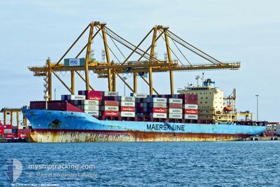
NYSTED MAERSK
Container Ship
Current Trip
| Time Travelled | 15 h, 10 mins |
|---|---|
| Remaining Time | 59 mins |
| Distance Travelled | 175.94 nm |
| Remaining Distance | 13.90 nm |
| AVG Speed | 11.3 Knots |
| MAX Speed | 13.9 Knots |
| AVG Wind | 6.1 knots |
| MAX Wind | 10 knots |
| MIN Temp | 16.4°C / 61.52°F |
| MAX Temp | 22.1°C / 71.78°F |
| Draught | 10.2 m |
| Position Received | 1 m ago |
Current Position
| Longitude | 2.45967° |
|---|---|
| Latitude | 41.27845° |
| Status | Under way using engine |
| Speed | 0.6 Knots |
| Course | 267° |
| Area | Balearic Sea |
| Station | T-AIS |
| Position Received | 1 m ago |
Info
Information
The current position of NYSTED MAERSK is in Balearic Sea with coordinates 41.27845° / 2.45967° as reported on 2024-05-20 05:52 by AIS to our vessel tracker app. The vessel's current speed is 0.6 Knots and is heading at the port of BARCELONA. The estimated time of arrival as calculated by vessel tracking app is 2024-05-20 06:52 LT
The vessel NYSTED MAERSK (IMO: 9220897, MMSI: 477642700) is a Container Ship that was built in 2001 ( 23 years old ). It's sailing under the flag of [HK] Hong Kong.
In this page you can find informations about the vessels current position, last detected port calls, and current voyage information. If the vessels is not in coverage by AIS you will find the latest position.
The current position of NYSTED MAERSK is detected by our AIS receivers and we are not responsible for the reliability of the data. The last position was recorded while the vessel was in Coverage by the Ais receivers of our vessel tracking app.
The current draught of NYSTED MAERSK as reported by AIS is 10.2 meters
Weather
| Temperature | 17.2°C / 62.96°F |
|---|---|
| Wind Speed | 1 knots |
| Direction | 47° NE |
| Pressure | 1009 hPa |
| Humidity | 84.4 % |
| Cloud Coverage | 100 % |
Featured Company
Last Port Calls
| Port | Arrival | Departure | Time In Port |
|---|---|---|---|
| 2024-05-18 15:28 | 2024-05-19 14:43 | 23 h | |
| 2024-05-16 04:24 | 2024-05-16 15:54 | 11 h | |
| 2024-05-09 13:15 | 2024-05-10 10:52 | 21 h | |
| 2024-05-07 09:44 | 2024-05-08 13:16 | 1 d | |
| 2024-04-30 17:37 | 2024-05-01 10:26 | 16 h | |
| 2024-04-27 18:36 | 2024-04-29 22:21 | 2 d | |
| 2024-04-22 02:54 | 2024-04-22 17:45 | 14 h | |
| 2024-04-19 22:45 | 2024-04-20 12:30 | 13 h | |
| 2024-04-17 04:18 | 2024-04-17 14:18 | 9 h | |
| 2024-04-12 02:16 |
Most Visited Ports (Last year)
| Port | Arrivals | |
|---|---|---|
| 11 | ||
| 8 | ||
| 8 | ||
| 8 | ||
| 7 | ||
| 6 |
Last Trips
| Origin | Departure | Destination | Arrival | Distance | |
|---|---|---|---|---|---|
| 2024-05-16 17:54 | 2024-05-18 17:28 | 263.71 nm | |||
| 2024-05-10 13:52 | 2024-05-16 06:24 | 1796.15 nm | |||
| 2024-05-08 15:16 | 2024-05-09 16:15 | 447.93 nm | |||
| 2024-05-01 12:26 | 2024-05-07 11:44 | 1823.98 nm | |||
| 2024-04-29 23:21 | 2024-04-30 19:37 | 207.44 nm | |||
| 2024-04-22 19:45 | 2024-04-27 19:36 | 612.00 nm | |||
| 2024-04-20 14:30 | 2024-04-22 04:54 | 171.66 nm | |||
| 2024-04-17 16:18 | 2024-04-20 00:45 | 426.34 nm | |||
| 2024-04-11 07:29 | 2024-04-12 05:16 | 262.16 nm | |||
| 2024-04-08 22:58 | 2024-04-10 06:25 | 438.10 nm |
Events
| Time | Event | Details | Position / Dest | Info |
|---|---|---|---|---|
| 2024-05-20 03:52 | ETA Changed | 2024/05/20 16:00 2024/05/20 05:00 |
41.46789 / 2.85721
FRFSM>>ESBCN
|
Speed: 11.4 kn Course: 238.6° |
| 2024-05-20 03:43 | Status Changed | Under way using engine Default |
41.46789 / 2.85721
FRFSM>>ESBCN
|
Speed: 11.4 kn Course: 239° |
| 2024-05-20 03:33 | Status Changed | Default Under way using engine |
41.48389 / 2.89374
FRFSM>>ESBCN
|
Speed: 11.4 kn Course: 239.3° |
| 2024-05-20 03:01 | Detected in Sea | Spanish part of the Balearic Sea |
41.53678 / 3.01212
Balearic Sea
FRFSM>>ESBCN
|
Speed: 11.5 kn Course: 238.9° |
| 2024-05-20 03:01 | Status Changed | Under way using engine Default |
41.53678 / 3.01212
FRFSM>>ESBCN
|
Speed: 11.6 kn Course: 240° |
| 2024-05-20 02:41 | IN Coverage |
41.53678 / 3.01212
Balearic Sea
FRFSM>>ESBCN
|
Speed: 11.5 kn Course: 238.9° |
|
| 2024-05-19 23:21 | Status Changed | Default Under way using engine |
42.04898 / 3.66065
FRFSM>>ESBCN
|
Speed: 11.4 kn Course: 221° |
| 2024-05-19 23:15 | Status Changed | Under way using engine Default |
42.06429 / 3.67839
FRFSM>>ESBCN
|
Speed: 11.7 kn Course: 222° |
| 2024-05-19 23:15 | OUT of Coverage |
42.06429 / 3.67839
Mediterranean Sea - Western Basin
FRFSM>>ESBCN
|
Speed: 11.4 kn Course: 221° |
|
| 2024-05-19 23:06 | Status Changed | Default Under way using engine |
42.08592 / 3.70381
FRFSM>>ESBCN
|
Speed: 11.6 kn Course: 220.8° |