
OBIRIX
General Cargo
Current Trip
| Time Travelled | 5 days |
|---|---|
| Remaining Time | --- |
| Distance Travelled | 1346.18 nm |
| Remaining Distance | --- |
| AVG Speed | 9.8 Knots |
| MAX Speed | 11.2 Knots |
| AVG Wind | 13.3 knots |
| MAX Wind | 27.9 knots |
| MIN Temp | 18.6°C / 65.48°F |
| MAX Temp | 22.1°C / 71.78°F |
| Draught | 7.3 m |
| Position Received | 4 d ago |
Current Position
| Longitude | -9.02069° |
|---|---|
| Latitude | 33.64349° |
| Status | Under way using engine |
| Speed | 9.6 Knots |
| Course | 224.3° |
| Area | North Atlantic Ocean |
| Station | T-AIS |
| Position Received | 4 d ago |
Info
Information
The current position of OBIRIX is in North Atlantic Ocean with coordinates 33.64349° / -9.02069° as reported on 2024-06-04 09:16 by AIS to our vessel tracker app. The vessel's current speed is 9.6 Knots and is heading at the port of SAN PEDRO. The estimated time of arrival as calculated by vessel tracking app is 2024-06-14 17:00 LT
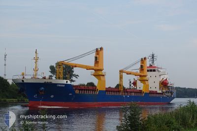
The vessel OBIRIX (IMO: 9504267, MMSI: 314558000) is a General Cargo that was built in 2008 ( 16 years old ). It's sailing under the flag of [BB] Barbados.
In this page you can find informations about the vessels current position, last detected port calls, and current voyage information. If the vessels is not in coverage by AIS you will find the latest position.
The current position of OBIRIX is detected by our AIS receivers and we are not responsible for the reliability of the data. The last position was recorded while the vessel was in Coverage by the Ais receivers of our vessel tracking app.
The current draught of OBIRIX as reported by AIS is 7.3 meters
Weather
| Temperature | 22.1°C / 71.78°F |
|---|---|
| Wind Speed | 21 knots |
| Direction | 339° NNW |
| Pressure | 1013.2 hPa |
| Humidity | 79.8 % |
| Cloud Coverage | 1 % |
Featured Company
Last Port Calls
| Port | Arrival | Departure | Time In Port |
|---|---|---|---|
| 2024-06-03 00:51 | 2024-06-03 08:18 | 7 h | |
| 2024-05-26 07:24 | 2024-05-29 07:21 | 2 d | |
| 2024-05-12 14:28 | 2024-05-16 17:46 | 4 d | |
| 2024-05-02 13:23 | 2024-05-02 22:33 | 9 h | |
| 2024-04-17 12:38 | 2024-04-27 21:44 | 10 d | |
| 2024-04-05 15:17 |
Last Trips
| Origin | Departure | Destination | Arrival | Distance | |
|---|---|---|---|---|---|
| 2024-05-29 08:21 | 2024-06-03 02:51 | 1079.37 nm | |||
| 2024-05-16 19:46 | 2024-05-26 08:24 | 2392.94 nm | |||
| 2024-05-02 23:33 | 2024-05-12 16:28 | 1584.09 nm | |||
| 2024-04-27 21:44 | 2024-05-02 14:23 | 855.15 nm | |||
| 2024-04-05 15:17 | 2024-04-17 12:38 | 1529.27 nm |
Events
| Time | Event | Details | Position / Dest | Info |
|---|---|---|---|---|
| 2024-06-04 09:21 | Status Changed | Default Under way using engine |
33.63334 / -9.03167
CI SPY
|
Speed: 9.6 kn Course: 224.3° |
| 2024-06-04 09:16 | Status Changed | Under way using engine Default |
33.64349 / -9.02069
CI SPY
|
Speed: 9 kn Course: 225° |
| 2024-06-04 09:16 | OUT of Coverage |
33.64349 / -9.02069
North Atlantic Ocean
CI SPY
|
Speed: 9.6 kn Course: 224.3° |
|
| 2024-06-04 09:09 | IN Coverage |
33.64349 / -9.02069
North Atlantic Ocean
CI SPY
|
Speed: 9.6 kn Course: 224.3° |
|
| 2024-06-04 05:21 | Status Changed | Default Under way using engine |
34.09333 / -8.48833
CI SPY
|
Speed: 9.6 kn Course: 225.4° |
| 2024-06-04 05:15 | OUT of Coverage |
34.10498 / -8.47501
North Atlantic Ocean
CI SPY
|
Speed: 9.6 kn Course: 225.4° |
|
| 2024-06-04 05:15 | Status Changed | Under way using engine Default |
34.10563 / -8.47421
CI SPY
|
Speed: 9 kn Course: 226° |
| 2024-06-04 04:57 | IN Coverage |
34.10498 / -8.47501
North Atlantic Ocean
CI SPY
|
Speed: 9.6 kn Course: 225.4° |
|
| 2024-06-04 01:30 | Status Changed | Default Under way using engine |
34.54167 / -7.95167
CI SPY
|
Speed: 9.7 kn Course: 223.9° |
| 2024-06-04 01:27 | OUT of Coverage |
34.54866 / -7.94504
North Atlantic Ocean
CI SPY
|
Speed: 9.7 kn Course: 223.9° |