
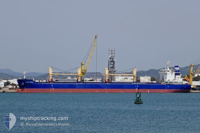
OCEAN BRAVE
Cargo
Current Trip
| Time Travelled | 1 day |
|---|---|
| Remaining Time | --- |
| Distance Travelled | 592.56 nm |
| Remaining Distance | --- |
| AVG Speed | 13.9 Knots |
| MAX Speed | 13.9 Knots |
| AVG Wind | 10.9 knots |
| MAX Wind | 17 knots |
| MIN Temp | 25.3°C / 77.54°F |
| MAX Temp | 28°C / 82.4°F |
| Draught | 7.1 m |
| Position Received | 45 m ago |
Current Position
| Longitude | 34.69736° |
|---|---|
| Latitude | 35.36283° |
| Status | Not under command |
| Speed | 0.3 Knots |
| Course | 257° |
| Area | Mediterranean Sea - Eastern Basin |
| Station | T-AIS |
| Position Received | 45 m ago |
Info
Information
The current position of OCEAN BRAVE is in Mediterranean Sea - Eastern Basin with coordinates 35.36283° / 34.69736° as reported on 2024-06-29 03:53 by AIS to our vessel tracker app. The vessel's current speed is 0.3 Knots
The vessel OCEAN BRAVE (IMO: 9883352, MMSI: 636019924) is a Cargo It's sailing under the flag of [LR] Liberia.
In this page you can find informations about the vessels current position, last detected port calls, and current voyage information. If the vessels is not in coverage by AIS you will find the latest position.
The current position of OCEAN BRAVE is detected by our AIS receivers and we are not responsible for the reliability of the data. The last position was recorded while the vessel was in Coverage by the Ais receivers of our vessel tracking app.
The current draught of OCEAN BRAVE as reported by AIS is 7.1 meters
Weather
| Temperature | 26.9°C / 80.42°F |
|---|---|
| Wind Speed | 3 knots |
| Direction | 179° S |
| Pressure | 1001.2 hPa |
| Humidity | 82.6 % |
| Cloud Coverage | 9 % |
Featured Company
Last Port Calls
| Port | Arrival | Departure | Time In Port |
|---|---|---|---|
| 2024-06-22 12:49 | 2024-06-27 10:49 | 4 d | |
| 2024-05-31 03:45 | 2024-06-06 16:59 | 6 d | |
| 2024-05-27 07:33 | 2024-05-29 02:35 | 1 d | |
| 2024-05-17 11:03 | 2024-05-24 18:39 | 7 d | |
| 2024-05-07 05:48 | 2024-05-07 15:08 | 9 h | |
| 2024-05-03 07:04 | 2024-05-05 16:25 | 2 d | |
| 2024-04-25 16:03 | |||
| 2024-04-19 06:00 | 2024-04-19 14:52 | 8 h | |
| 2024-04-15 11:07 | 2024-04-15 12:24 | 1 h | |
| 2024-04-08 16:36 | 2024-04-12 10:44 | 3 d |
Most Visited Ports (Last year)
| Port | Arrivals | |
|---|---|---|
| 3 | ||
| 2 | ||
| 2 | ||
| 2 | ||
| 1 | ||
| 1 |
Last Trips
| Origin | Departure | Destination | Arrival | Distance | |
|---|---|---|---|---|---|
| 2024-06-06 18:59 | 2024-06-22 14:49 | 3339.42 nm | |||
| 2024-05-29 04:35 | 2024-05-31 05:45 | 187.02 nm | |||
| 2024-05-24 20:39 | 2024-05-27 09:33 | 786.26 nm | |||
| 2024-05-05 19:25 | 2024-05-17 13:03 | 2963.05 nm | |||
| 2024-05-05 19:25 | 2024-05-07 07:48 | 268.69 nm | |||
| 2024-04-15 15:24 | 2024-04-25 19:03 | 1195.64 nm | |||
| 2024-04-15 15:24 | 2024-04-19 08:00 | 807.53 nm | |||
| 2024-04-12 13:44 | 2024-04-15 14:07 | 195.81 nm | |||
| 2024-04-06 10:38 | 2024-04-08 19:36 | 15.64 nm | |||
| 2024-04-01 17:04 | 2024-04-04 19:37 | 264.49 nm |
Events
| Time | Event | Details | Position / Dest | Info |
|---|---|---|---|---|
| 2024-06-29 03:53 | Status Changed | Not under command Default |
35.36283 / 34.69736
ISKENDERUN
|
Speed: 0.5 kn Course: 257° |
| 2024-06-29 03:53 | STOP Moving |
35.36283 / 34.69736
ISKENDERUN
|
Speed: 0.3 kn Course: 257° |
|
| 2024-06-29 03:35 | Status Changed | Default Not under command |
35.36191 / 34.69969
ISKENDERUN
|
Speed: 2.4 kn Course: 249° |
| 2024-06-29 03:35 | IN Coverage |
35.36283 / 34.69736
Mediterranean Sea - Eastern Basin
|
Speed: 0.3 kn Course: 298.8° |
|
| 2024-06-29 02:50 | OUT of Coverage |
35.35976 / 34.71668
Mediterranean Sea - Eastern Basin
|
Speed: 2.4 kn Course: 254° |
|
| 2024-06-29 02:41 | Status Changed | Not under command Under way using engine |
35.36224 / 34.72587
ISKENDERUN
|
Speed: 7.1 kn Course: 224.1° |
| 2024-06-29 00:39 | Detected in Sea | Cypriote part of the Mediterranean Sea - Eastern Basin |
35.63938 / 35.06178
Mediterranean Sea - Eastern Basin
|
Speed: 12.2 kn Course: 217.2° |
| 2024-06-29 00:39 | Status Changed | Under way using engine Default |
35.63938 / 35.06178
ISKENDERUN
|
Speed: 12.1 kn Course: 217° |
| 2024-06-29 00:07 | Status Changed | Default Under way using engine |
35.72849 / 35.14316
ISKENDERUN
|
Speed: 12.1 kn Course: 218.8° |
| 2024-06-28 22:56 | Status Changed | Under way using engine Not under command |
35.91834 / 35.32158
ISKENDERUN
|
Speed: 11.8 kn Course: 220.7° |