
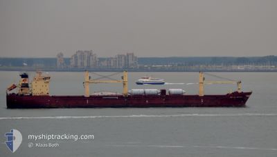
OCEAN CASTLE
Bulk Carrier
Current Trip
| Time Travelled | 1 day |
|---|---|
| Remaining Time | --- |
| Distance Travelled | 325.97 nm |
| Remaining Distance | --- |
| AVG Speed | 10.5 Knots |
| MAX Speed | 11.5 Knots |
| AVG Wind | 12.6 knots |
| MAX Wind | 17.6 knots |
| MIN Temp | 18.1°C / 64.58°F |
| MAX Temp | 20.4°C / 68.72°F |
| Draught | 9 m |
| Position Received | 9 h, 6 m ago |
Current Position
| Longitude | -11.76592° |
|---|---|
| Latitude | 35.12842° |
| Status | Under way using engine |
| Speed | 10.7 Knots |
| Course | 292.1° |
| Area | North Atlantic Ocean |
| Station | T-AIS |
| Position Received | 9 h, 6 m ago |
Info
Information
The current position of OCEAN CASTLE is in North Atlantic Ocean with coordinates 35.12842° / -11.76592° as reported on 2024-06-15 20:17 by AIS to our vessel tracker app. The vessel's current speed is 10.7 Knots and is heading at the port of ARGENTIA. The estimated time of arrival as calculated by vessel tracking app is 2024-06-22 09:00 LT
The vessel OCEAN CASTLE (IMO: 9315537, MMSI: 229236000) is a Bulk Carrier that was built in 2005 ( 19 years old ). It's sailing under the flag of [MT] Malta.
In this page you can find informations about the vessels current position, last detected port calls, and current voyage information. If the vessels is not in coverage by AIS you will find the latest position.
The current position of OCEAN CASTLE is detected by our AIS receivers and we are not responsible for the reliability of the data. The last position was recorded while the vessel was in Coverage by the Ais receivers of our vessel tracking app.
The current draught of OCEAN CASTLE as reported by AIS is 9 meters
Weather
| Temperature | 18°C / 64.4°F |
|---|---|
| Wind Speed | 13 knots |
| Direction | 8° N |
| Pressure | 1019.9 hPa |
| Humidity | 78.6 % |
| Cloud Coverage | 24 % |
Featured Company
Last Port Calls
| Port | Arrival | Departure | Time In Port |
|---|---|---|---|
| 2024-06-07 11:25 | 2024-06-14 21:52 | 7 d | |
| 2024-05-29 03:50 | 2024-05-31 12:18 | 2 d | |
| 2024-05-13 08:53 | 2024-05-21 12:46 | 8 d | |
| 2024-04-30 09:08 | 2024-05-04 14:20 | 4 d | |
| 2024-04-19 02:07 | 2024-04-19 04:17 | 2 h | |
| 2024-04-09 02:37 | 2024-04-17 09:03 | 8 d | |
| 2024-04-08 21:38 |
Most Visited Ports (Last year)
| Port | Arrivals | |
|---|---|---|
| 6 | ||
| 4 | ||
| 4 | ||
| 3 | ||
| 2 | ||
| 2 |
Last Trips
| Origin | Departure | Destination | Arrival | Distance | |
|---|---|---|---|---|---|
| 2024-05-31 15:18 | 2024-06-07 12:25 | 1867.67 nm | |||
| 2024-05-21 13:46 | 2024-05-29 06:50 | 1925.19 nm | |||
| 2024-05-04 15:20 | 2024-05-13 09:53 | 1202.67 nm | |||
| 2024-04-19 00:17 | 2024-04-30 10:08 | 2829.87 nm | |||
| 2024-04-17 05:03 | 2024-04-18 22:07 | 315.20 nm | |||
| 2024-04-08 17:38 | 2024-04-08 22:37 | 60.71 nm |
Events
| Time | Event | Details | Position / Dest | Info |
|---|---|---|---|---|
| 2024-06-15 20:21 | Status Changed | Default Under way using engine |
35.13141 / -11.77800
ARGENTIA
|
Speed: 10.7 kn Course: 292.1° |
| 2024-06-15 20:17 | OUT of Coverage |
35.12842 / -11.76592
North Atlantic Ocean
ARGENTIA
|
Speed: 10.7 kn Course: 292.1° |
|
| 2024-06-15 20:01 | Detected in Sea | Portuguese part of the North Atlantic Ocean |
35.11437 / -11.70880
North Atlantic Ocean
ARGENTIA
|
Speed: 10.7 kn Course: 283.6° |
| 2024-06-15 20:01 | Status Changed | Under way using engine Default |
35.11437 / -11.70880
ARGENTIA
|
Speed: 10.9 kn Course: 277° |
| 2024-06-15 20:01 | IN Coverage |
35.11437 / -11.70880
North Atlantic Ocean
ARGENTIA
|
Speed: 10.7 kn Course: 283.6° |
|
| 2024-06-15 15:25 | Status Changed | Default Under way using engine |
34.81084 / -10.86413
ARGENTIA
|
Speed: 10.2 kn Course: 333.1° |
| 2024-06-15 15:08 | IN Coverage |
34.76759 / -10.83844
North Atlantic Ocean
ARGENTIA
|
Speed: 10.2 kn Course: 333.1° |
|
| 2024-06-15 15:08 | OUT of Coverage |
34.76759 / -10.83844
North Atlantic Ocean
ARGENTIA
|
Speed: 10.2 kn Course: 333.1° |
|
| 2024-06-15 14:58 | Status Changed | Under way using engine Default |
34.74211 / -10.82352
ARGENTIA
|
Speed: 10 kn Course: 337° |
| 2024-06-15 09:10 | OUT of Coverage |
34.33793 / -9.74776
North Atlantic Ocean
ARGENTIA
|
Speed: 10.6 kn Course: 287° |