
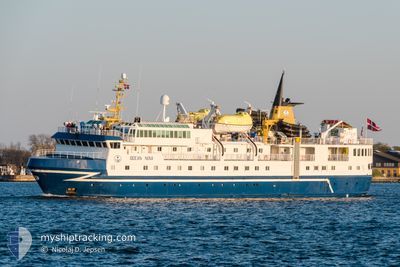
OCEAN NOVA
Passengers Ship
Current Trip
IONA
| Time Travelled | 1 day |
|---|---|
| Remaining Time | --- |
| Distance Travelled | 277.92 nm |
| Remaining Distance | --- |
| AVG Speed | 8.6 Knots |
| MAX Speed | 11 Knots |
| AVG Wind | 11.9 knots |
| MAX Wind | 22 knots |
| MIN Temp | 9.8°C / 49.64°F |
| MAX Temp | 13.2°C / 55.76°F |
| Draught | 4.5 m |
| Position Received | 1 m ago |
Current Position
| Longitude | -7.67786° |
|---|---|
| Latitude | 56.73276° |
| Status | Under way using engine |
| Speed | 9.7 Knots |
| Course | 134.3° |
| Area | North Atlantic Ocean |
| Station | T-AIS |
| Position Received | 1 m ago |
Info
Information
The current position of OCEAN NOVA is in North Atlantic Ocean with coordinates 56.73276° / -7.67786° as reported on 2024-05-17 02:13 by AIS to our vessel tracker app. The vessel's current speed is 9.7 Knots
The vessel OCEAN NOVA (IMO: 8913916, MMSI: 309051000) is a Passengers Ship that was built in 1992 ( 32 years old ). It's sailing under the flag of [BS] Bahamas.
In this page you can find informations about the vessels current position, last detected port calls, and current voyage information. If the vessels is not in coverage by AIS you will find the latest position.
The current position of OCEAN NOVA is detected by our AIS receivers and we are not responsible for the reliability of the data. The last position was recorded while the vessel was in Coverage by the Ais receivers of our vessel tracking app.
The current draught of OCEAN NOVA as reported by AIS is 4.5 meters
Weather
| Temperature | 11°C / 51.8°F |
|---|---|
| Wind Speed | 22 knots |
| Direction | 2° N |
| Pressure | 1012.1 hPa |
| Humidity | 95.5 % |
| Cloud Coverage | 78 % |
Featured Company
Last Port Calls
| Port | Arrival | Departure | Time In Port |
|---|---|---|---|
| 2024-05-15 05:55 | 2024-05-15 06:21 | 25 m | |
| 2024-05-14 12:02 | 2024-05-14 12:31 | 29 m | |
| 2024-05-14 07:03 | 2024-05-14 11:49 | 4 h | |
| 2024-05-14 06:22 | 2024-05-14 06:28 | 5 m | |
| 2024-05-09 05:03 | 2024-05-09 17:17 | 12 h | |
| 2024-05-07 05:40 | 2024-05-07 18:42 | 13 h | |
| 2024-05-04 07:17 | 2024-05-04 07:49 | 31 m | |
| 2024-05-02 06:03 | 2024-05-02 12:15 | 6 h | |
| 2024-04-29 06:13 | 2024-04-29 12:10 | 5 h | |
| 2024-04-26 18:00 | 2024-04-28 18:09 | 2 d |
Most Visited Ports (Last year)
| Port | Arrivals | |
|---|---|---|
| 7 | ||
| 3 | ||
| 3 | ||
| 2 | ||
| 2 | ||
| 2 |
Last Trips
| Origin | Departure | Destination | Arrival | Distance | |
|---|---|---|---|---|---|
| 2024-05-14 13:31 | 2024-05-15 06:55 | 57.39 nm | |||
| 2024-05-14 12:49 | 2024-05-14 13:02 | 0.23 nm | |||
| 2024-05-14 07:28 | 2024-05-14 08:03 | 1.73 nm | |||
| 2024-05-09 18:17 | 2024-05-14 07:22 | 466.82 nm | |||
| 2024-05-07 19:42 | 2024-05-09 06:03 | 252.87 nm | |||
| 2024-05-04 08:49 | 2024-05-07 06:40 | 454.99 nm | |||
| 2024-05-02 13:15 | 2024-05-04 08:17 | 289.61 nm | |||
| 2024-04-29 13:10 | 2024-05-02 07:03 | 439.75 nm | |||
| 2024-04-28 19:09 | 2024-04-29 07:13 | 100.42 nm | |||
| 2024-04-23 17:45 | 2024-04-26 19:00 | 701.41 nm |
Events
| Time | Event | Details | Position / Dest | Info |
|---|---|---|---|---|
| 2024-05-16 19:16 | START Moving |
57.80471 / -8.56217
IONA
|
Speed: 5.6 kn Course: 134.3° |
|
| 2024-05-16 19:02 | Status Changed | Under way using engine Not under command |
57.80573 / -8.56367
IONA
|
Speed: 0.7 kn Course: 298° |
| 2024-05-16 19:02 | Status Changed | Not under command At anchor |
57.80576 / -8.56364
IONA
|
Speed: 0.6 kn Course: 300° |
| 2024-05-16 12:43 | ETA Changed | 2024/05/17 07:30 2024/05/16 09:30 |
57.80502 / -8.56465
IONA
|
Speed: 0.5 kn Course: 358° |
| 2024-05-16 12:38 | Status Changed | At anchor Under way using engine |
57.80494 / -8.56416
IONA
|
Speed: 0.5 kn Course: 56° |
| 2024-05-16 12:37 | Destination Changed | IONA STACLEE |
57.80494 / -8.56424
IONA
|
Speed: 0.6 kn Course: 59° |
| 2024-05-16 12:30 | STOP Moving |
57.80568 / -8.56503
STACLEE
|
Speed: 0.3 kn Course: 7° |
|
| 2024-05-16 11:55 | START Moving |
57.82875 / -8.60409
STACLEE
|
Speed: 6.2 kn Course: 353.2° |
|
| 2024-05-16 11:49 | STOP Moving |
57.82689 / -8.60312
STACLEE
|
Speed: 0.3 kn Course: 257° |
|
| 2024-05-16 11:44 | START Moving |
57.82493 / -8.60084
STACLEE
|
Speed: 3.1 kn Course: 15° |