
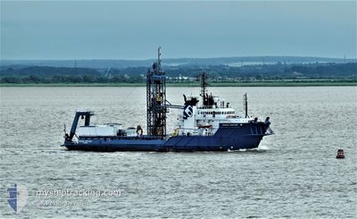
OCEAN VANTAGE
Offshore Supply Ship
Current Trip
DRILL SITE CPA 1NM
| Time Travelled | 34 days |
|---|---|
| Remaining Time | --- |
| Distance Travelled | 1089.07 nm |
| Remaining Distance | --- |
| AVG Speed | 9.3 Knots |
| MAX Speed | 11.8 Knots |
| AVG Wind | 9.8 knots |
| MAX Wind | 21 knots |
| MIN Temp | 4.8°C / 40.64°F |
| MAX Temp | 15.9°C / 60.62°F |
| Draught | 5.4 m |
| Position Received | 1 m ago |
Current Position
| Longitude | -3.57635° |
|---|---|
| Latitude | 53.76189° |
| Status | Restricted manoeuverability |
| Speed | |
| Course | 90° |
| Area | Irish Sea and St. George's Channel |
| Station | T-AIS |
| Position Received | 1 m ago |
Info
Information
The current position of OCEAN VANTAGE is in Irish Sea and St. George's Channel with coordinates 53.76189° / -3.57635° as reported on 2024-05-25 09:46 by AIS to our vessel tracker app. The vessel's current speed is 0 Knots
The vessel OCEAN VANTAGE (IMO: 8405440, MMSI: 351149000) is a Offshore Supply Ship that was built in 1985 ( 39 years old ). It's sailing under the flag of [PA] Panama.
In this page you can find informations about the vessels current position, last detected port calls, and current voyage information. If the vessels is not in coverage by AIS you will find the latest position.
The current position of OCEAN VANTAGE is detected by our AIS receivers and we are not responsible for the reliability of the data. The last position was recorded while the vessel was in Coverage by the Ais receivers of our vessel tracking app.
The current draught of OCEAN VANTAGE as reported by AIS is 5.4 meters
Weather
| Temperature | 11.5°C / 52.7°F |
|---|---|
| Wind Speed | 10 knots |
| Direction | 141° SE |
| Pressure | 1018 hPa |
| Humidity | 80.8 % |
| Cloud Coverage | 5 % |
Featured Company
Most Visited Ports (Last year)
| Port | Arrivals | |
|---|---|---|
| 6 | ||
| 3 | ||
| 1 | ||
| 1 |
Events
| Time | Event | Details | Position / Dest | Info |
|---|---|---|---|---|
| 2024-05-24 05:11 | ETA Changed | 2024/05/24 06:00 2024/05/20 12:00 |
53.76191 / -3.57651
DRILL SITE CPA 1NM
|
Speed: 0.1 kn Course: 89° |
| 2024-05-24 05:03 | Status Changed | Restricted manoeuverability Under way using engine |
53.76189 / -3.57654
DRILL SITE CPA 1NM
|
Speed: 0.2 kn Course: 94° |
| 2024-05-24 04:45 | STOP Moving | 18.51 nm, North of LIVERPOOL ANCH |
53.76195 / -3.57674
DRILL SITE CPA 1NM
|
Speed: 0.2 kn Course: 94° |
| 2024-05-24 04:33 | IN Coverage |
53.76475 / -3.60321
Irish Sea and St. George's Channel
|
Speed: 9.3 kn Course: 102.5° |
|
| 2024-05-23 21:18 | OUT of Coverage |
54.08077 / -4.57148
Irish Sea and St. George's Channel
|
Speed: 0.1 kn Course: 264.9° |
|
| 2024-05-23 21:13 | IN Coverage |
54.08074 / -4.57150
Irish Sea and St. George's Channel
|
Speed: 0.1 kn Course: 264.9° |
|
| 2024-05-22 10:17 | OUT of Coverage |
53.76156 / -3.57643
Irish Sea and St. George's Channel
|
Speed: 1 kn Course: 314.1° |
|
| 2024-05-22 10:15 | IN Coverage |
53.76179 / -3.57632
Irish Sea and St. George's Channel
|
Speed: 0.2 kn Course: 188.8° |
|
| 2024-05-22 09:13 | OUT of Coverage |
53.76185 / -3.57637
Irish Sea and St. George's Channel
|
Speed: 0.1 kn Course: 280° |
|
| 2024-05-20 04:29 | Destination Changed | DRILL SITE CPA 1NM GBLIV |
53.76189 / -3.57647
DRILL SITE CPA 1NM
|
Speed: 0.1 kn Course: 89° |