
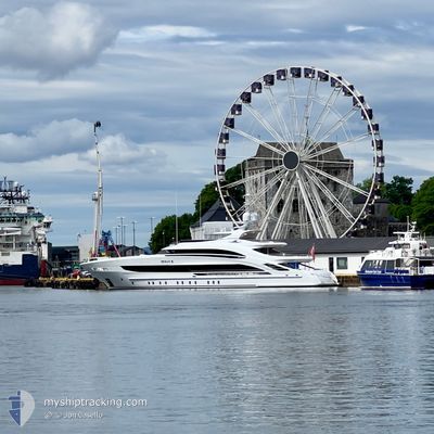
OCEAN Z
Pleasure Craft
Current Trip
NO FJA
| Time Travelled | 20 h, 49 mins |
|---|---|
| Remaining Time | --- |
| Distance Travelled | 38.56 nm |
| Remaining Distance | --- |
| AVG Speed | 12.6 Knots |
| MAX Speed | 14.1 Knots |
| AVG Wind | 3.5 knots |
| MAX Wind | 4.6 knots |
| MIN Temp | 3°C / 37.4°F |
| MAX Temp | 8°C / 46.4°F |
| Draught | 2.6 m |
| Position Received | 17 h, 41 m ago |
Current Position
| Longitude | 6.71327° |
|---|---|
| Latitude | 61.33971° |
| Status | Under way using engine |
| Speed | 12.9 Knots |
| Course | 35.8° |
| Area | Norwegian Sea |
| Station | T-AIS |
| Position Received | 17 h, 41 m ago |
Info
Information
The current position of OCEAN Z is in Norwegian Sea with coordinates 61.33971° / 6.71327° as reported on 2024-06-16 08:03 by AIS to our vessel tracker app. The vessel's current speed is 12.9 Knots
The vessel OCEAN Z (IMO: 9884540, MMSI: 319232200) is a Pleasure Craft It's sailing under the flag of [KY] Cayman Is.
In this page you can find informations about the vessels current position, last detected port calls, and current voyage information. If the vessels is not in coverage by AIS you will find the latest position.
The current position of OCEAN Z is detected by our AIS receivers and we are not responsible for the reliability of the data. The last position was recorded while the vessel was in Coverage by the Ais receivers of our vessel tracking app.
The current draught of OCEAN Z as reported by AIS is 2.6 meters
Weather
| Temperature | 7.4°C / 45.32°F |
|---|---|
| Wind Speed | 4 knots |
| Direction | 108° ESE |
| Pressure | 1004.3 hPa |
| Humidity | 88.1 % |
| Cloud Coverage | 100 % |
Featured Company
Last Port Calls
| Port | Arrival | Departure | Time In Port |
|---|---|---|---|
| 2024-06-15 11:34 | 2024-06-16 04:55 | 17 h | |
| 2024-06-14 10:10 | 2024-06-15 09:51 | 23 h | |
| 2024-05-27 10:48 | 2024-06-12 14:08 | 16 d | |
| 2024-05-21 10:18 | 2024-05-24 10:49 | 3 d | |
| 2024-04-19 15:13 | 2024-04-23 15:05 | 3 d | |
| 2024-04-19 13:39 | 2024-04-19 13:52 | 12 m | |
| 2024-04-19 13:37 |
Most Visited Ports (Last year)
| Port | Arrivals | |
|---|---|---|
| 4 | ||
| 4 | ||
| 2 | ||
| 2 | ||
| 1 | ||
| 1 |
Last Trips
| Origin | Departure | Destination | Arrival | Distance | |
|---|---|---|---|---|---|
| 2024-06-15 11:51 | 2024-06-15 13:34 | 17.97 nm | |||
| 2024-06-12 16:08 | 2024-06-14 12:10 | 149.04 nm | |||
| 2024-05-24 11:49 | 2024-05-27 12:48 | 841.46 nm | |||
| 2024-04-23 11:05 | 2024-05-21 11:18 | 3986.78 nm | |||
| 2024-04-19 09:52 | 2024-04-19 11:13 | 13.90 nm | |||
| 2024-04-19 09:37 | 2024-04-19 09:39 | 0.07 nm |
Events
| Time | Event | Details | Position / Dest | Info |
|---|---|---|---|---|
| 2024-06-16 08:03 | OUT of Coverage |
61.33971 / 6.71327
Norwegian Sea
NO FJA
|
Speed: 12.9 kn Course: 35.8° |
|
| 2024-06-16 04:55 | START Moving | 0.43 nm, North of FLAM |
60.87056 / 7.12917
NO FJA
|
Speed: 4.7 kn Course: 51° |
| 2024-06-16 04:55 | PORT DEPARTURE |
|
60.87056 / 7.12917
NO FJA
|
Speed: 2.4 kn Course: 32° |
| 2024-06-16 04:43 | Destination Changed | NO FJA NO FLA |
60.86700 / 7.12635
[NO] FLAM
|
Speed: 0.5 kn Course: 288° |
| 2024-06-16 04:43 | ETA Changed | 2024/06/16 10:45 2024/06/15 13:30 |
60.86700 / 7.12635
[NO] FLAM
|
Speed: 0.5 kn Course: 288° |
| 2024-06-16 04:43 | Status Changed | Under way using engine At anchor |
60.86700 / 7.12635
[NO] FLAM
|
Speed: Course: 236° |
| 2024-06-15 11:44 | STOP Moving |
60.86743 / 7.12784
[NO] FLAM
|
Speed: Course: 251° |
|
| 2024-06-15 11:42 | Status Changed | At anchor Under way using engine |
60.86739 / 7.12767
[NO] FLAM
|
Speed: 0.7 kn Course: 256° |
| 2024-06-15 11:34 | PORT ARRIVAL |
|
60.86759 / 7.12861
[NO] FLAM
|
Speed: 5 kn Course: 231.3° |
| 2024-06-15 10:00 | Destination Changed | NO FLA NO GUD |
60.90737 / 6.87023
NO FLA
|
Speed: 6.3 kn Course: 12.4° |