
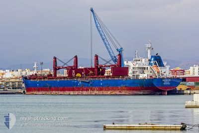
OCEANLADY
Bulk Carrier
Current Trip
| Time Travelled | 2 days |
|---|---|
| Remaining Time | --- |
| Distance Travelled | 273.33 nm |
| Remaining Distance | --- |
| AVG Speed | 11.7 Knots |
| MAX Speed | 14.5 Knots |
| AVG Wind | 9 knots |
| MAX Wind | 16.2 knots |
| MIN Temp | 12.7°C / 54.86°F |
| MAX Temp | 16.5°C / 61.7°F |
| Draught | 6.5 m |
| Position Received | Now |
Current Position
| Longitude | 8.12807° |
|---|---|
| Latitude | 54.05000° |
| Status | At anchor |
| Speed | 0.1 Knots |
| Course | 281° |
| Area | North Sea |
| Station | T-AIS |
| Position Received | Now |
Info
Information
The current position of OCEANLADY is in North Sea with coordinates 54.05000° / 8.12807° as reported on 2024-05-20 19:07 by AIS to our vessel tracker app. The vessel's current speed is 0.1 Knots
The vessel OCEANLADY (IMO: 9641364, MMSI: 636015760) is a Bulk Carrier that was built in 2013 ( 11 years old ). It's sailing under the flag of [LR] Liberia.
In this page you can find informations about the vessels current position, last detected port calls, and current voyage information. If the vessels is not in coverage by AIS you will find the latest position.
The current position of OCEANLADY is detected by our AIS receivers and we are not responsible for the reliability of the data. The last position was recorded while the vessel was in Coverage by the Ais receivers of our vessel tracking app.
The current draught of OCEANLADY as reported by AIS is 6.5 meters
Weather
| Temperature | 15.6°C / 60.08°F |
|---|---|
| Wind Speed | 12 knots |
| Direction | 68° ENE |
| Pressure | 1011.5 hPa |
| Humidity | 88.7 % |
| Cloud Coverage | 100 % |
Featured Company
Last Port Calls
| Port | Arrival | Departure | Time In Port |
|---|---|---|---|
| 2024-05-14 12:03 | 2024-05-18 04:56 | 3 d | |
| 2024-05-12 00:48 | 2024-05-14 09:38 | 2 d | |
| 2024-04-20 06:40 | 2024-05-09 13:15 | 19 d | |
| 2024-04-04 09:25 | 2024-04-05 15:33 | 1 d | |
| 2024-04-01 07:50 | 2024-04-02 09:11 | 1 d |
Most Visited Ports (Last year)
| Port | Arrivals | |
|---|---|---|
| 4 | ||
| 4 | ||
| 1 | ||
| 1 | ||
| 1 | ||
| 1 |
Last Trips
| Origin | Departure | Destination | Arrival | Distance | |
|---|---|---|---|---|---|
| 2024-05-14 11:38 | 2024-05-14 14:03 | 31.42 nm | |||
| 2024-05-09 14:15 | 2024-05-12 02:48 | 727.30 nm | |||
| 2024-04-05 17:33 | 2024-04-20 07:40 | 686.95 nm | |||
| 2024-04-02 11:11 | 2024-04-04 11:25 | 500.53 nm | |||
| 2024-02-01 17:21 | 2024-04-01 09:50 | 7763.05 nm |
Events
| Time | Event | Details | Position / Dest | Info |
|---|---|---|---|---|
| 2024-05-20 19:07 | Status Changed | At anchor Default |
54.05000 / 8.12807
DEHAM
|
Speed: 0.1 kn Course: 283° |
| 2024-05-20 19:04 | Status Changed | Default At anchor |
54.04993 / 8.12805
DEHAM
|
Speed: 0.1 kn Course: 280° |
| 2024-05-20 18:55 | Status Changed | At anchor Default |
54.04982 / 8.12822
DEHAM
|
Speed: Course: 278° |
| 2024-05-20 18:52 | Status Changed | Default At anchor |
54.04981 / 8.12824
DEHAM
|
Speed: Course: 274° |
| 2024-05-20 18:46 | Status Changed | At anchor Default |
54.04975 / 8.12812
DEHAM
|
Speed: Course: 271° |
| 2024-05-20 18:34 | Status Changed | Default At anchor |
54.04991 / 8.12810
DEHAM
|
Speed: 0.1 kn Course: 261° |
| 2024-05-20 18:10 | Status Changed | At anchor Default |
54.04987 / 8.12820
DEHAM
|
Speed: 0.1 kn Course: 268° |
| 2024-05-20 18:04 | Status Changed | Default At anchor |
54.04987 / 8.12806
DEHAM
|
Speed: 0.1 kn Course: 259° |
| 2024-05-20 17:22 | Status Changed | At anchor Default |
54.05008 / 8.12775
DEHAM
|
Speed: 0.1 kn Course: 277° |
| 2024-05-20 17:16 | Status Changed | Default At anchor |
54.05008 / 8.12789
DEHAM
|
Speed: 0.4 kn Course: 249° |